TopoQuest Logo
Do you find TopoQuest useful?
Help keep TopoQuest running and adding new maps/features by donating!
Bitcoin:  19c7KJd3qBynnjoSw5npx9KScwjBe4ifkT
Litecoin:  LXs6TkuXGGXo1vDsWCkWVdjQX94eUKd6ui
Home View Maps Find Maps Find Places Resources & Links


Princedale, Arkansas Topographic Map

USGS Map Title: Princedale, AR
USGS Map MRC: 35090C6
DRG (GeoTIFF) Download: o35090c6.tif


Neighboring USGS Topographic Map Quads:


  Cherry Valley West, AR  
35090D7
 

  Cherry Valley East, AR  
35090D6
 

  Monterey, AR  
35090D5
 

  Vanndale, AR  
35090C7
 

  Princedale, AR  
35090C6
 

  Parkin, AR  
35090C5
 

  Wynne, AR  
35090B7
 

  Wittsburg, AR  
35090B6
 

  Gieseck, AR  
35090B5


Map MRC Location:

N36°
W91°
N36°
W90°
H8 H7 H6 H5 H4 H3 H2 H1
G8 G7 G6 G5 G4 G3 G2 G1
F8 F7 F6 F5 F4 F3 F2 F1
E8 E7 E6 E5 E4 E3 E2 E1
D8 D7 D6 D5 D4 D3 D2 D1
C8 C7 C6 C5 C4 C3 C2 C1
B8 B7 B6 B5 B4 B3 B2 B1
A8 A7 A6 A5 A4 A3 A2 A1
N35°
W91°
N35°
W90°

Princedale, AR USGS 1:24K Topographic Map Preview:
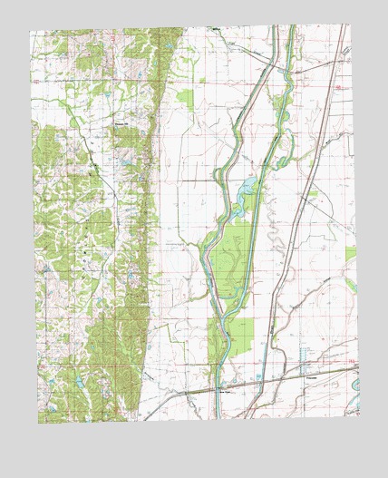
Princedale, AR USGS Topographic Map
Click on map above to begin viewing in our Map Viewer.

This topographic map contains these locations and features:
Feature Name Type Latitude Longitude GNIS ID View Map
Akins CemeteryCemeteryN35.3376°W90.7193°45799View Map
Bee Tree SloughStreamN35.2545°W90.6659°46308View Map
Bethel ChurchChurchN35.3737°W90.6776°46454View Map
Cross County DitchCanalN35.3704°W90.6490°48193View Map
Hare Farm School (historical)SchoolN35.2784°W90.7073°82777View Map
Harefarm CemeteryCemeteryN35.2756°W90.7090°49858View Map
Lindley SloughStreamN35.3654°W90.6493°51167View Map
Magot SloughStreamN35.2834°W90.6523°51613View Map
Merck ChurchChurchN35.3181°W90.6407°51915View Map
Mount Pisgah ChurchChurchN35.3470°W90.7184°52381View Map
New Hope ChurchChurchN35.3126°W90.7076°52690View Map
Pleasant HillPopulated PlaceN35.3454°W90.7196°58400View Map
Pleasant Hill School (historical)SchoolN35.3462°W90.7176°82781View Map
Pope CreekStreamN35.3645°W90.6573°53690View Map
PrincedalePopulated PlaceN35.2640°W90.6471°58431View Map
Princedale School (historical)SchoolN35.2648°W90.6509°82782View Map
River FrontPopulated PlaceN35.2629°W90.6668°58496View Map
Robinson LakeReservoirN35.2630°W90.7336°79933View Map
Robinson Lake DamDamN35.2618°W90.7334°79932View Map
Sharps ChapelChurchN35.3362°W90.7054°54738View Map
Springhill ChurchChurchN35.3737°W90.6918°55137View Map
Wolf SloughStreamN35.3309°W90.6598°56502View Map

Note: Coordinates in the location and feature list above are referenced to NAD83 datum.


Copyright (C) 2008-2024 Ryan Niemi / Sunset Dynamics ... All Rights Reserved