TopoQuest Logo
Do you find TopoQuest useful?
Help keep TopoQuest running and adding new maps/features by donating!
Bitcoin:  19c7KJd3qBynnjoSw5npx9KScwjBe4ifkT
Litecoin:  LXs6TkuXGGXo1vDsWCkWVdjQX94eUKd6ui
Home View Maps Find Maps Find Places Resources & Links


Monterey, Arkansas Topographic Map

USGS Map Title: Monterey, AR
USGS Map MRC: 35090D5
DRG (GeoTIFF) Download: o35090d5.tif


Neighboring USGS Topographic Map Quads:


  Harrisburg, AR  
35090E6
 

  McCormick, AR  
35090E5
 

  Marked Tree, AR  
35090E4
 

  Cherry Valley East, AR  
35090D6
 

  Monterey, AR  
35090D5
 

  Joyland, AR  
35090D4
 

  Princedale, AR  
35090C6
 

  Parkin, AR  
35090C5
 

  Earle, AR  
35090C4


Map MRC Location:

N36°
W91°
N36°
W90°
H8 H7 H6 H5 H4 H3 H2 H1
G8 G7 G6 G5 G4 G3 G2 G1
F8 F7 F6 F5 F4 F3 F2 F1
E8 E7 E6 E5 E4 E3 E2 E1
D8 D7 D6 D5 D4 D3 D2 D1
C8 C7 C6 C5 C4 C3 C2 C1
B8 B7 B6 B5 B4 B3 B2 B1
A8 A7 A6 A5 A4 A3 A2 A1
N35°
W91°
N35°
W90°

Monterey, AR USGS 1:24K Topographic Map Preview:
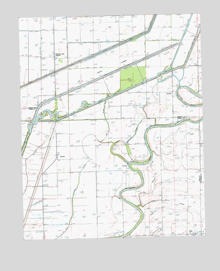
Monterey, AR USGS Topographic Map
Click on map above to begin viewing in our Map Viewer.

This topographic map contains these locations and features:
Feature Name Type Latitude Longitude GNIS ID View Map
Anderson TullyPopulated PlaceN35.4854°W90.6018°57265View Map
Anderson Tully Baptist ChurchChurchN35.4787°W90.6015°65760View Map
Arthur (historical)Populated PlaceN35.4556°W90.6009°65761View Map
Bethlehem ChurchChurchN35.3770°W90.5040°46480View Map
Big Beaver SloughStreamN35.3915°W90.5462°46505View Map
Boat RunPopulated PlaceN35.4581°W90.5209°76384View Map
Burton ChapelChurchN35.4498°W90.5309°47223View Map
Cow IslandFlatN35.4440°W90.5243°48117View Map
Ditch Number 108CanalN35.4854°W90.5168°82046View Map
Ditch Number 109CanalN35.4451°W90.5918°82047View Map
Ditch Number 37CanalN35.4862°W90.5696°82235View Map
Ditch Number 71CanalN35.4423°W90.5548°82380View Map
Ditch Number 73CanalN35.4470°W90.5320°82383View Map
Ditch Number 74CanalN35.4512°W90.5318°82385View Map
Ditch Number 78CanalN35.4709°W90.5765°82388View Map
Ditch Number 79CanalN35.4565°W90.5765°82389View Map
FortunePopulated PlaceN35.4148°W90.5532°59254View Map
Fortune BarBarN35.4115°W90.5462°49182View Map
Fortune ChurchChurchN35.4134°W90.5537°49183View Map
Fortune SloughStreamN35.4173°W90.5518°49185View Map
Harris PondLakeN35.4354°W90.5070°75732View Map
Hit ChapelChurchN35.4318°W90.5415°50152View Map
Hog SloughStreamN35.4293°W90.5707°50169View Map
Lee BarBarN35.4315°W90.5373°51038View Map
Little Beaver SloughStreamN35.3937°W90.5440°51193View Map
MontereyPopulated PlaceN35.4226°W90.6007°58207View Map
Singer Forest Natural Heritage AreaParkN35.4662°W90.5473°59289View Map
Singer School (historical)SchoolN35.4265°W90.5396°82785View Map
Steep Gut BayouGutN35.4640°W90.5265°55197View Map
StewartPopulated PlaceN35.4779°W90.6015°78461View Map
Sugar BarBarN35.4395°W90.5120°55291View Map
Sunk Timber LakeFlatN35.4287°W90.5776°55336View Map
Township of TwistCivilN35.3955°W90.5279°66480View Map
Turnbull BarBarN35.4365°W90.5220°55734View Map
Turney (historical)Populated PlaceN35.4273°W90.5923°61669View Map
TwistPopulated PlaceN35.3762°W90.5073°58776View Map
Twist Ferry (historical)CrossingN35.3759°W90.5562°82787View Map
Twist Post OfficePost OfficeN35.3759°W90.5065°82788View Map
Welford (historical)Populated PlaceN35.3959°W90.6112°61674View Map
Wheeler BarBarN35.3868°W90.5493°56221View Map
Wildwood ChurchChurchN35.4681°W90.5173°56373View Map
Wildwood SchoolSchoolN35.4681°W90.5184°56374View Map

Note: Coordinates in the location and feature list above are referenced to NAD83 datum.


Copyright (C) 2008-2025 Ryan Niemi / Sunset Dynamics ... All Rights Reserved