TopoQuest Logo
Do you find TopoQuest useful?
Help keep TopoQuest running and adding new maps/features by donating!
Bitcoin:  19c7KJd3qBynnjoSw5npx9KScwjBe4ifkT
Litecoin:  LXs6TkuXGGXo1vDsWCkWVdjQX94eUKd6ui
Home View Maps Find Maps Find Places Resources & Links


Pritchett, Texas Topographic Map

USGS Map Title: Pritchett, TX
USGS Map MRC: 32095F1
DRG (GeoTIFF) Download: o32095f1.tif


Neighboring USGS Topographic Map Quads:


  Rhonesboro, TX  
32095G2
 

  Thomas, TX  
32095G1
 

  Bettie, TX  
32094G8
 

  Shady Grove, TX  
32095F2
 

  Pritchett, TX  
32095F1
 

  Gilmer, TX  
32094F8
 

  Hawkins, TX  
32095E2
 

  Big Sandy, TX  
32095E1
 

  Gladewater, TX  
32094E8


Map MRC Location:

N33°
W96°
N33°
W95°
H8 H7 H6 H5 H4 H3 H2 H1
G8 G7 G6 G5 G4 G3 G2 G1
F8 F7 F6 F5 F4 F3 F2 F1
E8 E7 E6 E5 E4 E3 E2 E1
D8 D7 D6 D5 D4 D3 D2 D1
C8 C7 C6 C5 C4 C3 C2 C1
B8 B7 B6 B5 B4 B3 B2 B1
A8 A7 A6 A5 A4 A3 A2 A1
N32°
W96°
N32°
W95°

Pritchett, TX USGS 1:24K Topographic Map Preview:
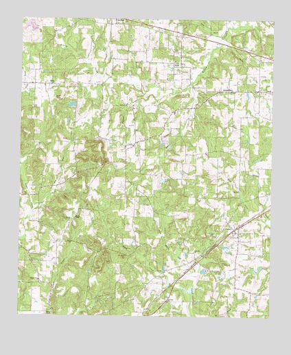
Pritchett, TX USGS Topographic Map
Click on map above to begin viewing in our Map Viewer.

This topographic map contains these locations and features:
Feature Name Type Latitude Longitude GNIS ID View Map
Bane LakeReservoirN32.7468°W95.1169°1865375View Map
Bane Lake DamDamN32.7468°W95.1169°1865374View Map
Barton SpringSpringN32.7162°W95.1083°1330114View Map
Beech CreekStreamN32.6351°W95.0391°1330336View Map
Browns ChapelChurchN32.6662°W95.0977°1331372View Map
Coon CreekStreamN32.7229°W95.0408°1333283View Map
East Fork Glade CreekStreamN32.6668°W95.1205°1334917View Map
Freeman Memorial Branch LibraryBuildingN32.6540°W95.1211°2014950View Map
Hall BranchStreamN32.7207°W95.0658°1337245View Map
Hopewell BranchStreamN32.7196°W95.0633°1338054View Map
Hopewell ChurchChurchN32.7143°W95.0724°1338068View Map
Johnson ChapelChurchN32.7229°W95.1086°1338788View Map
KelseyPopulated PlaceN32.7318°W95.0497°1378521View Map
Kelsey CemeteryCemeteryN32.7299°W95.0408°1339016View Map
KHYM-AM (Gilmer)TowerN32.7310°W95.0433°1385570View Map
La Porte Branch LibraryBuildingN32.7193°W95.0166°2014904View Map
LatchPopulated PlaceN32.6968°W95.0691°1378566View Map
Lone Pine ChurchChurchN32.6521°W95.0383°1340386View Map
Medley LakeReservoirN32.7135°W95.0969°1861589View Map
Medley Lake DamDamN32.7135°W95.0969°1861588View Map
Moore BranchStreamN32.6749°W95.1111°1341861View Map
New Hope CemeteryCemeteryN32.6501°W95.0713°1342460View Map
New Hope ChurchChurchN32.6318°W95.0511°1342475View Map
Oak Grove ChurchChurchN32.7196°W95.0213°1342974View Map
Peter Hayes HillSummitN32.6551°W95.0999°1343896View Map
Pleasant Grove ChurchChurchN32.6399°W95.1149°1344197View Map
Pleasant Grove Volunteer Fire DepartmentBuildingN32.6390°W95.1144°2655713View Map
Pleasant Hill CemeteryCemeteryN32.6438°W95.0238°1344208View Map
PritchettPopulated PlaceN32.6618°W95.0186°1378910View Map
Rocky BranchStreamN32.7454°W95.0236°1345439View Map
SummerfieldPopulated PlaceN32.7201°W95.0261°1379131View Map
Turkey PondLakeN32.6821°W95.0547°1348892View Map

Note: Coordinates in the location and feature list above are referenced to NAD83 datum.


Copyright (C) 2008-2025 Ryan Niemi / Sunset Dynamics ... All Rights Reserved