TopoQuest Logo
Do you find TopoQuest useful?
Help keep TopoQuest running and adding new maps/features by donating!
Bitcoin:  19c7KJd3qBynnjoSw5npx9KScwjBe4ifkT
Litecoin:  LXs6TkuXGGXo1vDsWCkWVdjQX94eUKd6ui
Home View Maps Find Maps Find Places Resources & Links


Shady Grove, Texas Topographic Map

USGS Map Title: Shady Grove, TX
USGS Map MRC: 32095F2
DRG (GeoTIFF) Download: o32095f2.tif


Neighboring USGS Topographic Map Quads:


  Cartwright, TX  
32095G3
 

  Rhonesboro, TX  
32095G2
 

  Thomas, TX  
32095G1
 

  Hainesville, TX  
32095F3
 

  Shady Grove, TX  
32095F2
 

  Pritchett, TX  
32095F1
 

  Crow, TX  
32095E3
 

  Hawkins, TX  
32095E2
 

  Big Sandy, TX  
32095E1


Map MRC Location:

N33°
W96°
N33°
W95°
H8 H7 H6 H5 H4 H3 H2 H1
G8 G7 G6 G5 G4 G3 G2 G1
F8 F7 F6 F5 F4 F3 F2 F1
E8 E7 E6 E5 E4 E3 E2 E1
D8 D7 D6 D5 D4 D3 D2 D1
C8 C7 C6 C5 C4 C3 C2 C1
B8 B7 B6 B5 B4 B3 B2 B1
A8 A7 A6 A5 A4 A3 A2 A1
N32°
W96°
N32°
W95°

Shady Grove, TX USGS 1:24K Topographic Map Preview:
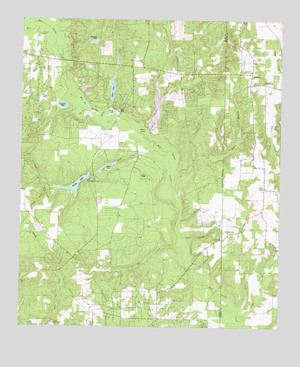
Shady Grove, TX USGS Topographic Map
Click on map above to begin viewing in our Map Viewer.

This topographic map contains these locations and features:
Feature Name Type Latitude Longitude GNIS ID View Map
Black BranchStreamN32.7135°W95.2186°1330734View Map
Blue BranchStreamN32.6835°W95.1774°1330894View Map
Boggy CreekStreamN32.7001°W95.1855°1331011View Map
Boggy LakeReservoirN32.6913°W95.2067°1331015View Map
Boggy Lake DamDamN32.6918°W95.2036°1856048View Map
Brookhaven LodgeBuildingN32.6840°W95.2180°1331311View Map
Brooks LakeReservoirN32.6828°W95.2242°1331321View Map
Brooks Lake DamDamN32.6868°W95.2169°1856046View Map
Bull CreekStreamN32.7446°W95.2355°1331594View Map
Byrd BranchStreamN32.7446°W95.2424°1331787View Map
Carding Factory BranchStreamN32.6818°W95.2374°1332154View Map
Childress PondLakeN32.7150°W95.2306°1332740View Map
Clear CreekStreamN32.7140°W95.1847°1332935View Map
Clonts RanchLocaleN32.7135°W95.2027°1333000View Map
Deep EddyLakeN32.7117°W95.2183°1334194View Map
Galena Park Branch LibraryBuildingN32.6615°W95.2366°2014956View Map
Gin CreekStreamN32.6296°W95.1447°1336543View Map
Glade CreekStreamN32.6287°W95.1455°1373843View Map
Glaspy LakeLakeN32.7120°W95.2062°1336566View Map
Greenbriar CreekStreamN32.7012°W95.1891°1336958View Map
Hawk Ranch AirportAirportN32.6390°W95.1591°1386795View Map
Hawkins DivisionCivilN32.6661°W95.2425°1938829View Map
Highland PondLakeN32.7413°W95.2153°1337745View Map
Holly CreekStreamN32.7096°W95.2116°1337956View Map
Holly LakeReservoirN32.7220°W95.2067°1337959View Map
Holly Lake DamDamN32.7168°W95.2069°1856044View Map
Holly Lake Ranch AirportAirportN32.6976°W95.2077°1386796View Map
Holly Lake Ranch Census Designated PlaceCensusN32.7125°W95.2004°2586938View Map
Holly Lake Volunteer Fire DepartmentBuildingN32.7140°W95.2033°2655196View Map
Honey CreekStreamN32.7140°W95.1847°1338021View Map
Jacinto City Branch LibraryBuildingN32.6890°W95.2405°2014877View Map
Kingwood Branch LibraryBuildingN32.7154°W95.1791°2014900View Map
Lake GreenbriarLakeN32.7145°W95.1847°2574565View Map
Little Mound Missionary ChurchChurchN32.7246°W95.1333°1340140View Map
Maple Springs ChurchChurchN32.6637°W95.1511°1340917View Map
Mill CreekStreamN32.6537°W95.1674°1341617View Map
Mill CreekStreamN32.7376°W95.2330°1374949View Map
Moore LakeLakeN32.7158°W95.2192°1341870View Map
Mulberry CreekStreamN32.7274°W95.2305°1342243View Map
Nichols BranchStreamN32.6676°W95.1747°1342585View Map
North Channel Branch LibraryBuildingN32.7379°W95.1905°2014834View Map
Parker Williams Branch LibraryBuildingN32.7471°W95.2147°2014782View Map
Peron BranchStreamN32.6568°W95.1699°1343866View Map
Peron ChurchChurchN32.6610°W95.1533°1343867View Map
Pine Mills Oil FieldOilfieldN32.6990°W95.2466°1344067View Map
Sand BranchStreamN32.6490°W95.1666°1346497View Map
Shady GrovePopulated PlaceN32.6815°W95.1327°1379060View Map
Warren SwampSwampN32.7049°W95.1899°1349500View Map

Note: Coordinates in the location and feature list above are referenced to NAD83 datum.


Copyright (C) 2008-2025 Ryan Niemi / Sunset Dynamics ... All Rights Reserved