TopoQuest Logo
Do you find TopoQuest useful?
Help keep TopoQuest running and adding new maps/features by donating!
Bitcoin:  19c7KJd3qBynnjoSw5npx9KScwjBe4ifkT
Litecoin:  LXs6TkuXGGXo1vDsWCkWVdjQX94eUKd6ui
Home View Maps Find Maps Find Places Resources & Links


Proctor, Vermont Topographic Map

USGS Map Title: Proctor, VT
USGS Map MRC: 43073F1
DRG (GeoTIFF) Download: o43073f1.tif


Neighboring USGS Topographic Map Quads:


  Sudbury, VT  
43073G2
 

  Brandon, VT  
43073G1
 

  Mount Carmel, VT  
43072G8
 

  Bomoseen, VT  
43073F2
 

  Proctor, VT  
43073F1
 

  Chittenden, VT  
43072F8
 

  Poultney, VT  
43073E2
 

  West Rutland, VT  
43073E1
 

  Rutland, VT  
43072E8


Map MRC Location:

N44°
W74°
N44°
W73°
H8 H7 H6 H5 H4 H3 H2 H1
G8 G7 G6 G5 G4 G3 G2 G1
F8 F7 F6 F5 F4 F3 F2 F1
E8 E7 E6 E5 E4 E3 E2 E1
D8 D7 D6 D5 D4 D3 D2 D1
C8 C7 C6 C5 C4 C3 C2 C1
B8 B7 B6 B5 B4 B3 B2 B1
A8 A7 A6 A5 A4 A3 A2 A1
N43°
W74°
N43°
W73°

Proctor, VT USGS 1:24K Topographic Map Preview:
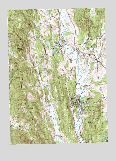
Proctor, VT USGS Topographic Map
Click on map above to begin viewing in our Map Viewer.

This topographic map contains these locations and features:
Feature Name Type Latitude Longitude GNIS ID View Map
Beaver PondReservoirN43.6658°W73.0463°1456357View Map
Beaver Pond DamDamN43.6634°W73.0446°1766671View Map
Biddie KnobSummitN43.7134°W73.1098°1456408View Map
Butler PondLakeN43.6944°W73.0800°1456693View Map
Caverly Preventorium (historical)HospitalN43.7148°W73.0176°1921794View Map
Colburn BridgeBridgeN43.7070°W73.0207°1921819View Map
Congregational Burial YardCemeteryN43.7083°W73.0281°1921827View Map
Cooley Covered BridgeBridgeN43.6834°W73.0223°1921828View Map
Cox MountainSummitN43.7381°W73.0271°1457036View Map
Depot Covered BridgeBridgeN43.7209°W73.0534°1921845View Map
Evergreen CemeteryCemeteryN43.7076°W73.0190°1921865View Map
FlorencePopulated PlaceN43.7165°W73.0615°1457459View Map
Florence Post OfficePost OfficeN43.7104°W73.0569°2759991View Map
Furnace BrookStreamN43.6945°W73.0365°1460893View Map
Furnace SchoolSchoolN43.7215°W73.0062°1457505View Map
Goodnough SchoolSchoolN43.6776°W73.0290°1457566View Map
Gorham BridgeBridgeN43.6801°W73.0382°1457579View Map
Grandpa KnobSummitN43.6578°W73.0948°1457606View Map
GrangervillePopulated PlaceN43.7234°W73.0057°1921902View Map
Hammond Covered BridgeBridgeN43.7167°W73.0515°1921914View Map
Little BrookStreamN43.7162°W73.0046°1461077View Map
Lothrop SchoolSchoolN43.7057°W73.0190°1921963View Map
Muddy PondLakeN43.6299°W73.0040°1458636View Map
Old CemeteryCemeteryN43.7101°W73.0329°1922012View Map
Olympus PoolLakeN43.6523°W73.0287°1458843View Map
Pine HillSummitN43.6470°W73.0165°1458972View Map
PittsfordPopulated PlaceN43.7067°W73.0282°1458990View Map
Pittsford Census Designated PlaceCensusN43.7067°W73.0290°2586647View Map
Pittsford Congregational ChurchChurchN43.7084°W73.0290°1922038View Map
Pittsford Fire DepartmentBuildingN43.7047°W73.0204°2121275View Map
Pittsford Fire Department - Fire Service TrainingBuildingN43.7178°W73.0195°2121268View Map
Pittsford First Response Emergency SquadBuildingN43.7036°W73.0160°2578086View Map
Pittsford Green Historic DistrictParkN43.7067°W73.0282°1922039View Map
Pittsford Post OfficePost OfficeN43.7060°W73.0273°1922042View Map
Pittsford Town HallBuildingN43.7067°W73.0273°1922044View Map
ProctorPopulated PlaceN43.6606°W73.0357°1459076View Map
Proctor DamDamN43.6634°W73.0346°1766368View Map
Proctor Elementary SchoolSchoolN43.6618°W73.0388°1922055View Map
Proctor Junior / Senior High SchoolSchoolN43.6550°W73.0292°1922057View Map
Proctor Post OfficePost OfficeN43.6608°W73.0357°1922058View Map
Proctor Town HallBuildingN43.6626°W73.0368°1922059View Map
Proctor Village Municipal ForestForestN43.6823°W73.0626°1922060View Map
Proctor Volunteer Fire DepartmentBuildingN43.6614°W73.0360°1922056View Map
Reynolds ReservoirReservoirN43.6441°W73.0255°1459170View Map
Riverside CemeteryCemeteryN43.6513°W73.0344°1459202View Map
Rocky PondLakeN43.6263°W73.0031°1459237View Map
Rutland Municipal ForestForestN43.6565°W73.0621°1922086View Map
Saint Alphonsus CemeteryCemeteryN43.7051°W73.0182°1922097View Map
Saint Dominicks Catholic ChurchChurchN43.6581°W73.0321°1922101View Map
Saint Dominicks CemeteryCemeteryN43.6579°W73.0312°1922102View Map
Sargent PondLakeN43.6770°W73.0757°1922115View Map
Smith PondLakeN43.7186°W73.0615°1459542View Map
Sugar Hollow BrookStreamN43.6951°W73.0232°1461491View Map
Sugar Hollow PondReservoirN43.7231°W73.0209°1922145View Map
Sutherland FallsFallsN43.6634°W73.0334°1922147View Map
Town of PittsfordCivilN43.7100°W73.0438°1462174View Map
Town of ProctorCivilN43.6520°W73.0367°1462180View Map
Union Church of ProctorChurchN43.6606°W73.0351°1922168View Map
Vermont Police AcademySchoolN43.7142°W73.0259°1922172View Map
Vermont Police Academy LibraryBuildingN43.7142°W73.0259°1922173View Map
Vermont SanatoriumHospitalN43.7145°W73.0179°1460023View Map
Walker Memorial LibraryBuildingN43.7070°W73.0284°1922178View Map
Warner CoveBayN43.6542°W73.0329°1922181View Map
West Rutland State ForestForestN43.6556°W73.0973°1922201View Map
Whipple Hollow CemeteryCemeteryN43.6618°W73.0679°1922205View Map
Whipple Hollow SchoolSchoolN43.6317°W73.0632°1460210View Map
Whipple Hollow Wildlife Management AreaParkN43.6717°W73.0643°1922206View Map
Wilson CastleBuildingN43.6442°W73.0426°1922211View Map
WRVT-FM (Rutland)TowerN43.6590°W73.1065°1461902View Map
WVER-TV (Rutland)TowerN43.6590°W73.1065°1461910View Map

Note: Coordinates in the location and feature list above are referenced to NAD83 datum.


Copyright (C) 2008-2024 Ryan Niemi / Sunset Dynamics ... All Rights Reserved