TopoQuest Logo
Do you find TopoQuest useful?
Help keep TopoQuest running and adding new maps/features by donating!
Bitcoin:  19c7KJd3qBynnjoSw5npx9KScwjBe4ifkT
Litecoin:  LXs6TkuXGGXo1vDsWCkWVdjQX94eUKd6ui
Home View Maps Find Maps Find Places Resources & Links


Bomoseen, Vermont Topographic Map

USGS Map Title: Bomoseen, VT
USGS Map MRC: 43073F2
DRG (GeoTIFF) Download: o43073f2.tif


Neighboring USGS Topographic Map Quads:


  Orwell, VT  
43073G3
 

  Sudbury, VT  
43073G2
 

  Brandon, VT  
43073G1
 

  Benson, VT  
43073F3
 

  Bomoseen, VT  
43073F2
 

  Proctor, VT  
43073F1
 

  Thorn Hill, NY  
43073E3
 

  Poultney, VT  
43073E2
 

  West Rutland, VT  
43073E1


Map MRC Location:

N44°
W74°
N44°
W73°
H8 H7 H6 H5 H4 H3 H2 H1
G8 G7 G6 G5 G4 G3 G2 G1
F8 F7 F6 F5 F4 F3 F2 F1
E8 E7 E6 E5 E4 E3 E2 E1
D8 D7 D6 D5 D4 D3 D2 D1
C8 C7 C6 C5 C4 C3 C2 C1
B8 B7 B6 B5 B4 B3 B2 B1
A8 A7 A6 A5 A4 A3 A2 A1
N43°
W74°
N43°
W73°

Bomoseen, VT USGS 1:24K Topographic Map Preview:
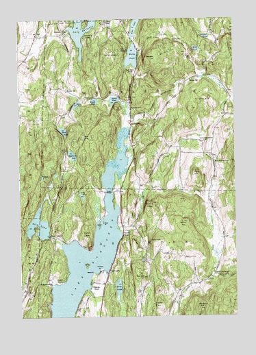
Bomoseen, VT USGS Topographic Map
Click on map above to begin viewing in our Map Viewer.

This topographic map contains these locations and features:
Feature Name Type Latitude Longitude GNIS ID View Map
Austin PondReservoirN43.7161°W73.1947°1456188View Map
Austin Pond DamDamN43.7159°W73.1937°1766475View Map
Avalon BeachPopulated PlaceN43.6401°W73.2251°1456190View Map
Bangall SchoolSchoolN43.7434°W73.2393°1456240View Map
Barber LedgeCliffN43.7353°W73.1990°1456247View Map
Barker HillSummitN43.6648°W73.1548°1456254View Map
Beaver MeadowLakeN43.6893°W73.2328°1921739View Map
Beebe PondLakeN43.7341°W73.1837°1456366View Map
Beechwood CampLocaleN43.7426°W73.2107°1456371View Map
Big D CampgroundLocaleN43.6915°W73.1837°1921746View Map
Black PondLakeN43.7032°W73.2241°1456452View Map
Blueberry HillSummitN43.6278°W73.1459°1456495View Map
BomoseenPopulated PlaceN43.6437°W73.1987°1456519View Map
Bomoseen Hiking LoopTrailN43.6653°W73.2232°1921754View Map
Bomoseen State ParkParkN43.6887°W73.2301°1921756View Map
Bomoseen State Park CampgroundLocaleN43.6581°W73.2307°1921757View Map
Bomossen Wildlife ReserveParkN43.6720°W73.2196°1921758View Map
Bradley Family CemeteryCemeteryN43.7197°W73.2208°1921759View Map
Bradley SchoolSchoolN43.7198°W73.2218°1456543View Map
Breese PondLakeN43.7142°W73.2160°1456558View Map
Bull HillSummitN43.6415°W73.1784°1456634View Map
Camp AwaneeLocaleN43.7370°W73.1857°1456726View Map
Camp Twin LakeLocaleN43.7420°W73.1818°1921783View Map
Castleton Municipal ForestForestN43.6631°W73.1882°1921788View Map
Cedar MountainSummitN43.6584°W73.2109°1456803View Map
Cedar PointCapeN43.6523°W73.2096°1921795View Map
Chizmar DamDamN43.6384°W73.2346°1766542View Map
Crystal BeachPopulated PlaceN43.6595°W73.1901°1457064View Map
Crystal Beach - Town Farm CemeteryCemeteryN43.6604°W73.1905°1921833View Map
Daniel Coffey Memorial TrialTrailN43.6990°W73.2159°1921841View Map
Eagle RockSummitN43.7334°W73.1723°1457240View Map
Eagle Rock CampLocaleN43.7273°W73.1840°1457241View Map
East HubbardtonPopulated PlaceN43.6931°W73.1382°1457293View Map
East Hubbardton CemeteryCemeteryN43.6988°W73.1425°1457294View Map
Eaton HillSummitN43.6567°W73.1707°1457330View Map
Echo LakeLakeN43.7473°W73.1817°1456092View Map
Float BridgeBridgeN43.6773°W73.1979°1457458View Map
Ganson HillSummitN43.7362°W73.1546°1457517View Map
Giddings BrookStreamN43.7031°W73.1851°1457536View Map
Glen LakeReservoirN43.6636°W73.2390°1457556View Map
Glen Lake DamDamN43.6584°W73.2329°1766415View Map
Glen Lake TrailTrailN43.6715°W73.2304°1921899View Map
Green Mountain CampLocaleN43.7481°W73.1993°1457631View Map
Half Moon Pond TrailTrailN43.6920°W73.2190°1921913View Map
Half Moon State Park CampgroundLocaleN43.6920°W73.2162°1921912View Map
Halfmoon LakeLakeN43.6929°W73.2191°1457685View Map
High PondLakeN43.7003°W73.2122°1457817View Map
Hooker HillSummitN43.6309°W73.1696°1457883View Map
HortoniaPopulated PlaceN43.7453°W73.2232°1457899View Map
Hortonville CemeteryCemeteryN43.7487°W73.2191°1921922View Map
HubbardtonPopulated PlaceN43.7073°W73.1843°1457926View Map
Hubbardton Battle MonumentParkN43.6973°W73.1373°1921930View Map
Hubbardton BattlefieldParkN43.6970°W73.1329°1921928View Map
Hubbardton Battlefield Wildlife Management AreaParkN43.6973°W73.1332°1921929View Map
Hubbardton Fire Department Station 1BuildingN43.7200°W73.2220°2121264View Map
Hubbardton Fire Department Station 2BuildingN43.7092°W73.1304°2121262View Map
Hubbardton GulfValleyN43.7153°W73.1690°1457927View Map
Hubbardton North CemeteryCemeteryN43.7485°W73.1908°1921931View Map
Lake BomoseenLakeN43.6330°W73.2216°1456520View Map
Lake Bomoseen CampgroundLocaleN43.6870°W73.1868°1921957View Map
Lake Hortonia DamDamN43.7457°W73.2217°1766313View Map
Lily PondLakeN43.6755°W73.2134°1458215View Map
Lincoln CemeteryCemeteryN43.6707°W73.1390°1921962View Map
Loves MarshReservoirN43.6709°W73.2053°1766532View Map
Loves Marsh DamDamN43.6667°W73.2046°1766531View Map
Marsh Pond Wildlife Management AreaParkN43.6281°W73.2423°1921969View Map
Mason PointCapeN43.6434°W73.2076°1458376View Map
Mortimer Brown LandingAirportN43.6655°W73.1655°2717192View Map
Moscow PondLakeN43.6842°W73.2366°1458557View Map
Mudd PondLakeN43.7372°W73.1462°1458633View Map
Munger DamDamN43.7284°W73.2379°1766511View Map
Neshobe BeachPopulated PlaceN43.6392°W73.2084°1458664View Map
Neshobe IslandIslandN43.6465°W73.2112°1458665View Map
North Breton SchoolSchoolN43.6423°W73.1373°1458708View Map
O'Brien PointCapeN43.6623°W73.2407°1458804View Map
Page PointCapeN43.6645°W73.2012°1458880View Map
Parsons SchoolSchoolN43.7245°W73.1498°1458899View Map
Pine PondReservoirN43.6370°W73.1932°1458980View Map
Pine Pond DamDamN43.6370°W73.1932°1766449View Map
Pleasant View CemeteryCemeteryN43.7162°W73.1860°1459007View Map
Prospect PointCapeN43.6451°W73.2029°1459088View Map
Rabbit IslandIslandN43.6634°W73.2037°1459132View Map
RansomvalePopulated PlaceN43.6576°W73.1315°1922065View Map
Ressegrie Family CemeteryCemeteryN43.7114°W73.1671°1922068View Map
Roach PondLakeN43.7157°W73.2057°1459208View Map
Said DamDamN43.6784°W73.2329°1766520View Map
Said PondLakeN43.6842°W73.2293°1922095View Map
Saint Matthews ChurchChurchN43.6387°W73.2323°1459339View Map
Sargent HillSummitN43.7170°W73.1393°1459375View Map
Sucker BrookStreamN43.6612°W73.1918°1459759View Map
Town of CastletonCivilN43.6326°W73.1742°1462065View Map
Town of HubbardtonCivilN43.7128°W73.1766°1462120View Map
Turnpike SchoolSchoolN43.7128°W73.1848°1459970View Map
Vermont State History TrailTrailN43.6598°W73.2318°1922174View Map
Walker PondLakeN43.7426°W73.1412°1460046View Map
Walker Pond DamDamN43.7434°W73.1396°1766751View Map
Wallace LedgeCliffN43.6720°W73.1768°1460051View Map
West CastletonPopulated PlaceN43.6590°W73.2318°1460124View Map
Zion HillSummitN43.6862°W73.1465°1460345View Map

Note: Coordinates in the location and feature list above are referenced to NAD83 datum.


Copyright (C) 2008-2024 Ryan Niemi / Sunset Dynamics ... All Rights Reserved