TopoQuest Logo
Do you find TopoQuest useful?
Help keep TopoQuest running and adding new maps/features by donating!
Bitcoin:  19c7KJd3qBynnjoSw5npx9KScwjBe4ifkT
Litecoin:  LXs6TkuXGGXo1vDsWCkWVdjQX94eUKd6ui
Home View Maps Find Maps Find Places Resources & Links


Poultney, Vermont Topographic Map

USGS Map Title: Poultney, VT
USGS Map MRC: 43073E2
DRG (GeoTIFF) Download: o43073e2.tif


Neighboring USGS Topographic Map Quads:


  Benson, VT  
43073F3
 

  Bomoseen, VT  
43073F2
 

  Proctor, VT  
43073F1
 

  Thorn Hill, NY  
43073E3
 

  Poultney, VT  
43073E2
 

  West Rutland, VT  
43073E1
 

  Granville, NY  
43073D3
 

  Wells, VT  
43073D2
 

  Middletown Springs, VT  
43073D1


Map MRC Location:

N44°
W74°
N44°
W73°
H8 H7 H6 H5 H4 H3 H2 H1
G8 G7 G6 G5 G4 G3 G2 G1
F8 F7 F6 F5 F4 F3 F2 F1
E8 E7 E6 E5 E4 E3 E2 E1
D8 D7 D6 D5 D4 D3 D2 D1
C8 C7 C6 C5 C4 C3 C2 C1
B8 B7 B6 B5 B4 B3 B2 B1
A8 A7 A6 A5 A4 A3 A2 A1
N43°
W74°
N43°
W73°

Poultney, VT USGS 1:24K Topographic Map Preview:
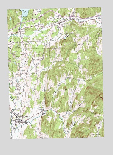
Poultney, VT USGS Topographic Map
Click on map above to begin viewing in our Map Viewer.

This topographic map contains these locations and features:
Feature Name Type Latitude Longitude GNIS ID View Map
Ames Memorial HallBuildingN43.5167°W73.2407°1921729View Map
BlissvillePopulated PlaceN43.5931°W73.2298°1456473View Map
Blissville CemeteryCemeteryN43.5927°W73.2289°1921750View Map
Blueberry Hill Wildlife Management AreaParkN43.6223°W73.1440°1921751View Map
Bomoseen Post OfficePost OfficeN43.6084°W73.2097°1921755View Map
Calvin Coolidge LibraryBuildingN43.6092°W73.1782°1921779View Map
CastletonPopulated PlaceN43.6106°W73.1798°1456785View Map
Castleton Census Designated PlaceCensusN43.6054°W73.1852°2586622View Map
Castleton CornersPopulated PlaceN43.6084°W73.2079°1456786View Map
Castleton Hubbardton Elementary SchoolSchoolN43.6198°W73.2119°1921787View Map
Castleton Police DepartmentBuildingN43.6122°W73.1768°2752739View Map
Castleton Post OfficePost OfficeN43.6122°W73.1773°1921789View Map
Castleton State CollegeSchoolN43.6080°W73.1815°1456788View Map
Castleton Town HallBuildingN43.6120°W73.1771°1921790View Map
Castleton Village Historic DistrictParkN43.6109°W73.1807°1921791View Map
Castleton Village SchoolSchoolN43.6122°W73.1784°2427574View Map
Castleton Volunteer Fire DepartmentBuildingN43.6113°W73.1772°2121283View Map
Clark HollowValleyN43.5231°W73.1718°1456904View Map
Clark Hollow BrookStreamN43.5231°W73.1737°1456906View Map
Culver CemeteryCemeteryN43.5868°W73.2267°1457069View Map
East PoultneyPopulated PlaceN43.5265°W73.2046°1457309View Map
East Poultney CemeteryCemeteryN43.5278°W73.2009°1921856View Map
East Poultney Historic DistrictParkN43.5267°W73.2054°1921857View Map
East Poultney Post OfficePost OfficeN43.5262°W73.2048°1921858View Map
Federated ChurchChurchN43.6128°W73.1762°1921874View Map
Fifield CemeteryCemeteryN43.5753°W73.2178°1457428View Map
Finel HollowValleyN43.5281°W73.1923°1457429View Map
Finel Hollow BrookStreamN43.5278°W73.1934°1457430View Map
Gates CemeteryCemeteryN43.5939°W73.2077°1457526View Map
GorhamtownPopulated PlaceN43.5728°W73.1907°1460422View Map
Graham HillSummitN43.6192°W73.1890°1457593View Map
Green Mountain CollegeSchoolN43.5171°W73.2411°1921909View Map
Gully BrookStreamN43.6095°W73.1265°1457675View Map
Hampshire HollowValleyN43.5237°W73.1723°1457710View Map
Hampshire Hollow BrookStreamN43.5215°W73.1829°1457711View Map
Hillside CemeteryCemeteryN43.6134°W73.1859°1457833View Map
Hosford Crossing CemeteryCemeteryN43.5623°W73.2254°1921925View Map
Hosford Tomb PlotCemeteryN43.5676°W73.2263°1921926View Map
HydevillePopulated PlaceN43.6056°W73.2282°1457957View Map
Hydeville Post OfficePost OfficeN43.6074°W73.2266°1921935View Map
Hydeville School (historical)SchoolN43.6053°W73.2296°1921936View Map
Indian BayBayN43.6153°W73.2268°1457961View Map
Interchange 4CrossingN43.6159°W73.2065°1921940View Map
Interchange 5CrossingN43.6167°W73.1657°1921941View Map
Jewish CemeteryCemeteryN43.5270°W73.2013°1921947View Map
Lake Bomossen DamDamN43.6051°W73.2329°1766605View Map
Lavery BrookStreamN43.5045°W73.1746°1458172View Map
Lewis BrookStreamN43.5526°W73.2487°1458199View Map
Morse HollowValleyN43.5053°W73.1726°1458550View Map
North Breton BrookStreamN43.6142°W73.1690°1458707View Map
Old Baptist ChurchChurchN43.5259°W73.2054°1922007View Map
Old Burying GroundCemeteryN43.6128°W73.1757°1922009View Map
Old KnobSummitN43.5473°W73.1751°1458825View Map
Old Poultney CemeteryCemeteryN43.5205°W73.2311°1922016View Map
Parker HillSummitN43.6006°W73.1909°1458896View Map
Point of PinesPopulated PlaceN43.6228°W73.2307°1459024View Map
Pond HillSummitN43.5898°W73.1532°1459036View Map
Pond Hill BrookStreamN43.6112°W73.1848°1459037View Map
PoultneyPopulated PlaceN43.5170°W73.2362°1459064View Map
Poultney CemeteryCemeteryN43.5223°W73.2297°1922048View Map
Poultney Elementary SchoolSchoolN43.5246°W73.2377°1922049View Map
Poultney Fire DepartmentBuildingN43.5208°W73.2340°2121261View Map
Poultney High SchoolSchoolN43.5165°W73.2297°1922050View Map
Poultney Main Street Historic DistrictParkN43.5173°W73.2365°1922051View Map
Poultney Post OfficePost OfficeN43.5168°W73.2354°1922052View Map
Poultney Rescue SquadBuildingN43.5127°W73.2211°2578115View Map
Poultney Town HallBuildingN43.5331°W73.2329°1922053View Map
Poultney United Methodist ChurchChurchN43.5176°W73.2348°1922054View Map
Rutland County Grammar School (historical)SchoolN43.6092°W73.1782°1922074View Map
Rutland Southwest Essential Early Education ProgramSchoolN43.5165°W73.2298°2427509View Map
Saint John CemeteryCemeteryN43.5263°W73.2076°1922103View Map
Saint John Episcopal ChurchChurchN43.5259°W73.2068°1922104View Map
Saint Raphael CemeteryCemeteryN43.5211°W73.2297°1459345View Map
Spaulding HillSummitN43.5228°W73.1337°1459633View Map
Town HillSummitN43.5387°W73.1990°1459937View Map
Town of PoultneyCivilN43.5327°W73.1913°1462178View Map
Village of PoultneyCivilN43.5181°W73.2360°2378326View Map
Ward CemeteryCemeteryN43.5582°W73.1708°1460059View Map
WIUV-FM (Castleton)TowerN43.6081°W73.1812°1461889View Map
WVNR-AM (Poultney)TowerN43.5045°W73.2026°1461880View Map

Note: Coordinates in the location and feature list above are referenced to NAD83 datum.


Copyright (C) 2008-2024 Ryan Niemi / Sunset Dynamics ... All Rights Reserved