TopoQuest Logo
Do you find TopoQuest useful?
Help keep TopoQuest running and adding new maps/features by donating!
Bitcoin:  19c7KJd3qBynnjoSw5npx9KScwjBe4ifkT
Litecoin:  LXs6TkuXGGXo1vDsWCkWVdjQX94eUKd6ui
Home View Maps Find Maps Find Places Resources & Links


Proctor Creek, Missouri Topographic Map

USGS Map Title: Proctor Creek, MO
USGS Map MRC: 38092C8
DRG (GeoTIFF) Download: o38092c8.tif


Neighboring USGS Topographic Map Quads:


  Crockerville, MO  
38093D1
 

  Stover, MO  
38092D8
 

  Versailles, MO  
38092D7
 

  Boylers Mill, MO  
38093C1
 

  Proctor Creek, MO  
38092C8
 

  Gravois Mills, MO  
38092C7
 

  Knobby, MO  
38093B1
 

  Bollinger Creek, MO  
38092B8
 

  Sunrise Beach, MO  
38092B7


Map MRC Location:

N39°
W93°
N39°
W92°
H8 H7 H6 H5 H4 H3 H2 H1
G8 G7 G6 G5 G4 G3 G2 G1
F8 F7 F6 F5 F4 F3 F2 F1
E8 E7 E6 E5 E4 E3 E2 E1
D8 D7 D6 D5 D4 D3 D2 D1
C8 C7 C6 C5 C4 C3 C2 C1
B8 B7 B6 B5 B4 B3 B2 B1
A8 A7 A6 A5 A4 A3 A2 A1
N38°
W93°
N38°
W92°

Proctor Creek, MO USGS 1:24K Topographic Map Preview:
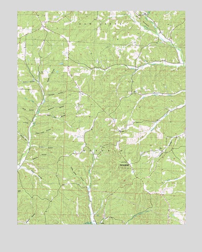
Proctor Creek, MO USGS Topographic Map
Click on map above to begin viewing in our Map Viewer.

This topographic map contains these locations and features:
Feature Name Type Latitude Longitude GNIS ID View Map
Ard-Menteer CemeteryCemeteryN38.3095°W92.9919°742865View Map
Bates HollowValleyN38.2842°W92.9977°713729View Map
Brewer HollowValleyN38.3331°W92.9855°714674View Map
Brewner HollowValleyN38.2967°W92.9896°729712View Map
Bryant HollowValleyN38.2984°W92.9921°714930View Map
Carlisle School (historical)SchoolN38.2861°W92.9949°745311View Map
Coon Rod HollowValleyN38.3131°W92.9860°716271View Map
Decker HollowValleyN38.3303°W92.9830°716784View Map
Dennis Lake DamDamN38.3434°W92.9685°765139View Map
Dry SinkBasinN38.2945°W92.8921°717132View Map
Flag BranchStreamN38.3707°W92.9039°717971View Map
Holt CreekStreamN38.3184°W92.9844°719737View Map
Indian Camp HollowValleyN38.2714°W92.9485°720104View Map
Lindloff School (historical)SchoolN38.3350°W92.9874°745310View Map
Locust ChurchChurchN38.3272°W92.9144°721381View Map
Locust CreekStreamN38.3425°W92.8766°721382View Map
Locust School (historical)SchoolN38.3431°W92.9133°745312View Map
Markham HollowValleyN38.3159°W92.9846°721883View Map
New Bethel ChurchChurchN38.3045°W92.9244°742864View Map
ProctorPopulated PlaceN38.2550°W92.9357°735981View Map
Proctor CemeteryCemeteryN38.2506°W92.9399°724945View Map
Proctor CreekStreamN38.2531°W92.9455°736047View Map
Proctor HollowValleyN38.2531°W92.9452°724946View Map
Proctor Lookout TowerTowerN38.2856°W92.9199°755372View Map
Proctor Towersite State Wildlife AreaParkN38.2850°W92.9207°742863View Map
Richie ChurchChurchN38.3727°W92.9044°730014View Map
Rocky Ford CreekStreamN38.3617°W92.8971°725510View Map
Sawmill HollowValleyN38.2875°W92.9938°729811View Map
Shop HollowValleyN38.3161°W92.9874°726410View Map
Spangler HollowValleyN38.3250°W92.9802°726824View Map
Sugar Camp HollowValleyN38.3031°W92.9899°727218View Map
Todd (historical)Populated PlaceN38.3178°W92.9855°744845View Map
Township of BuffaloCivilN38.2849°W92.9565°767053View Map
Webb School (historical)SchoolN38.3053°W92.9277°745313View Map

Note: Coordinates in the location and feature list above are referenced to NAD83 datum.


Copyright (C) 2008-2025 Ryan Niemi / Sunset Dynamics ... All Rights Reserved