TopoQuest Logo
Do you find TopoQuest useful?
Help keep TopoQuest running and adding new maps/features by donating!
Bitcoin:  19c7KJd3qBynnjoSw5npx9KScwjBe4ifkT
Litecoin:  LXs6TkuXGGXo1vDsWCkWVdjQX94eUKd6ui
Home View Maps Find Maps Find Places Resources & Links


Versailles, Missouri Topographic Map

USGS Map Title: Versailles, MO
USGS Map MRC: 38092D7
DRG (GeoTIFF) Download: o38092d7.tif


Neighboring USGS Topographic Map Quads:


  Florence, MO  
38092E8
 

  Fortuna, MO  
38092E7
 

  Latham, MO  
38092E6
 

  Stover, MO  
38092D8
 

  Versailles, MO  
38092D7
 

  Barnett, MO  
38092D6
 

  Proctor Creek, MO  
38092C8
 

  Gravois Mills, MO  
38092C7
 

  Rocky Mount, MO  
38092C6


Map MRC Location:

N39°
W93°
N39°
W92°
H8 H7 H6 H5 H4 H3 H2 H1
G8 G7 G6 G5 G4 G3 G2 G1
F8 F7 F6 F5 F4 F3 F2 F1
E8 E7 E6 E5 E4 E3 E2 E1
D8 D7 D6 D5 D4 D3 D2 D1
C8 C7 C6 C5 C4 C3 C2 C1
B8 B7 B6 B5 B4 B3 B2 B1
A8 A7 A6 A5 A4 A3 A2 A1
N38°
W93°
N38°
W92°

Versailles, MO USGS 1:24K Topographic Map Preview:
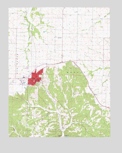
Versailles, MO USGS Topographic Map
Click on map above to begin viewing in our Map Viewer.

This topographic map contains these locations and features:
Feature Name Type Latitude Longitude GNIS ID View Map
Ball School (historical)SchoolN38.4659°W92.8677°745304View Map
Calcina (historical)LocaleN38.4259°W92.8744°740582View Map
City of VersaillesCivilN38.4333°W92.8453°2397131View Map
Freedom Church (historical)ChurchN38.4900°W92.8555°718198View Map
Gravois CampLocaleN38.3764°W92.8057°729746View Map
James Mill SpringSpringN38.3764°W92.8144°720248View Map
MarvinPopulated PlaceN38.4164°W92.7707°741043View Map
Morgan County Sheriff's OfficeBuildingN38.4320°W92.8399°2752363View Map
Mount Zion ChurchChurchN38.4956°W92.7902°722954View Map
Oak Grove ChurchChurchN38.3950°W92.8074°723583View Map
Oak Grove School (historical)SchoolN38.3920°W92.8216°745555View Map
Prairie Dale School (historical)SchoolN38.4525°W92.7913°745554View Map
Prairie Valley School (historical)SchoolN38.4922°W92.7810°745552View Map
Rolling Hills Country ClubLocaleN38.4711°W92.8102°755384View Map
Roy Otten Memorial AirfieldAirportN38.4278°W92.8735°743214View Map
Sunny Side School (historical)SchoolN38.4567°W92.7580°745553View Map
Township of MoreauCivilN38.4316°W92.7521°767056View Map
VersaillesPopulated PlaceN38.4314°W92.8410°728176View Map
Versailles City CemeteryCemeteryN38.4254°W92.8478°2702574View Map
Versailles City Fire DepartmentBuildingN38.4314°W92.8436°2620289View Map
Versailles Municipal Airport (historical)AirportN38.4436°W92.8127°741574View Map
Versailles Post OfficePost OfficeN38.4300°W92.8423°2783023View Map
Versailles Rural Fire Protection DistrictBuildingN38.4320°W92.8656°2621651View Map
Walnut Grove School (historical)SchoolN38.4814°W92.8266°745551View Map
West Union ChurchChurchN38.3959°W92.8469°728636View Map

Note: Coordinates in the location and feature list above are referenced to NAD83 datum.


Copyright (C) 2008-2025 Ryan Niemi / Sunset Dynamics ... All Rights Reserved