TopoQuest Logo
Do you find TopoQuest useful?
Help keep TopoQuest running and adding new maps/features by donating!
Bitcoin:  19c7KJd3qBynnjoSw5npx9KScwjBe4ifkT
Litecoin:  LXs6TkuXGGXo1vDsWCkWVdjQX94eUKd6ui
Home View Maps Find Maps Find Places Resources & Links


Purcell, Oklahoma Topographic Map

USGS Map Title: Purcell, OK
USGS Map MRC: 35097A3
DRG (GeoTIFF) Download: o35097a3.tif


Neighboring USGS Topographic Map Quads:


  Norman, OK  
35097B4
 

  Denver, OK  
35097B3
 

  Little Axe, OK  
35097B2
 

  Washington, OK  
35097A4
 

  Purcell, OK  
35097A3
 

  Eason, OK  
35097A2
 

  Stealy, OK  
34097H4
 

  Wayne, OK  
34097H3
 

  Rosedale, OK  
34097H2


Map MRC Location:

N36°
W98°
N36°
W97°
H8 H7 H6 H5 H4 H3 H2 H1
G8 G7 G6 G5 G4 G3 G2 G1
F8 F7 F6 F5 F4 F3 F2 F1
E8 E7 E6 E5 E4 E3 E2 E1
D8 D7 D6 D5 D4 D3 D2 D1
C8 C7 C6 C5 C4 C3 C2 C1
B8 B7 B6 B5 B4 B3 B2 B1
A8 A7 A6 A5 A4 A3 A2 A1
N35°
W98°
N35°
W97°

Purcell, OK USGS 1:24K Topographic Map Preview:
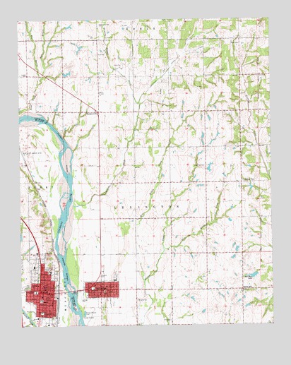
Purcell, OK USGS Topographic Map
Click on map above to begin viewing in our Map Viewer.

This topographic map contains these locations and features:
Feature Name Type Latitude Longitude GNIS ID View Map
Al Salyer DamDamN35.0317°W97.2570°1754314View Map
Al Salyer ReservoirReservoirN35.0317°W97.2570°1754315View Map
Alamo Oil FieldOilfieldN35.1001°W97.3009°1089564View Map
Banner CemeteryCemeteryN35.1016°W97.2565°1089838View Map
Bell Mere DamDamN35.0217°W97.2586°1751152View Map
Bell Mere LakeReservoirN35.0203°W97.2599°1089981View Map
Boone CreekStreamN35.0867°W97.3709°1101923View Map
Canada SchoolSchoolN35.1026°W97.3711°1090888View Map
Chouteau CreekStreamN35.0342°W97.3523°1091336View Map
City of LexingtonCivilN35.0179°W97.3344°2410830View Map
City of PurcellCivilN35.0180°W97.3747°2411503View Map
Coulters York FarmLocaleN35.1172°W97.3367°2611291View Map
Dripping Springs CemeteryCemeteryN35.1229°W97.3351°1092199View Map
Dripping Springs CreekStreamN35.0912°W97.3148°1092201View Map
East Branch Boone CreekStreamN35.0990°W97.3659°1101932View Map
East Willow CreekStreamN35.0306°W97.3039°1092453View Map
Esau R Green Detention CenterBuildingN35.0132°W97.3618°2757850View Map
First Christian ChurchChurchN35.0140°W97.3603°1809862View Map
First Presbyterian ChurchChurchN35.0237°W97.3689°1809863View Map
Hawthorn SchoolSchoolN35.0056°W97.3648°1093609View Map
LexingtonPopulated PlaceN35.0148°W97.3356°1094597View Map
Lexington CemeteryCemeteryN35.0023°W97.3010°1094598View Map
Lexington Elementary SchoolSchoolN35.0191°W97.3272°1793749View Map
Lexington Fire DepartmentBuildingN35.0152°W97.3347°2658325View Map
Lexington High SchoolSchoolN35.0159°W97.3253°1793747View Map
Lexington Intermediate SchoolSchoolN35.0195°W97.3282°2713020View Map
Lexington Junior - High SchoolSchoolN35.0187°W97.3285°1793748View Map
Lexington Police DepartmentBuildingN35.0152°W97.3349°2757461View Map
Mc Caslin AirportAirportN35.0909°W97.3369°1102534View Map
McClain County Sheriff's OfficeBuildingN35.0132°W97.3616°2757788View Map
Methodist ChurchChurchN35.0165°W97.3278°1798511View Map
Northeast Gibbon Spur Oil FieldOilfieldN35.0723°W97.3731°1096026View Map
Oknoname 02704 DamDamN35.1034°W97.3536°1753089View Map
Oknoname 02704 ReservoirReservoirN35.1030°W97.3511°1753090View Map
Oknoname 02705 DamDamN35.0567°W97.2870°1758667View Map
Oknoname 02705 ReservoirReservoirN35.0570°W97.2867°1758668View Map
Oknoname 02706 DamDamN35.0634°W97.2886°1753091View Map
Oknoname 02706 ReservoirReservoirN35.0634°W97.2886°1753092View Map
Oknoname 02707 DamDamN35.0634°W97.2820°1753093View Map
Oknoname 02707 ReservoirReservoirN35.0644°W97.2808°1753094View Map
Oknoname 027070 DamDamN35.0284°W97.2620°1754308View Map
Oknoname 027070 ReservoirReservoirN35.0284°W97.2620°1754309View Map
Oknoname 027071 DamDamN35.0317°W97.2686°1754310View Map
Oknoname 027071 ReservoirReservoirN35.0317°W97.2686°1754311View Map
Our Lady of Victory SchoolSchoolN35.0165°W97.3636°1096351View Map
PurcellPopulated PlaceN35.0137°W97.3611°1096963View Map
Purcell Elementary SchoolSchoolN35.0230°W97.3716°1819299View Map
Purcell Fire DepartmentBuildingN35.0284°W97.3665°2658305View Map
Purcell High SchoolSchoolN35.0381°W97.3675°1819297View Map
Purcell Intermediate SchoolSchoolN35.0207°W97.3727°2712851View Map
Purcell Junior High SchoolSchoolN35.0106°W97.3650°1819298View Map
Purcell Municipal HospitalHospitalN35.0285°W97.3646°2695734View Map
Purcell Police DepartmentBuildingN35.0292°W97.3667°2757414View Map
Saint Johns CemeteryCemeteryN35.0106°W97.3176°1097596View Map
Shilo ChurchChurchN35.0951°W97.3345°1097994View Map
Shiloh CemeteryCemeteryN35.0949°W97.3347°2681389View Map
Simpson SchoolSchoolN35.0140°W97.3678°1098062View Map
SlaughtervillePopulated PlaceN35.0873°W97.3350°1100833View Map
Slaughterville Baptist ChurchChurchN35.0928°W97.3450°1790581View Map
Slaughterville Fire Department Station 1BuildingN35.0878°W97.2645°2658473View Map
Slaughterville Fire Department Station 2BuildingN35.1176°W97.3084°2658694View Map
Slaughterville Fire Department Station 3BuildingN35.0886°W97.3364°2658700View Map
Spring HillPopulated PlaceN35.0148°W97.2653°1100846View Map
Town of SlaughtervilleCivilN35.0910°W97.2879°2413296View Map
Township of LexingtonCivilN35.0487°W97.3086°1824749View Map
Trinity United Methodist ChurchChurchN35.0142°W97.3617°1809864View Map
Wadleys Emergency Medical ServicesBuildingN35.0137°W97.3649°2695894View Map
West Branch Boone CreekStreamN35.0990°W97.3659°1101954View Map
West Willow CreekStreamN35.0165°W97.3136°1099623View Map
Willow ViewPopulated PlaceN35.0584°W97.2650°1100940View Map
Willow View CemeteryCemeteryN35.0656°W97.2830°1099871View Map

Note: Coordinates in the location and feature list above are referenced to NAD83 datum.


Copyright (C) 2008-2025 Ryan Niemi / Sunset Dynamics ... All Rights Reserved