TopoQuest Logo
Do you find TopoQuest useful?
Help keep TopoQuest running and adding new maps/features by donating!
Bitcoin:  19c7KJd3qBynnjoSw5npx9KScwjBe4ifkT
Litecoin:  LXs6TkuXGGXo1vDsWCkWVdjQX94eUKd6ui
Home View Maps Find Maps Find Places Resources & Links


Eason, Oklahoma Topographic Map

USGS Map Title: Eason, OK
USGS Map MRC: 35097A2
DRG (GeoTIFF) Download: o35097a2.tif


Neighboring USGS Topographic Map Quads:


  Denver, OK  
35097B3
 

  Little Axe, OK  
35097B2
 

  Macomb, OK  
35097B1
 

  Purcell, OK  
35097A3
 

  Eason, OK  
35097A2
 

  Tribbey, OK  
35097A1
 

  Wayne, OK  
34097H3
 

  Rosedale, OK  
34097H2
 

  Wanette, OK  
34097H1


Map MRC Location:

N36°
W98°
N36°
W97°
H8 H7 H6 H5 H4 H3 H2 H1
G8 G7 G6 G5 G4 G3 G2 G1
F8 F7 F6 F5 F4 F3 F2 F1
E8 E7 E6 E5 E4 E3 E2 E1
D8 D7 D6 D5 D4 D3 D2 D1
C8 C7 C6 C5 C4 C3 C2 C1
B8 B7 B6 B5 B4 B3 B2 B1
A8 A7 A6 A5 A4 A3 A2 A1
N35°
W98°
N35°
W97°

Eason, OK USGS 1:24K Topographic Map Preview:
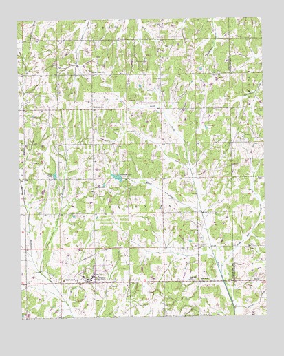
Eason, OK USGS Topographic Map
Click on map above to begin viewing in our Map Viewer.

This topographic map contains these locations and features:
Feature Name Type Latitude Longitude GNIS ID View Map
Cedar Country Fire Protection District HeadquartersBuildingN35.0948°W97.1768°2658539View Map
Conklin LakeReservoirN35.0561°W97.2072°1091613View Map
Council Creek CemeteryCemeteryN35.0869°W97.1253°1091736View Map
Cropper CemeteryCemeteryN35.0301°W97.1589°1091843View Map
Dahlgren LakeReservoirN35.0587°W97.2002°1091913View Map
Dahlgrin Lake DamDamN35.0584°W97.1986°1754336View Map
EasonPopulated PlaceN35.0148°W97.1303°1100374View Map
East Pond CreekStreamN35.0179°W97.1481°1092430View Map
Griffin Memorial Hospital AnnexHospitalN35.0162°W97.2145°1093417View Map
Helsel CreekStreamN35.0440°W97.1575°1093661View Map
Joseph Harp Correctional CenterBuildingN35.0309°W97.2033°1763584View Map
Jumper CreekStreamN35.0031°W97.1417°1094275View Map
Lexington Assessment and Reception CenterBuildingN35.0166°W97.2201°1763586View Map
Lexington Wildlife Managment AreaReserveN35.0634°W97.2203°1763583View Map
Little Buckhead CreekStreamN35.0192°W97.2403°1094717View Map
McKiddyvillePopulated PlaceN35.0876°W97.2120°1100618View Map
Metcalf CemeteryCemeteryN35.0582°W97.1260°1095338View Map
Muldrow Airfield HeliportAirportN35.0167°W97.2339°1102535View Map
Muldrow Army HeliportAirportN35.0241°W97.2294°1763585View Map
Oknoname 02703 DamDamN35.1051°W97.1553°1753095View Map
Oknoname 02703 ReservoirReservoirN35.1051°W97.1553°1753096View Map
Red Oak CemeteryCemeteryN35.1012°W97.1510°1097111View Map
Rose Hill ChurchChurchN35.0154°W97.1586°1097438View Map
Rose Hill SchoolSchoolN35.0156°W97.1645°1097440View Map
Shiloh ChurchChurchN35.1062°W97.2092°1098000View Map
Smith LakeReservoirN35.0598°W97.2323°1098138View Map
Spring Creek SchoolSchoolN35.1023°W97.2117°1098435View Map
Township of CanadianCivilN35.0459°W97.1892°1824750View Map

Note: Coordinates in the location and feature list above are referenced to NAD83 datum.


Copyright (C) 2008-2025 Ryan Niemi / Sunset Dynamics ... All Rights Reserved