TopoQuest Logo
Do you find TopoQuest useful?
Help keep TopoQuest running and adding new maps/features by donating!
Bitcoin:  19c7KJd3qBynnjoSw5npx9KScwjBe4ifkT
Litecoin:  LXs6TkuXGGXo1vDsWCkWVdjQX94eUKd6ui
Home View Maps Find Maps Find Places Resources & Links


Puxico, Missouri Topographic Map

USGS Map Title: Puxico, MO
USGS Map MRC: 36090H2
DRG (GeoTIFF) Download: o36090h2.tif


Neighboring USGS Topographic Map Quads:


  Shook, MO  
37090A3
 

  McGee, MO  
37090A2
 

  Sturdivant, MO  
37090A1
 

  Wappapello, MO  
36090H3
 

  Puxico, MO  
36090H2
 

  Acorn Ridge, MO  
36090H1
 

  Rombauer, MO  
36090G3
 

  Fisk, MO  
36090G2
 

  Dudley, MO  
36090G1


Map MRC Location:

N37°
W91°
N37°
W90°
H8 H7 H6 H5 H4 H3 H2 H1
G8 G7 G6 G5 G4 G3 G2 G1
F8 F7 F6 F5 F4 F3 F2 F1
E8 E7 E6 E5 E4 E3 E2 E1
D8 D7 D6 D5 D4 D3 D2 D1
C8 C7 C6 C5 C4 C3 C2 C1
B8 B7 B6 B5 B4 B3 B2 B1
A8 A7 A6 A5 A4 A3 A2 A1
N36°
W91°
N36°
W90°

Puxico, MO USGS 1:24K Topographic Map Preview:
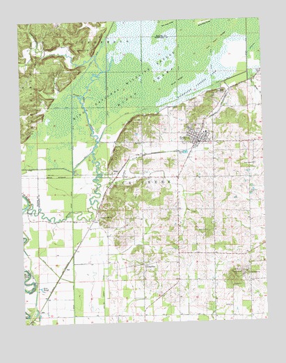
Puxico, MO USGS Topographic Map
Click on map above to begin viewing in our Map Viewer.

This topographic map contains these locations and features:
Feature Name Type Latitude Longitude GNIS ID View Map
AshervillePopulated PlaceN36.8987°W90.1873°713433View Map
Bee Press RidgeRidgeN36.9987°W90.1720°713871View Map
Bee Tree Cypress Spreads (historical)SwampN36.8989°W90.2212°739909View Map
Boardwalk Nature TrailTrailN36.9706°W90.1470°736220View Map
City of PuxicoCivilN36.9508°W90.1586°2396295View Map
Clubb CemeteryCemeteryN36.9287°W90.1326°716017View Map
Coal Oil Johnny DitchCanalN36.8903°W90.2090°716038View Map
CobbPopulated PlaceN36.9176°W90.2134°740754View Map
Corinth ChurchChurchN36.8814°W90.1432°716315View Map
Cow Knoll RidgeRidgeN36.9912°W90.1468°716410View Map
DalePopulated PlaceN36.8801°W90.2426°758427View Map
Devils WashboardCliffN36.9898°W90.2323°730500View Map
Ditch Number 10CanalN36.9837°W90.2115°755056View Map
Ditch Number 11CanalN36.9634°W90.1823°755057View Map
Ditch Number 13CanalN36.8995°W90.2379°755059View Map
Ditch Number 5CanalN36.9826°W90.1862°755122View Map
Ditch Number 6CanalN36.9701°W90.2048°755129View Map
Ditch Number 7CanalN36.9645°W90.2284°755141View Map
Ditch Number 9CanalN36.9395°W90.2434°755165View Map
Duck Creek ChurchChurchN36.9403°W90.1301°717143View Map
Egypt ChurchChurchN36.9495°W90.1876°735593View Map
Flat Mingo CreekStreamN36.9778°W90.1323°717992View Map
Fry BluffCliffN36.9912°W90.2082°718271View Map
Gravel Hill CemeteryCemeteryN36.9123°W90.1540°718737View Map
Hodges Ferry School (historical)SchoolN36.8792°W90.2426°730427View Map
Job Corps Conservation CenterLocaleN36.9368°W90.2044°736221View Map
Johns BranchStreamN36.9887°W90.2409°750518View Map
Kentucky SloughStreamN36.9689°W90.2195°720547View Map
King SloughGutN36.8898°W90.2412°720616View Map
Lepper Lake DamDamN36.9317°W90.1534°765559View Map
Main DikeDamN36.9584°W90.2334°765528View Map
MingoPopulated PlaceN36.9373°W90.2001°741073View Map
Mingo CreekStreamN36.9253°W90.2451°722435View Map
Mingo National Wildlife RefugeParkN36.9933°W90.1735°751117View Map
Mingo WildernessReserveN36.9803°W90.1994°737866View Map
Monopoly Lake (historical)LakeN36.9909°W90.1923°739865View Map
Moons Mills (historical)LocaleN36.9370°W90.2420°740535View Map
Oscar HollowValleyN36.9717°W90.2307°730499View Map
Page School (historical)SchoolN36.9037°W90.1665°747615View Map
Pleasant Valley ChurchChurchN36.9187°W90.2101°724618View Map
Pool SixSwampN36.9920°W90.1379°738120View Map
Providence ChurchChurchN36.8948°W90.1337°724968View Map
PuxicoPopulated PlaceN36.9498°W90.1584°725011View Map
Puxico Police DepartmentBuildingN36.9499°W90.1575°2752379View Map
Puxico Post OfficePost OfficeN36.9506°W90.1580°2782982View Map
Puxico Volunteer Fire DepartmentBuildingN36.9492°W90.1583°2620924View Map
Red Mill Hunters EntranceLocaleN36.9698°W90.1437°732628View Map
Red Mill PondReservoirN36.9728°W90.1432°736068View Map
Reece Post OfficePost OfficeN36.8801°W90.2426°765604View Map
Rock Hill CemeteryCemeteryN36.8950°W90.1365°725456View Map
Rock Hill SchoolSchoolN36.8995°W90.1320°747616View Map
Rockhouse Cypress LakeSwampN36.9745°W90.1529°725483View Map
Sand Blow RidgeRidgeN36.9992°W90.1534°725997View Map
Shaw RidgeRidgeN36.9745°W90.1673°726289View Map
Shoemaker SchoolSchoolN36.9253°W90.1695°747614View Map
Stanley CreekStreamN36.9792°W90.2065°727007View Map
StarPopulated PlaceN36.8978°W90.2287°741282View Map
Township of Duck CreekCivilN36.8854°W90.1495°767417View Map
Turkey CreekStreamN36.9389°W90.2098°727845View Map
Union Hill SchoolSchoolN36.9734°W90.2498°747613View Map

Note: Coordinates in the location and feature list above are referenced to NAD83 datum.


Copyright (C) 2008-2024 Ryan Niemi / Sunset Dynamics ... All Rights Reserved