TopoQuest Logo
Do you find TopoQuest useful?
Help keep TopoQuest running and adding new maps/features by donating!
Bitcoin:  19c7KJd3qBynnjoSw5npx9KScwjBe4ifkT
Litecoin:  LXs6TkuXGGXo1vDsWCkWVdjQX94eUKd6ui
Home View Maps Find Maps Find Places Resources & Links


Pyrmont, Indiana Topographic Map

USGS Map Title: Pyrmont, IN
USGS Map MRC: 40086D6
DRG (GeoTIFF) Download: o40086d6.tif


Neighboring USGS Topographic Map Quads:


  Brookston, IN  
40086E7
 

  Delphi, IN  
40086E6
 

  Flora, IN  
40086E5
 

  Lafayette East, IN  
40086D7
 

  Pyrmont, IN  
40086D6
 

  Rossville, IN  
40086D5
 

  Stockwell, IN  
40086C7
 

  Mulberry, IN  
40086C6
 

  Frankfort, IN  
40086C5


Map MRC Location:

N41°
W87°
N41°
W86°
H8 H7 H6 H5 H4 H3 H2 H1
G8 G7 G6 G5 G4 G3 G2 G1
F8 F7 F6 F5 F4 F3 F2 F1
E8 E7 E6 E5 E4 E3 E2 E1
D8 D7 D6 D5 D4 D3 D2 D1
C8 C7 C6 C5 C4 C3 C2 C1
B8 B7 B6 B5 B4 B3 B2 B1
A8 A7 A6 A5 A4 A3 A2 A1
N40°
W87°
N40°
W86°

Pyrmont, IN USGS 1:24K Topographic Map Preview:
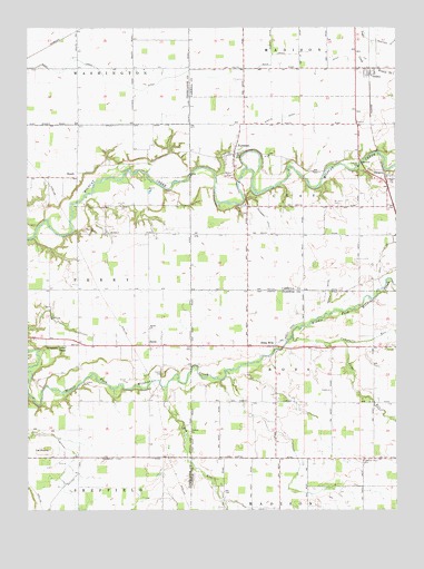
Pyrmont, IN USGS Topographic Map
Click on map above to begin viewing in our Map Viewer.

This topographic map contains these locations and features:
Feature Name Type Latitude Longitude GNIS ID View Map
Barnhart Strip Airport (historical)AirportN40.4723°W86.6514°449144View Map
Bethel ChurchChurchN40.4220°W86.7092°430938View Map
Buck Creek DitchCanalN40.4892°W86.6931°431730View Map
Campbells RunStreamN40.4195°W86.6606°432087View Map
Cripe RunStreamN40.4186°W86.6428°433133View Map
Deiter DitchCanalN40.4314°W86.6475°433443View Map
Dunk CreekStreamN40.4109°W86.6831°446666View Map
Edna MillsPopulated PlaceN40.4175°W86.6678°434027View Map
Fairview ChurchChurchN40.4473°W86.7272°434342View Map
HeathPopulated PlaceN40.4611°W86.7333°435952View Map
Hog RunStreamN40.4064°W86.7036°436291View Map
OckleyPopulated PlaceN40.4884°W86.6339°440498View Map
OwascoPopulated PlaceN40.4609°W86.6281°440788View Map
Oxford ChurchChurchN40.3953°W86.6950°440819View Map
PettitPopulated PlaceN40.4175°W86.7092°441066View Map
Pleasant View CemeteryCemeteryN40.3879°W86.6372°441338View Map
PyrmontPopulated PlaceN40.4675°W86.6797°441677View Map
Saint Johns CemeteryCemeteryN40.4539°W86.6462°442574View Map
Schimnel DitchCanalN40.4525°W86.6706°443072View Map
Shaftey DitchCanalN40.4964°W86.6289°443264View Map
Sheets DitchCanalN40.4745°W86.6728°443338View Map
Swank CemeteryCemeteryN40.4103°W86.7044°444466View Map
Sycamore Valley CampParkN40.4161°W86.7411°444517View Map
The MoundSummitN40.3906°W86.7428°444673View Map
Township of ClayCivilN40.4569°W86.6378°453205View Map
Weil DitchCanalN40.4395°W86.6306°445640View Map
Zion CemeteryCemeteryN40.4248°W86.7422°446444View Map

Note: Coordinates in the location and feature list above are referenced to NAD83 datum.


Copyright (C) 2008-2025 Ryan Niemi / Sunset Dynamics ... All Rights Reserved