TopoQuest Logo
Do you find TopoQuest useful?
Help keep TopoQuest running and adding new maps/features by donating!
Bitcoin:  19c7KJd3qBynnjoSw5npx9KScwjBe4ifkT
Litecoin:  LXs6TkuXGGXo1vDsWCkWVdjQX94eUKd6ui
Home View Maps Find Maps Find Places Resources & Links


Mulberry, Indiana Topographic Map

USGS Map Title: Mulberry, IN
USGS Map MRC: 40086C6
DRG (GeoTIFF) Download: o40086c6.tif


Neighboring USGS Topographic Map Quads:


  Lafayette East, IN  
40086D7
 

  Pyrmont, IN  
40086D6
 

  Rossville, IN  
40086D5
 

  Stockwell, IN  
40086C7
 

  Mulberry, IN  
40086C6
 

  Frankfort, IN  
40086C5
 

  Kirkpatrick, IN  
40086B7
 

  Colfax, IN  
40086B6
 

  Thorntown, IN  
40086B5


Map MRC Location:

N41°
W87°
N41°
W86°
H8 H7 H6 H5 H4 H3 H2 H1
G8 G7 G6 G5 G4 G3 G2 G1
F8 F7 F6 F5 F4 F3 F2 F1
E8 E7 E6 E5 E4 E3 E2 E1
D8 D7 D6 D5 D4 D3 D2 D1
C8 C7 C6 C5 C4 C3 C2 C1
B8 B7 B6 B5 B4 B3 B2 B1
A8 A7 A6 A5 A4 A3 A2 A1
N40°
W87°
N40°
W86°

Mulberry, IN USGS 1:24K Topographic Map Preview:
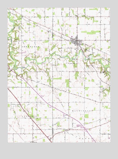
Mulberry, IN USGS Topographic Map
Click on map above to begin viewing in our Map Viewer.

This topographic map contains these locations and features:
Feature Name Type Latitude Longitude GNIS ID View Map
Abbot CemeteryCemeteryN40.2651°W86.6868°429983View Map
Anderson DitchCanalN40.2728°W86.7403°430159View Map
Baker CemeteryCemeteryN40.3665°W86.7330°430424View Map
Camp George CullomParkN40.3145°W86.6311°432034View Map
Clark CemeteryCemeteryN40.2545°W86.7198°432552View Map
Clover Leaf ChurchChurchN40.2620°W86.6753°432685View Map
Deer Run CreekStreamN40.3243°W86.7071°2704669View Map
Fairhaven ChurchChurchN40.3667°W86.6653°434299View Map
FicklePopulated PlaceN40.2611°W86.6750°446766View Map
Hentz DitchCanalN40.2878°W86.7181°436046View Map
Holladay CemeteryCemeteryN40.3060°W86.7138°436321View Map
Lauramie CreekStreamN40.3228°W86.7403°437652View Map
Madison Township Volunteer Fire DepartmentBuildingN40.3450°W86.6593°2626593View Map
McClellan Fickle DitchCanalN40.2581°W86.6750°438793View Map
Miller Field (historical)AirportN40.3559°W86.7217°449140View Map
MonroePopulated PlaceN40.2864°W86.7353°439339View Map
MulberryPopulated PlaceN40.3445°W86.6653°439866View Map
Mulberry Elementary SchoolSchoolN40.3420°W86.6661°446520View Map
Mulberry Town MarshalBuildingN40.3439°W86.6665°2758038View Map
Newcomer CemeteryCemeteryN40.3247°W86.7189°440139View Map
Rutan Farms LakeReservoirN40.3184°W86.7033°448902View Map
Rutan Farms Lake DamDamN40.3184°W86.7033°448903View Map
Spring CreekStreamN40.3192°W86.6311°443974View Map
Town of MulberryCivilN40.3458°W86.6675°2396793View Map
Township of MadisonCivilN40.3432°W86.6535°453589View Map
Wildcat Conservation ClubLocaleN40.3350°W86.6564°452415View Map
WyandotPopulated PlaceN40.3453°W86.7495°446346View Map

Note: Coordinates in the location and feature list above are referenced to NAD83 datum.


Copyright (C) 2008-2024 Ryan Niemi / Sunset Dynamics ... All Rights Reserved