TopoQuest Logo
Do you find TopoQuest useful?
Help keep TopoQuest running and adding new maps/features by donating!
Bitcoin:  19c7KJd3qBynnjoSw5npx9KScwjBe4ifkT
Litecoin:  LXs6TkuXGGXo1vDsWCkWVdjQX94eUKd6ui
Home View Maps Find Maps Find Places Resources & Links


Flora, Indiana Topographic Map

USGS Map Title: Flora, IN
USGS Map MRC: 40086E5
DRG (GeoTIFF) Download: o40086e5.tif


Neighboring USGS Topographic Map Quads:


  Yeoman, IN  
40086F6
 

  Burrows, IN  
40086F5
 

  Clymers, IN  
40086F4
 

  Delphi, IN  
40086E6
 

  Flora, IN  
40086E5
 

  Deer Creek, IN  
40086E4
 

  Pyrmont, IN  
40086D6
 

  Rossville, IN  
40086D5
 

  Burlington, IN  
40086D4


Map MRC Location:

N41°
W87°
N41°
W86°
H8 H7 H6 H5 H4 H3 H2 H1
G8 G7 G6 G5 G4 G3 G2 G1
F8 F7 F6 F5 F4 F3 F2 F1
E8 E7 E6 E5 E4 E3 E2 E1
D8 D7 D6 D5 D4 D3 D2 D1
C8 C7 C6 C5 C4 C3 C2 C1
B8 B7 B6 B5 B4 B3 B2 B1
A8 A7 A6 A5 A4 A3 A2 A1
N40°
W87°
N40°
W86°

Flora, IN USGS 1:24K Topographic Map Preview:
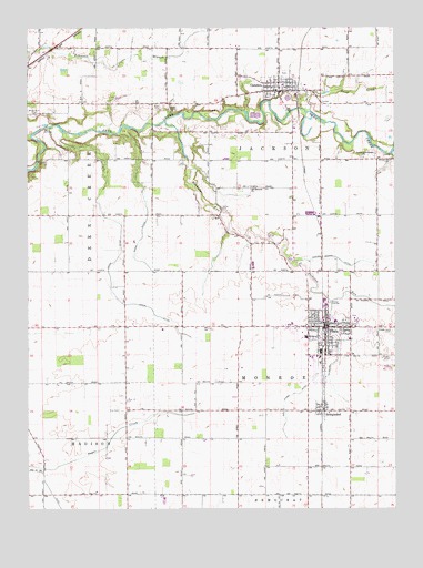
Flora, IN USGS Topographic Map
Click on map above to begin viewing in our Map Viewer.

This topographic map contains these locations and features:
Feature Name Type Latitude Longitude GNIS ID View Map
Ayres DitchCanalN40.5303°W86.5331°430369View Map
Bachelor RunStreamN40.6006°W86.5789°430385View Map
BringhurstPopulated PlaceN40.5253°W86.5250°431531View Map
CamdenPopulated PlaceN40.6086°W86.5400°432002View Map
Camden - Jackson Township Volunteer Fire DepartmentBuildingN40.6076°W86.5417°2625733View Map
Carroll CountyCivilN40.5829°W86.5635°450406View Map
Cook Hog FarmLocaleN40.5317°W86.6097°2710726View Map
FloraPopulated PlaceN40.5473°W86.5244°434609View Map
Flora Fire DepartmentBuildingN40.5489°W86.5244°2625807View Map
Flora Municipal AirportAirportN40.5409°W86.5513°449165View Map
Flora Police DepartmentBuildingN40.5482°W86.5235°2758219View Map
Johns DitchCanalN40.5653°W86.5947°437028View Map
Kuns DitchCanalN40.5386°W86.5206°437477View Map
Lower Deer Creek ChurchChurchN40.5911°W86.5108°438366View Map
Maple Lawn CemeteryCemeteryN40.5461°W86.5003°438568View Map
Moss CemeteryCemeteryN40.5389°W86.5028°439497View Map
Musselman CemeteryCemeteryN40.5912°W86.5020°439905View Map
Nebo CemeteryCemeteryN40.6041°W86.5768°439961View Map
Nettle CemeteryCemeteryN40.5780°W86.5591°440002View Map
Old German ChurchChurchN40.5834°W86.5500°440561View Map
Paint CreekStreamN40.6036°W86.5308°440829View Map
Sharp Point CemeteryCemeteryN40.6026°W86.6220°443307View Map
Sines DitchCanalN40.5775°W86.5847°443544View Map
Town of CamdenCivilN40.6098°W86.5391°2396624View Map
Town of FloraCivilN40.5452°W86.5242°2396940View Map
Township of JacksonCivilN40.5979°W86.5251°453434View Map
Township of MonroeCivilN40.5327°W86.5251°453635View Map
Wise CemeteryCemeteryN40.6048°W86.5797°446207View Map
Zion CemeteryCemeteryN40.5255°W86.5930°446441View Map

Note: Coordinates in the location and feature list above are referenced to NAD83 datum.


Copyright (C) 2008-2024 Ryan Niemi / Sunset Dynamics ... All Rights Reserved