TopoQuest Logo
Do you find TopoQuest useful?
Help keep TopoQuest running and adding new maps/features by donating!
Bitcoin:  19c7KJd3qBynnjoSw5npx9KScwjBe4ifkT
Litecoin:  LXs6TkuXGGXo1vDsWCkWVdjQX94eUKd6ui
Home View Maps Find Maps Find Places Resources & Links


Rossville, Indiana Topographic Map

USGS Map Title: Rossville, IN
USGS Map MRC: 40086D5
DRG (GeoTIFF) Download: o40086d5.tif


Neighboring USGS Topographic Map Quads:


  Delphi, IN  
40086E6
 

  Flora, IN  
40086E5
 

  Deer Creek, IN  
40086E4
 

  Pyrmont, IN  
40086D6
 

  Rossville, IN  
40086D5
 

  Burlington, IN  
40086D4
 

  Mulberry, IN  
40086C6
 

  Frankfort, IN  
40086C5
 

  Michigantown, IN  
40086C4


Map MRC Location:

N41°
W87°
N41°
W86°
H8 H7 H6 H5 H4 H3 H2 H1
G8 G7 G6 G5 G4 G3 G2 G1
F8 F7 F6 F5 F4 F3 F2 F1
E8 E7 E6 E5 E4 E3 E2 E1
D8 D7 D6 D5 D4 D3 D2 D1
C8 C7 C6 C5 C4 C3 C2 C1
B8 B7 B6 B5 B4 B3 B2 B1
A8 A7 A6 A5 A4 A3 A2 A1
N40°
W87°
N40°
W86°

Rossville, IN USGS 1:24K Topographic Map Preview:
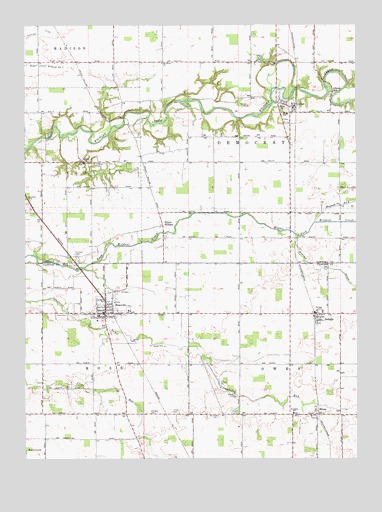
Rossville, IN USGS Topographic Map
Click on map above to begin viewing in our Map Viewer.

This topographic map contains these locations and features:
Feature Name Type Latitude Longitude GNIS ID View Map
Adams MillPopulated PlaceN40.4806°W86.5089°430014View Map
Branch Number SixCanalN40.4459°W86.5125°436551View Map
CutlerPopulated PlaceN40.4764°W86.5242°433265View Map
Gray Field (historical)AirportN40.4209°W86.5869°449331View Map
Hiner CemeteryCemeteryN40.3880°W86.5720°436234View Map
Hufford CemeteryCemeteryN40.4609°W86.6003°436589View Map
Hufford CemeteryCemeteryN40.4340°W86.6062°436590View Map
Hughes CemeteryCemeteryN40.4606°W86.5983°436595View Map
Latshaw CemeteryCemeteryN40.3880°W86.5781°437641View Map
MoranPopulated PlaceN40.3875°W86.5153°439418View Map
Mount Hope CemeteryCemeteryN40.3871°W86.5523°439579View Map
Mount Olivet ChurchChurchN40.4892°W86.5733°439634View Map
Prince WilliamPopulated PlaceN40.4423°W86.5731°441601View Map
RayPopulated PlaceN40.4542°W86.5253°446704View Map
Robinson BranchStreamN40.4392°W86.5231°446498View Map
RossvillePopulated PlaceN40.4170°W86.5947°442329View Map
Rossville Police DepartmentBuildingN40.4167°W86.5954°2758151View Map
Rossville Volunteer Ambulance ServiceBuildingN40.4180°W86.5934°2719272View Map
Rossville Volunteer Fire DepartmentBuildingN40.4177°W86.5849°2625912View Map
SedaliaPopulated PlaceN40.4156°W86.5147°443192View Map
Shaffer DitchCanalN40.4970°W86.6236°443262View Map
Town of RossvilleCivilN40.4200°W86.5955°2396891View Map
Township of DemocratCivilN40.4675°W86.5249°453263View Map
Township of OwenCivilN40.3950°W86.5157°453701View Map
Township of RossCivilN40.3980°W86.6183°453813View Map
Vernon Payne LakeReservoirN40.4899°W86.5362°448566View Map
Vernon Payne Lake DamDamN40.4900°W86.5350°448565View Map
WLFI-TV (Lafayette)TowerN40.3889°W86.6128°447007View Map

Note: Coordinates in the location and feature list above are referenced to NAD83 datum.


Copyright (C) 2008-2024 Ryan Niemi / Sunset Dynamics ... All Rights Reserved