TopoQuest Logo
Do you find TopoQuest useful?
Help keep TopoQuest running and adding new maps/features by donating!
Bitcoin:  19c7KJd3qBynnjoSw5npx9KScwjBe4ifkT
Litecoin:  LXs6TkuXGGXo1vDsWCkWVdjQX94eUKd6ui
Home View Maps Find Maps Find Places Resources & Links


Queens Head, New Mexico Topographic Map

USGS Map Title: Queens Head, NM
USGS Map MRC: 33108H6
DRG (GeoTIFF) Download: o33108h6.tif


Neighboring USGS Topographic Map Quads:


  Black Peak, NM  
34108A7
 

  Gallo Mountains West, NM  
34108A6
 

  Gallo Mountains East, NM  
34108A5
 

  Centerfire Bog, NM  
33108H7
 

  Queens Head, NM  
33108H6
 

  Aragon, NM  
33108H5
 

  Dillon Mountain, NM  
33108G7
 

  Cruzville, NM  
33108G6
 

  Squirrel Springs Canyon, NM  
33108G5


Map MRC Location:

N34°
W109°
N34°
W108°
H8 H7 H6 H5 H4 H3 H2 H1
G8 G7 G6 G5 G4 G3 G2 G1
F8 F7 F6 F5 F4 F3 F2 F1
E8 E7 E6 E5 E4 E3 E2 E1
D8 D7 D6 D5 D4 D3 D2 D1
C8 C7 C6 C5 C4 C3 C2 C1
B8 B7 B6 B5 B4 B3 B2 B1
A8 A7 A6 A5 A4 A3 A2 A1
N33°
W109°
N33°
W108°

Queens Head, NM USGS 1:24K Topographic Map Preview:
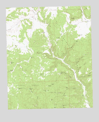
Queens Head, NM USGS Topographic Map
Click on map above to begin viewing in our Map Viewer.

This topographic map contains these locations and features:
Feature Name Type Latitude Longitude GNIS ID View Map
Apache Creek Deaf RanchLocaleN33.9157°W108.6510°913130View Map
Bear CanyonValleyN33.9387°W108.6801°903640View Map
Bear Canyon TankReservoirN33.9384°W108.7156°903647View Map
Bear Canyon Tank Number TwoReservoirN33.9228°W108.7465°903648View Map
Daisy GulchValleyN33.9234°W108.6567°905580View Map
Deep CanyonValleyN33.9420°W108.6820°905657View Map
Deep Canyon TankReservoirN33.9617°W108.6723°905662View Map
Dry LakeLakeN33.9899°W108.6821°905882View Map
Dry LakesLakeN33.9582°W108.7400°905886View Map
East Camp TankReservoirN33.9533°W108.7387°905950View Map
East Camp WindmillLocaleN33.9878°W108.7126°905952View Map
Elk Horn ParkFlatN33.8859°W108.6876°906126View Map
Elk Horn TankReservoirN33.8762°W108.6831°906127View Map
Fitzgerald CienegaSwampN33.9686°W108.6929°913254View Map
Gann TankReservoirN33.9634°W108.6910°906466View Map
Gann WindmillLocaleN33.9914°W108.7051°906467View Map
Hardcastle CanyonValleyN33.9334°W108.6673°906836View Map
Hastings TankReservoirN33.9970°W108.6306°906865View Map
Headwater CanyonValleyN33.9826°W108.6323°906894View Map
Jewett Gap CanyonValleyN33.9739°W108.6362°907357View Map
Jewett Work CenterLocaleN33.9809°W108.6323°907358View Map
Kerr CanyonValleyN33.9017°W108.6384°907544View Map
Kerr SpringSpringN33.9006°W108.6647°907545View Map
Kerr TankReservoirN33.8796°W108.6828°907546View Map
Lawson CanyonValleyN33.9937°W108.7051°909576View Map
Lee Russell CanyonValleyN33.9112°W108.6498°907923View Map
Lee Russell SpringSpringN33.9179°W108.6724°907924View Map
Lee Russell TankReservoirN33.9046°W108.6826°907925View Map
Lower Water SpringSpringN33.9571°W108.6461°908296View Map
Mule SpringSpringN33.8900°W108.6412°908977View Map
Negrohead ButteSummitN33.9337°W108.7451°923633View Map
Oak SpringsSpringN33.8906°W108.6692°909243View Map
Park TankReservoirN33.9403°W108.6377°909483View Map
Piney ParkFlatN33.8973°W108.6923°909698View Map
Piney Park CanyonValleyN33.8934°W108.6678°909700View Map
Piney Park TankReservoirN33.8968°W108.6937°909702View Map
Piney Park Tank Number 1ReservoirN33.9029°W108.6908°909703View Map
Preston TankReservoirN33.9468°W108.7464°909846View Map
Queens HeadSummitN33.9851°W108.6531°909928View Map
Quemado Ranger DistrictForestN33.9942°W108.6726°2038638View Map
Red WindmillLocaleN33.9728°W108.7478°910089View Map
Sawmill CanyonValleyN33.8751°W108.6334°910841View Map
Schoolhouse CanyonValleyN33.9109°W108.6478°910875View Map
Schoolhouse SpringSpringN33.9147°W108.6323°910878View Map
Turkey ParkFlatN33.9248°W108.6990°911879View Map
Turkey Park TankReservoirN33.9175°W108.7024°911883View Map
Upper Sawmill TankReservoirN33.8785°W108.6705°912006View Map
Whiskey CreekStreamN33.9334°W108.6673°912285View Map
Wild Horse TankReservoirN33.9447°W108.7067°912375View Map
Wilson Canyon Tank Number 1ReservoirN33.9002°W108.7346°912427View Map
Wilson Canyon Tank Number 2ReservoirN33.8998°W108.7188°912428View Map
Yankee GulchValleyN33.9234°W108.6567°912517View Map
Yankee SpringSpringN33.9352°W108.6427°912518View Map

Note: Coordinates in the location and feature list above are referenced to NAD83 datum.


Copyright (C) 2008-2025 Ryan Niemi / Sunset Dynamics ... All Rights Reserved