TopoQuest Logo
Do you find TopoQuest useful?
Help keep TopoQuest running and adding new maps/features by donating!
Bitcoin:  19c7KJd3qBynnjoSw5npx9KScwjBe4ifkT
Litecoin:  LXs6TkuXGGXo1vDsWCkWVdjQX94eUKd6ui
Home View Maps Find Maps Find Places Resources & Links


Gallo Mountains East, New Mexico Topographic Map

USGS Map Title: Gallo Mountains East, NM
USGS Map MRC: 34108A5
DRG (GeoTIFF) Download: o34108a5.tif


Neighboring USGS Topographic Map Quads:


  Ponderosa Tank, NM  
34108B6
 

  Largo Mesa, NM  
34108B5
 

  Escondido Mountain, NM  
34108B4
 

  Gallo Mountains West, NM  
34108A6
 

  Gallo Mountains East, NM  
34108A5
 

  Slaughter Mesa, NM  
34108A4
 

  Queens Head, NM  
33108H6
 

  Aragon, NM  
33108H5
 

  Tularosa Canyon, NM  
33108H4


Map MRC Location:

N35°
W109°
N35°
W108°
H8 H7 H6 H5 H4 H3 H2 H1
G8 G7 G6 G5 G4 G3 G2 G1
F8 F7 F6 F5 F4 F3 F2 F1
E8 E7 E6 E5 E4 E3 E2 E1
D8 D7 D6 D5 D4 D3 D2 D1
C8 C7 C6 C5 C4 C3 C2 C1
B8 B7 B6 B5 B4 B3 B2 B1
A8 A7 A6 A5 A4 A3 A2 A1
N34°
W109°
N34°
W108°

Gallo Mountains East, NM USGS 1:24K Topographic Map Preview:
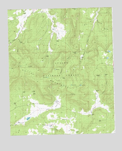
Gallo Mountains East, NM USGS Topographic Map
Click on map above to begin viewing in our Map Viewer.

This topographic map contains these locations and features:
Feature Name Type Latitude Longitude GNIS ID View Map
Acorn TankReservoirN34.0878°W108.5092°2038342View Map
Agua Fria TankReservoirN34.1242°W108.5435°1923412View Map
Ambrosia TankReservoirN34.0022°W108.5469°1923394View Map
Armijo CampgroundLocaleN34.0912°W108.5665°2038352View Map
Armijo SpringSpringN34.0928°W108.5648°1923404View Map
Armijo TankReservoirN34.1048°W108.5695°1923405View Map
Bog TankReservoirN34.0688°W108.6103°1923382View Map
Bull CampLocaleN34.0212°W108.5340°904172View Map
Bull Camp Pit TankReservoirN34.0031°W108.5381°2038387View Map
Bull Camp SpringSpringN34.0426°W108.5220°1923418View Map
Campground SpringSpringN34.0576°W108.5170°1923417View Map
Costilla SpringSpringN34.0428°W108.6092°1923386View Map
Crater TankReservoirN34.0484°W108.5399°1923415View Map
Davis WindmillLocaleN34.1209°W108.6034°1923379View Map
East TankReservoirN34.0562°W108.5940°2038452View Map
First WindmillLocaleN34.0128°W108.6159°1923388View Map
Frank SpringSpringN34.0681°W108.6023°1923383View Map
Gallita CanyonValleyN34.0176°W108.6006°1923392View Map
Gallita SpringSpringN34.0328°W108.5715°1923391View Map
Gallo LakeLakeN34.0166°W108.6033°906462View Map
Gallo MountainsRangeN34.0751°W108.6065°920598View Map
Gallo TankReservoirN34.0316°W108.6200°1923387View Map
Gibbs TankReservoirN34.0148°W108.5586°1923395View Map
Hog Back Pit TankReservoirN34.0528°W108.6248°2038500View Map
Hook TankReservoirN34.0128°W108.5190°1923420View Map
Malpais SpringSpringN34.0559°W108.5584°1923399View Map
Old State TankReservoirN34.0190°W108.5277°1923419View Map
Porcupine CanyonValleyN34.0834°W108.5340°1923402View Map
Porcupine SpringSpringN34.0814°W108.5448°1923403View Map
Preference TankReservoirN34.0207°W108.6104°2038629View Map
Pueblo SpringSpringN34.0431°W108.5970°1923384View Map
Rim SpringSpringN34.0395°W108.5481°1923396View Map
Road TanksReservoirN34.0084°W108.5773°1923393View Map
Route SpringSpringN34.0412°W108.5967°1923385View Map
Sawmill Camp TrailTrailN34.1039°W108.5090°1923413View Map
Sawmill WindmillLocaleN34.0759°W108.5381°1923414View Map
Shallow TankReservoirN34.0570°W108.5795°1923390View Map
Telephone CanyonValleyN34.0376°W108.5201°898497View Map
Telephone TankReservoirN34.0581°W108.5109°1923416View Map
Trough SpringSpringN34.0784°W108.5798°1923401View Map
Tule LakeLakeN34.0745°W108.5070°1923398View Map
Waterdog TankReservoirN34.0488°W108.5509°1923397View Map
White Rock LakeLakeN34.0813°W108.5048°911853View Map
Willow CreekStreamN34.1020°W108.6126°1923381View Map
Willow SpringSpringN34.0923°W108.6112°1923380View Map
Windy TankReservoirN34.0642°W108.5695°1923400View Map

Note: Coordinates in the location and feature list above are referenced to NAD83 datum.


Copyright (C) 2008-2024 Ryan Niemi / Sunset Dynamics ... All Rights Reserved