TopoQuest Logo
Do you find TopoQuest useful?
Help keep TopoQuest running and adding new maps/features by donating!
Bitcoin:  19c7KJd3qBynnjoSw5npx9KScwjBe4ifkT
Litecoin:  LXs6TkuXGGXo1vDsWCkWVdjQX94eUKd6ui
Home View Maps Find Maps Find Places Resources & Links


Quincy, Indiana Topographic Map

USGS Map Title: Quincy, IN
USGS Map MRC: 39086D6
DRG (GeoTIFF) Download: o39086d6.tif


Neighboring USGS Topographic Map Quads:


  Cloverdale, IN  
39086E7
 

  Eminence, IN  
39086E6
 

  Hall, IN  
39086E5
 

  Cataract, IN  
39086D7
 

  Quincy, IN  
39086D6
 

  Paragon, IN  
39086D5
 

  Spencer, IN  
39086C7
 

  Gosport, IN  
39086C6
 

  Modesto, IN  
39086C5


Map MRC Location:

N40°
W87°
N40°
W86°
H8 H7 H6 H5 H4 H3 H2 H1
G8 G7 G6 G5 G4 G3 G2 G1
F8 F7 F6 F5 F4 F3 F2 F1
E8 E7 E6 E5 E4 E3 E2 E1
D8 D7 D6 D5 D4 D3 D2 D1
C8 C7 C6 C5 C4 C3 C2 C1
B8 B7 B6 B5 B4 B3 B2 B1
A8 A7 A6 A5 A4 A3 A2 A1
N39°
W87°
N39°
W86°

Quincy, IN USGS 1:24K Topographic Map Preview:
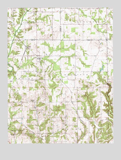
Quincy, IN USGS Topographic Map
Click on map above to begin viewing in our Map Viewer.

This topographic map contains these locations and features:
Feature Name Type Latitude Longitude GNIS ID View Map
AlaskaPopulated PlaceN39.4703°W86.6414°430040View Map
Amity ChurchChurchN39.4964°W86.6872°430140View Map
Asher CemeteryCemeteryN39.4136°W86.6672°430309View Map
Brush CreekStreamN39.4537°W86.7497°431677View Map
Cave StationLocaleN39.4048°W86.6678°452135View Map
Combes CemeteryCemeteryN39.4400°W86.7128°432830View Map
Ellis Lake DamDamN39.4400°W86.6400°448793View Map
Higgins BranchStreamN39.4973°W86.7256°436133View Map
Hudson Hill ChurchChurchN39.3834°W86.7422°436574View Map
Jack Oak AirportAirportN39.4838°W86.6773°2677057View Map
LewisvillePopulated PlaceN39.4712°W86.6319°437808View Map
Little Mount CemeteryCemeteryN39.3925°W86.6817°438100View Map
Little Mount CemeteryCemeteryN39.3953°W86.6819°438101View Map
Mannan CemeteryCemeteryN39.4712°W86.6669°438530View Map
Maxine Lake DamDamN39.4914°W86.6256°448626View Map
Montgomery ChapelChurchN39.4137°W86.7189°439363View Map
Porter Cave QuarryMineN39.4314°W86.6267°2649680View Map
QuincyPopulated PlaceN39.4537°W86.7125°441701View Map
Salem ChurchChurchN39.4087°W86.7181°442909View Map
Samaria ChurchChurchN39.4281°W86.6275°442949View Map
Sandy BranchStreamN39.4848°W86.6439°449610View Map
Shearer AirportAirportN39.4854°W86.6532°2676890View Map
Shenandoah Flying FieldAirportN39.4156°W86.6351°449183View Map
Smyrna ChurchChurchN39.4973°W86.7431°443718View Map
Township of HarrisonCivilN39.4381°W86.6688°453394View Map
Township of TaylorCivilN39.4346°W86.7432°453892View Map
Wallace JunctionPopulated PlaceN39.4637°W86.7270°445394View Map

Note: Coordinates in the location and feature list above are referenced to NAD83 datum.


Copyright (C) 2008-2025 Ryan Niemi / Sunset Dynamics ... All Rights Reserved