TopoQuest Logo
Do you find TopoQuest useful?
Help keep TopoQuest running and adding new maps/features by donating!
Bitcoin:  19c7KJd3qBynnjoSw5npx9KScwjBe4ifkT
Litecoin:  LXs6TkuXGGXo1vDsWCkWVdjQX94eUKd6ui
Home View Maps Find Maps Find Places Resources & Links


Modesto, Indiana Topographic Map

USGS Map Title: Modesto, IN
USGS Map MRC: 39086C5
DRG (GeoTIFF) Download: o39086c5.tif


Neighboring USGS Topographic Map Quads:


  Quincy, IN  
39086D6
 

  Paragon, IN  
39086D5
 

  Martinsville, IN  
39086D4
 

  Gosport, IN  
39086C6
 

  Modesto, IN  
39086C5
 

  Hindustan, IN  
39086C4
 

  Whitehall, IN  
39086B6
 

  Bloomington, IN  
39086B5
 

  Unionville, IN  
39086B4


Map MRC Location:

N40°
W87°
N40°
W86°
H8 H7 H6 H5 H4 H3 H2 H1
G8 G7 G6 G5 G4 G3 G2 G1
F8 F7 F6 F5 F4 F3 F2 F1
E8 E7 E6 E5 E4 E3 E2 E1
D8 D7 D6 D5 D4 D3 D2 D1
C8 C7 C6 C5 C4 C3 C2 C1
B8 B7 B6 B5 B4 B3 B2 B1
A8 A7 A6 A5 A4 A3 A2 A1
N39°
W87°
N39°
W86°

Modesto, IN USGS 1:24K Topographic Map Preview:
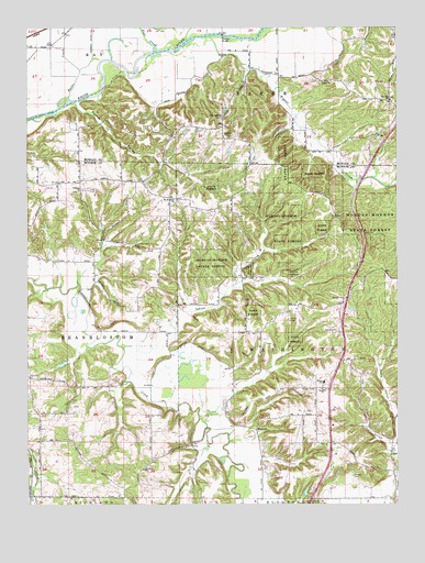
Modesto, IN USGS Topographic Map
Click on map above to begin viewing in our Map Viewer.

This topographic map contains these locations and features:
Feature Name Type Latitude Longitude GNIS ID View Map
Brown Elementary SchoolSchoolN39.2820°W86.5250°1959006View Map
Bryant CreekStreamN39.3731°W86.5639°431701View Map
Butler CreekStreamN39.3567°W86.6111°431901View Map
Collier CemeteryCemeteryN39.2987°W86.5369°432784View Map
Elliott CemeteryCemeteryN39.2978°W86.5978°434098View Map
Fall CreekStreamN39.3723°W86.5850°434370View Map
Fox HollowValleyN39.2647°W86.5004°434739View Map
Henke LakeReservoirN39.2868°W86.6134°448628View Map
Henke Lake DamDamN39.2884°W86.6117°448627View Map
Indian CreekStreamN39.2912°W86.5931°436734View Map
King CemeteryCemeteryN39.3328°W86.6042°437321View Map
Liberty ChurchChurchN39.3323°W86.6078°437833View Map
ModestoPopulated PlaceN39.2698°W86.5483°439306View Map
Morgan-Monroe State ForestForestN39.3214°W86.5353°1959007View Map
Mount Olive ChurchChurchN39.2592°W86.5861°439623View Map
Mount Pleasant ChurchChurchN39.3300°W86.5747°439679View Map
New Salem ChurchChurchN39.3517°W86.5600°440110View Map
Paragon BridgeBridgeN39.3731°W86.5594°440863View Map
Paragon LakeReservoirN39.3476°W86.5399°448775View Map
Paragon Lake DamDamN39.3484°W86.5383°448776View Map
Pocket HollowValleyN39.3550°W86.6083°441380View Map
Sample CemeteryCemeteryN39.2573°W86.5153°442950View Map
Simpson ChurchChurchN39.2803°W86.5258°443534View Map
Sodom CemeteryCemeteryN39.3473°W86.5592°443752View Map
Township of BakerCivilN39.3568°W86.5479°453094View Map
Township of WashingtonCivilN39.2964°W86.5178°454007View Map
Union ChurchChurchN39.3609°W86.5258°445102View Map
WayportPopulated PlaceN39.2662°W86.5208°452127View Map
Zion Hill ChurchChurchN39.3562°W86.5022°446476View Map

Note: Coordinates in the location and feature list above are referenced to NAD83 datum.


Copyright (C) 2008-2024 Ryan Niemi / Sunset Dynamics ... All Rights Reserved