TopoQuest Logo
Do you find TopoQuest useful?
Help keep TopoQuest running and adding new maps/features by donating!
Bitcoin:  19c7KJd3qBynnjoSw5npx9KScwjBe4ifkT
Litecoin:  LXs6TkuXGGXo1vDsWCkWVdjQX94eUKd6ui
Home View Maps Find Maps Find Places Resources & Links


Radnor, West Virginia Topographic Map

USGS Map Title: Radnor, WV
USGS Map MRC: 38082A4
DRG (GeoTIFF) Download: o38082a4.tif


Neighboring USGS Topographic Map Quads:


  Prichard, WV  
38082B5
 

  Wayne, WV  
38082B4
 

  Nestlow, WV  
38082B3
 

  Louisa, KY  
38082A5
 

  Radnor, WV  
38082A4
 

  Kiahsville, WV  
38082A3
 

  Milo, KY  
37082H5
 

  Webb, WV  
37082H4
 

  Wilsondale, WV  
37082H3


Map MRC Location:

N39°
W83°
N39°
W82°
H8 H7 H6 H5 H4 H3 H2 H1
G8 G7 G6 G5 G4 G3 G2 G1
F8 F7 F6 F5 F4 F3 F2 F1
E8 E7 E6 E5 E4 E3 E2 E1
D8 D7 D6 D5 D4 D3 D2 D1
C8 C7 C6 C5 C4 C3 C2 C1
B8 B7 B6 B5 B4 B3 B2 B1
A8 A7 A6 A5 A4 A3 A2 A1
N38°
W83°
N38°
W82°

Radnor, WV USGS 1:24K Topographic Map Preview:
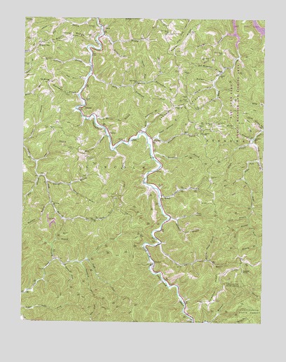
Radnor, WV USGS Topographic Map
Click on map above to begin viewing in our Map Viewer.

This topographic map contains these locations and features:
Feature Name Type Latitude Longitude GNIS ID View Map
Amp BranchStreamN38.0659°W82.4932°1534929View Map
Apple Orchard BranchStreamN38.0759°W82.4304°1534987View Map
Bearwallow BranchStreamN38.0995°W82.4324°1535426View Map
Bethel ChurchChurchN38.0912°W82.4679°1535692View Map
Big BranchStreamN38.0323°W82.4279°1535791View Map
Big BranchStreamN38.0706°W82.4529°1535792View Map
Billy BranchStreamN38.1015°W82.4660°1536010View Map
Billy Branch School (historical)SchoolN38.0987°W82.4413°1536012View Map
Bob Wetherall BranchStreamN38.1026°W82.3982°1536179View Map
Cassidy CemeteryCemeteryN38.1165°W82.4963°1537088View Map
Cox CemeteryCemeteryN38.1034°W82.4202°1537754View Map
Cox CemeteryCemeteryN38.1081°W82.4307°1537755View Map
Damel ForkStreamN38.0973°W82.4013°1537970View Map
Damron CemeteryCemeteryN38.0715°W82.4743°1537972View Map
Damron CemeteryCemeteryN38.0804°W82.4088°1537973View Map
Damron School (historical)SchoolN38.0776°W82.4060°1537975View Map
Dan Wallace CemeteryCemeteryN38.0823°W82.3993°1537979View Map
Dick BranchStreamN38.0406°W82.3815°1538173View Map
Donathan BranchStreamN38.0695°W82.4335°1538266View Map
Drift BranchStreamN38.1181°W82.4588°1538319View Map
DunlowPopulated PlaceN38.0231°W82.4315°1538448View Map
Dunlow Elementary SchoolSchoolN38.0272°W82.4332°1728923View Map
Dunlow Post OfficePost OfficeN38.0231°W82.4318°1728924View Map
Dunlow Volunteer Fire Department and RescueBuildingN38.0003°W82.4096°2577558View Map
Everett Dillon Memorial BridgeBridgeN38.0794°W82.4575°2647383View Map
Fairmont ChurchChurchN38.0004°W82.4101°1538792View Map
FergusonPopulated PlaceN38.0756°W82.4332°1538916View Map
Ferguson BranchStreamN38.0765°W82.4354°1538917View Map
Ferguson CemeteryCemeteryN38.0087°W82.4051°1538919View Map
Ferguson RidgeRidgeN38.0143°W82.3943°1538922View Map
Flat BranchStreamN38.0598°W82.4921°1539042View Map
FlemingPopulated PlaceN38.0879°W82.4710°1549685View Map
Geiger BranchStreamN38.0743°W82.3807°1539365View Map
GenoaPopulated PlaceN38.1220°W82.4599°1539366View Map
Genoa Post OfficePost OfficeN38.1218°W82.4596°1728947View Map
Grassy BranchStreamN38.0581°W82.4868°1539625View Map
Haney ChurchChurchN38.0776°W82.4163°1539900View Map
Haney ChurchChurchN38.1018°W82.3979°1539901View Map
Haney School (historical)SchoolN38.1031°W82.3968°1539903View Map
Harless CemeteryCemeteryN38.0790°W82.4852°1539960View Map
Henry Smith BranchStreamN38.0256°W82.4035°1540162View Map
Hickory GapLocaleN38.1145°W82.4913°1540212View Map
Holly BranchStreamN38.0765°W82.3796°1540394View Map
Hooker CemeteryCemeteryN38.0218°W82.3871°1540432View Map
Hooker KnobSummitN38.0218°W82.3863°1554735View Map
Humpy BranchStreamN38.0323°W82.3774°1540582View Map
Hurricane BranchStreamN38.0931°W82.4713°1540621View Map
Jackson BranchStreamN38.1056°W82.4652°1540773View Map
Jackson CemeteryCemeteryN38.1056°W82.4968°1540774View Map
John Napier CemeteryCemeteryN38.1087°W82.4079°1540950View Map
John Robertson CemeteryCemeteryN38.1079°W82.4893°1545851View Map
Justice CemeteryCemeteryN38.0929°W82.4149°1541051View Map
Laurel ForkStreamN38.0562°W82.4752°1541432View Map
Left Fork Rich CreekStreamN38.0670°W82.3779°1541708View Map
Left Fork Sycamore BranchStreamN38.0423°W82.4193°1541734View Map
Licklog BranchStreamN38.0523°W82.4288°1541951View Map
Little Spring BranchStreamN38.0793°W82.3751°1542224View Map
Lost Creek ChurchChurchN38.0420°W82.4629°1542464View Map
Lower Napier CemeteryCemeteryN38.1190°W82.4246°1542557View Map
Lycans CemeteryCemeteryN38.0915°W82.4151°1542618View Map
Lycans RidgeRidgeN38.0898°W82.4168°1542619View Map
Lycans Ridge School (historical)SchoolN38.0890°W82.4193°1542620View Map
Lynn ForkStreamN38.0237°W82.4779°1542642View Map
Marilyn Napier CemeteryCemeteryN38.1109°W82.3963°1542764View Map
Martha Noe BranchStreamN38.0834°W82.4629°1542799View Map
Mat Rice BranchStreamN38.0595°W82.3851°1542860View Map
Matthews CemeteryCemeteryN38.0601°W82.4024°1542872View Map
Matty Ferguson BranchStreamN38.0781°W82.4377°1542875View Map
May BranchStreamN38.0768°W82.4565°1542891View Map
Mill Creek ChurchChurchN38.0481°W82.4840°1543328View Map
Napier CemeteryCemeteryN38.0673°W82.4657°1544043View Map
Napier RidgeRidgeN38.1220°W82.4110°1544047View Map
Noe CemeteryCemeteryN38.0753°W82.4714°1544186View Map
Perry Memorial ChurchChurchN38.0987°W82.4868°1544731View Map
Porter CemeteryCemeteryN38.0651°W82.4613°1545157View Map
Pratt CemeteryCemeteryN38.0795°W82.4871°1545232View Map
Preston CemeteryCemeteryN38.0559°W82.4296°1545240View Map
QuakerPopulated PlaceN38.0523°W82.4276°1549888View Map
RadnorPopulated PlaceN38.0795°W82.4565°1555434View Map
Rich Creek School (historical)SchoolN38.0756°W82.3801°1545543View Map
Right Fork Lost CreekStreamN38.0254°W82.4654°1545672View Map
Right Fork Rich CreekStreamN38.0670°W82.3779°1545688View Map
Robertson CemeteryCemeteryN38.0820°W82.4015°1545850View Map
Rockhouse ForkStreamN38.0968°W82.4435°1545982View Map
Sally BranchStreamN38.0437°W82.3826°1546296View Map
Sam Noe BranchStreamN38.0995°W82.4671°1546320View Map
Sandlick BranchStreamN38.0245°W82.4690°1546388View Map
Smith CemeteryCemeteryN38.0331°W82.4301°1546962View Map
Spence CemeteryCemeteryN38.1029°W82.4143°1547122View Map
Spruce ForkStreamN38.0990°W82.4379°1547232View Map
Stiltner CemeteryCemeteryN38.1195°W82.4138°1547423View Map
Stonecoal BranchStreamN38.1190°W82.3910°1547453View Map
Sycamore BranchStreamN38.0431°W82.4226°1547816View Map
Thompson CemeteryCemeteryN38.1212°W82.4632°1548043View Map
Upper Napier CemeteryCemeteryN38.1195°W82.4249°1548539View Map
Watts and Perry CemeteryCemeteryN38.1179°W82.4763°1548839View Map
Watts RidgeRidgeN38.1151°W82.4902°1548840View Map
Wilson CemeteryCemeteryN38.1176°W82.4649°1549209View Map
Wolfpen BranchStreamN38.0259°W82.4824°1549313View Map
Wolfpen BranchStreamN38.0490°W82.4846°1549314View Map
Wolfpen BranchStreamN38.0993°W82.4013°1549315View Map
Wolfpen BranchStreamN38.1145°W82.4543°1549316View Map
Workman CemeteryCemeteryN38.0362°W82.4788°1549412View Map
Zion ChurchChurchN38.0554°W82.4160°1549488View Map

Note: Coordinates in the location and feature list above are referenced to NAD83 datum.


Copyright (C) 2008-2025 Ryan Niemi / Sunset Dynamics ... All Rights Reserved