TopoQuest Logo
Do you find TopoQuest useful?
Help keep TopoQuest running and adding new maps/features by donating!
Bitcoin:  19c7KJd3qBynnjoSw5npx9KScwjBe4ifkT
Litecoin:  LXs6TkuXGGXo1vDsWCkWVdjQX94eUKd6ui
Home View Maps Find Maps Find Places Resources & Links


Nestlow, West Virginia Topographic Map

USGS Map Title: Nestlow, WV
USGS Map MRC: 38082B3
DRG (GeoTIFF) Download: o38082b3.tif


Neighboring USGS Topographic Map Quads:


  Lavalette, WV  
38082C4
 

  Winslow, WV  
38082C3
 

  West Hamlin, WV  
38082C2
 

  Wayne, WV  
38082B4
 

  Nestlow, WV  
38082B3
 

  Branchland, WV  
38082B2
 

  Radnor, WV  
38082A4
 

  Kiahsville, WV  
38082A3
 

  Ranger, WV  
38082A2


Map MRC Location:

N39°
W83°
N39°
W82°
H8 H7 H6 H5 H4 H3 H2 H1
G8 G7 G6 G5 G4 G3 G2 G1
F8 F7 F6 F5 F4 F3 F2 F1
E8 E7 E6 E5 E4 E3 E2 E1
D8 D7 D6 D5 D4 D3 D2 D1
C8 C7 C6 C5 C4 C3 C2 C1
B8 B7 B6 B5 B4 B3 B2 B1
A8 A7 A6 A5 A4 A3 A2 A1
N38°
W83°
N38°
W82°

Nestlow, WV USGS 1:24K Topographic Map Preview:
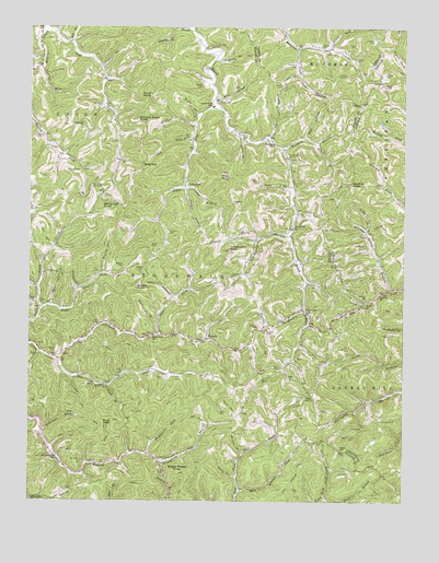
Nestlow, WV USGS Topographic Map
Click on map above to begin viewing in our Map Viewer.

This topographic map contains these locations and features:
Feature Name Type Latitude Longitude GNIS ID View Map
Adkins CemeteryCemeteryN38.1645°W82.3660°1534827View Map
Adkins CemeteryCemeteryN38.2209°W82.3043°1534832View Map
Adkins CemeteryCemeteryN38.2290°W82.2901°1534833View Map
Adkins CemeteryCemeteryN38.2348°W82.2568°1534834View Map
Adkins CemeteryCemeteryN38.2348°W82.3182°1534835View Map
Adkins CemeteryCemeteryN38.2423°W82.2668°1534836View Map
Albright CemeteryCemeteryN38.1795°W82.2621°1534852View Map
Alum Rock BranchStreamN38.2445°W82.2857°1534909View Map
Asbury CemeteryCemeteryN38.1862°W82.3368°1535038View Map
Asbury HollowValleyN38.1790°W82.3268°1535041View Map
Bates BranchStreamN38.2265°W82.3193°1535305View Map
Beckelheimer CemeteryCemeteryN38.1926°W82.2621°1535462View Map
Beech Fork ChurchChurchN38.1973°W82.2871°1535531View Map
Beech Fork School (historical)SchoolN38.2293°W82.3143°1535533View Map
Big BranchStreamN38.2459°W82.3618°1535809View Map
Bing GapGapN38.2140°W82.3374°1536016View Map
Blankenship CemeteryCemeteryN38.2120°W82.3626°1536092View Map
Bradshaw CemeteryCemeteryN38.2237°W82.3582°1536289View Map
Buck BranchStreamN38.2401°W82.3521°1536547View Map
Buck KnobSummitN38.1456°W82.3501°1554015View Map
Buck KnobSummitN38.2320°W82.3351°1554017View Map
Buzzard Roost KnobSummitN38.2254°W82.3396°1554040View Map
Calf BranchStreamN38.2206°W82.2954°1536860View Map
Camp BranchStreamN38.2073°W82.3229°1536899View Map
Camp Creek School (historical)SchoolN38.1687°W82.3338°1536922View Map
Carter BranchStreamN38.2079°W82.3235°1537072View Map
Cedar BranchStreamN38.2423°W82.3135°1537123View Map
Cedar Cliff CemeteryCemeteryN38.2454°W82.3146°1537124View Map
Clay CemeteryCemeteryN38.2459°W82.2671°1537367View Map
Coal HollowValleyN38.2218°W82.2832°1537448View Map
Covington--Ross CemeteryCemeteryN38.1768°W82.3701°1546088View Map
Crockett CemeteryCemeteryN38.2415°W82.3729°1537828View Map
Crockett ForkStreamN38.2395°W82.3715°1537830View Map
Davidson CemeteryCemeteryN38.1490°W82.2779°1538018View Map
Davis CemeteryCemeteryN38.1279°W82.3621°1538030View Map
Davis CemeteryCemeteryN38.1606°W82.2910°1538031View Map
Davis ForkStreamN38.1312°W82.3054°1538044View Map
Drenner CemeteryCemeteryN38.1809°W82.3576°1538316View Map
Drenner HollowValleyN38.1812°W82.3593°1538317View Map
East Lynn ChurchChurchN38.1773°W82.3726°1538509View Map
Elkins BranchStreamN38.2201°W82.2788°1538651View Map
Falls BranchStreamN38.2084°W82.2874°1538872View Map
Fort BranchStreamN38.2220°W82.3057°1539156View Map
GilkersonPopulated PlaceN38.2084°W82.3238°1549700View Map
Gilkerson BranchStreamN38.2493°W82.3210°1539398View Map
Gilles BranchStreamN38.1965°W82.2624°1539401View Map
GirardPopulated PlaceN38.1679°W82.3154°1549704View Map
Hobbs CemeteryCemeteryN38.2098°W82.2990°1540326View Map
Horse HollowValleyN38.1479°W82.3063°1540490View Map
Isaacs CemeteryCemeteryN38.1484°W82.3090°1540728View Map
Jones CemeteryCemeteryN38.1923°W82.3349°1541007View Map
Keesee CemeteryCemeteryN38.2381°W82.2568°1541107View Map
Left Fork Camp CreekStreamN38.1620°W82.3657°1541640View Map
Left Fork Millers ForkStreamN38.2487°W82.3701°1541694View Map
Liberty ChurchChurchN38.1795°W82.2579°1541815View Map
Lick BranchStreamN38.2209°W82.3207°1541856View Map
Lower Laurel School (historical)SchoolN38.1368°W82.3654°1542550View Map
Lynn CemeteryCemeteryN38.1606°W82.2704°1542636View Map
Mars CemeteryCemeteryN38.2306°W82.3124°1542777View Map
Massey CemeteryCemeteryN38.2376°W82.2721°1542855View Map
Mays KnobSummitN38.2109°W82.3082°1555072View Map
Mill CemeteryCemeteryN38.2215°W82.3218°1543302View Map
Mill HollowValleyN38.2318°W82.3129°1543341View Map
Miller CemeteryCemeteryN38.1381°W82.2690°1543369View Map
Miller CemeteryCemeteryN38.2354°W82.2913°1543371View Map
Mills CemeteryCemeteryN38.1962°W82.3049°1543410View Map
Mills CemeteryCemeteryN38.2076°W82.3521°1543411View Map
Milt Adkins ForkStreamN38.1273°W82.3046°1543432View Map
Morrison CemeteryCemeteryN38.1959°W82.3288°1543583View Map
Murder HollowValleyN38.1376°W82.3038°1544004View Map
NestlowPopulated PlaceN38.1756°W82.2835°1549848View Map
Nestlow BranchStreamN38.1754°W82.2826°1544099View Map
Osburn CemeteryCemeteryN38.1643°W82.3735°1544455View Map
Parsons CemeteryCemeteryN38.1712°W82.2988°1544601View Map
Parsons CemeteryCemeteryN38.2040°W82.3074°1544603View Map
Parsons CemeteryCemeteryN38.2470°W82.2604°1544604View Map
Parsons CemeteryCemeteryN38.2495°W82.2535°1544605View Map
Peter Cave BranchStreamN38.1762°W82.3679°1544738View Map
Price BranchStreamN38.1256°W82.2760°1545249View Map
Queen BranchStreamN38.2448°W82.2746°1545333View Map
Ramey CemeteryCemeteryN38.1387°W82.2704°1545394View Map
Ramey CemeteryCemeteryN38.2456°W82.2782°1545395View Map
Right Fork Beech ForkStreamN38.2290°W82.3124°1545608View Map
Right Fork Camp CreekStreamN38.1620°W82.3657°1545620View Map
Right Fork Little Lynn CreekStreamN38.1751°W82.3710°1545667View Map
Ross CemeteryCemeteryN38.1451°W82.3171°1546087View Map
Saddle KnobSummitN38.1815°W82.3396°1555551View Map
Sanders CemeteryCemeteryN38.1470°W82.2529°1546383View Map
Sanders CemeteryCemeteryN38.1698°W82.2960°1546384View Map
Sanson CemeteryCemeteryN38.2215°W82.3732°1546424View Map
Sellards BranchStreamN38.1434°W82.3701°1546561View Map
Shepherd CemeteryCemeteryN38.2406°W82.2865°1546668View Map
Shingle BranchStreamN38.2240°W82.3204°1546688View Map
Skeens CemeteryCemeteryN38.1326°W82.3318°1546858View Map
Squirrel KnobSummitN38.2093°W82.2679°1555699View Map
Stephens ForkStreamN38.1376°W82.3349°1547385View Map
Stevens BranchStreamN38.1959°W82.3482°1547395View Map
Stevens CemeteryCemeteryN38.1876°W82.3435°1547396View Map
Sulphur Spring BranchStreamN38.1809°W82.2543°1547716View Map
Sweet Potato KnobSummitN38.1329°W82.3249°1555766View Map
Tabor CemeteryCemeteryN38.1576°W82.3301°1547859View Map
Tallclay CemeteryCemeteryN38.1840°W82.3071°1547879View Map
Tiger ForkStreamN38.1693°W82.3324°1548090View Map
Trace BranchStreamN38.1554°W82.3488°1548192View Map
Turkeycamp BranchStreamN38.1954°W82.2879°1548366View Map
Turkeycamp KnobSummitN38.1912°W82.3085°1548367View Map
Upper Laurel School (historical)SchoolN38.1359°W82.3288°1548531View Map
Ward BranchStreamN38.1720°W82.3324°1548786View Map
Watson CemeteryCemeteryN38.1776°W82.2643°1548834View Map
Windy Oak KnobSummitN38.2043°W82.3504°1556006View Map
Wolfpen BranchStreamN38.2181°W82.2904°1549318View Map
Wolfpen ChurchChurchN38.2193°W82.2940°1549324View Map

Note: Coordinates in the location and feature list above are referenced to NAD83 datum.


Copyright (C) 2008-2025 Ryan Niemi / Sunset Dynamics ... All Rights Reserved