TopoQuest Logo
Do you find TopoQuest useful?
Help keep TopoQuest running and adding new maps/features by donating!
Bitcoin:  19c7KJd3qBynnjoSw5npx9KScwjBe4ifkT
Litecoin:  LXs6TkuXGGXo1vDsWCkWVdjQX94eUKd6ui
Home View Maps Find Maps Find Places Resources & Links


Ramhurst, Georgia Topographic Map

USGS Map Title: Ramhurst, GA
USGS Map MRC: 34084F6
DRG (GeoTIFF) Download: o34084f6.tif


Neighboring USGS Topographic Map Quads:


  Chatsworth, GA  
34084G7
 

  Crandall, GA  
34084G6
 

  Dyer Gap, GA  
34084G5
 

  Calhoun NE, GA  
34084F7
 

  Ramhurst, GA  
34084F6
 

  Webb, GA  
34084F5
 

  Redbud, GA  
34084E7
 

  Oakman, GA  
34084E6
 

  Talking Rock, GA  
34084E5


Map MRC Location:

N35°
W85°
N35°
W84°
H8 H7 H6 H5 H4 H3 H2 H1
G8 G7 G6 G5 G4 G3 G2 G1
F8 F7 F6 F5 F4 F3 F2 F1
E8 E7 E6 E5 E4 E3 E2 E1
D8 D7 D6 D5 D4 D3 D2 D1
C8 C7 C6 C5 C4 C3 C2 C1
B8 B7 B6 B5 B4 B3 B2 B1
A8 A7 A6 A5 A4 A3 A2 A1
N34°
W85°
N34°
W84°

Ramhurst, GA USGS 1:24K Topographic Map Preview:
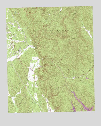
Ramhurst, GA USGS Topographic Map
Click on map above to begin viewing in our Map Viewer.

This topographic map contains these locations and features:
Feature Name Type Latitude Longitude GNIS ID View Map
Baker BranchStreamN34.7498°W84.6705°326996View Map
Bearpen BranchStreamN34.7498°W84.6705°327037View Map
BloodtownPopulated PlaceN34.6262°W84.6888°331191View Map
Bramlet MineMineN34.7451°W84.7194°334524View Map
Brushy TopSummitN34.6945°W84.6452°331262View Map
Buck KnobSummitN34.6756°W84.6635°354898View Map
Chatsworth DivisionCivilN34.7253°W84.7318°1936171View Map
Chestnut KnobSummitN34.7423°W84.6977°355142View Map
Cold SpringSpringN34.7120°W84.6555°327490View Map
Cold Spring MountainSummitN34.7079°W84.6580°331432View Map
ConistonPopulated PlaceN34.6379°W84.7091°331446View Map
Corbin LakeReservoirN34.7266°W84.6381°336864View Map
DennisPopulated PlaceN34.7020°W84.7088°331540View Map
Duck BranchStreamN34.7220°W84.7452°327702View Map
Falls BranchStreamN34.7417°W84.6738°327795View Map
Georgia MineMineN34.7429°W84.7316°334545View Map
Glenn LakeReservoirN34.7438°W84.7363°339628View Map
Glenn Lake DamDamN34.7434°W84.7366°339627View Map
HightopSummitN34.7101°W84.6494°331984View Map
Hill Wilbanks Memorial BridgeBridgeN34.7220°W84.7458°334551View Map
Little Sugar CreekStreamN34.6423°W84.7427°328578View Map
Long BranchStreamN34.6476°W84.7374°328612View Map
Miller-Grindley PondReservoirN34.6645°W84.6354°336829View Map
Miller-Grindley Pond DamDamN34.6651°W84.6349°336828View Map
Mount Pisgah ChurchChurchN34.7020°W84.7388°356404View Map
Mount Zion ChurchChurchN34.7279°W84.7494°328923View Map
Mountain View ChurchChurchN34.7212°W84.7258°356410View Map
Mountaintown Creek Watershed Dam Number FourDamN34.7251°W84.6383°336863View Map
Murray County Fire Department Station 2BuildingN34.7010°W84.7377°2604523View Map
Old Cohutta MineMineN34.7398°W84.7313°334562View Map
Pickering MineMineN34.7229°W84.7172°334564View Map
RamhurstPopulated PlaceN34.6981°W84.7308°356486View Map
Ramhurst Graded School (historical)SchoolN34.6962°W84.7333°335345View Map
Ramhurst Post Office (historical)Post OfficeN34.6981°W84.7305°352064View Map
Ramsey CemeteryCemeteryN34.6965°W84.7360°329368View Map
Reed LakeReservoirN34.7262°W84.7324°339626View Map
Reed Lake DamDamN34.7267°W84.7333°339625View Map
Ridgeway Baptist Church CemeteryCemeteryN34.6619°W84.6435°2681162View Map
Ridgeway ChurchChurchN34.6609°W84.6433°329435View Map
Ridgeway School (historical)SchoolN34.6629°W84.6430°352960View Map

Note: Coordinates in the location and feature list above are referenced to NAD83 datum.


Copyright (C) 2008-2024 Ryan Niemi / Sunset Dynamics ... All Rights Reserved