TopoQuest Logo
Do you find TopoQuest useful?
Help keep TopoQuest running and adding new maps/features by donating!
Bitcoin:  19c7KJd3qBynnjoSw5npx9KScwjBe4ifkT
Litecoin:  LXs6TkuXGGXo1vDsWCkWVdjQX94eUKd6ui
Home View Maps Find Maps Find Places Resources & Links


Calhoun NE, Georgia Topographic Map

USGS Map Title: Calhoun NE, GA
USGS Map MRC: 34084F7
DRG (GeoTIFF) Download: o34084f7.tif


Neighboring USGS Topographic Map Quads:


  Dalton North, GA  
34084G8
 

  Chatsworth, GA  
34084G7
 

  Crandall, GA  
34084G6
 

  Dalton South, GA  
34084F8
 

  Calhoun NE, GA  
34084F7
 

  Ramhurst, GA  
34084F6
 

  Calhoun North, GA  
34084E8
 

  Redbud, GA  
34084E7
 

  Oakman, GA  
34084E6


Map MRC Location:

N35°
W85°
N35°
W84°
H8 H7 H6 H5 H4 H3 H2 H1
G8 G7 G6 G5 G4 G3 G2 G1
F8 F7 F6 F5 F4 F3 F2 F1
E8 E7 E6 E5 E4 E3 E2 E1
D8 D7 D6 D5 D4 D3 D2 D1
C8 C7 C6 C5 C4 C3 C2 C1
B8 B7 B6 B5 B4 B3 B2 B1
A8 A7 A6 A5 A4 A3 A2 A1
N34°
W85°
N34°
W84°

Calhoun NE, GA USGS 1:24K Topographic Map Preview:
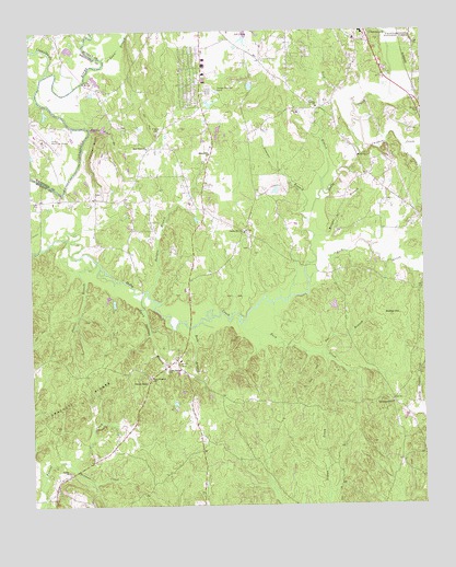
Calhoun NE, GA USGS Topographic Map
Click on map above to begin viewing in our Map Viewer.

This topographic map contains these locations and features:
Feature Name Type Latitude Longitude GNIS ID View Map
Ball GroundPopulated PlaceN34.6520°W84.7602°1705474View Map
Ball Ground ChurchChurchN34.6518°W84.7602°354444View Map
Beamer CreekStreamN34.6365°W84.8633°327023View Map
Brackett RidgesRidgeN34.6479°W84.8738°327204View Map
Brindle LakeReservoirN34.6514°W84.8296°336995View Map
Brindle Lake DamDamN34.6518°W84.8299°336994View Map
Browns BridgeBridgeN34.7076°W84.8652°327238View Map
Buck CreekStreamN34.6729°W84.8086°327257View Map
Bullpen BranchStreamN34.6817°W84.8374°327283View Map
Casey Springs BranchStreamN34.6812°W84.8391°327373View Map
Casey Springs ChurchChurchN34.6612°W84.8313°327374View Map
Casey Springs DivisionCivilN34.6595°W84.8418°1936164View Map
Casey Springs School (historical)SchoolN34.6612°W84.8311°1705475View Map
Center Hill ChurchChurchN34.6970°W84.8066°327402View Map
Center Hill School (historical)SchoolN34.6981°W84.8077°1705476View Map
Chatsworth Christian AcademySchoolN34.6598°W84.8347°1705479View Map
Chicken CreekStreamN34.7173°W84.7691°327450View Map
Coahulla CreekStreamN34.7390°W84.8694°355203View Map
Cochran CemeteryCemeteryN34.6898°W84.8227°1705477View Map
Connally CemeteryCemeteryN34.6856°W84.7644°1705478View Map
Dalton Municipal AirportAirportN34.7232°W84.8735°330801View Map
Doe BranchStreamN34.6651°W84.7827°327662View Map
Fincher BluffCliffN34.7204°W84.8547°327816View Map
HolleyPopulated PlaceN34.6634°W84.8288°1705480View Map
Hooker School (historical)SchoolN34.7065°W84.8444°1705482View Map
Kanaanland Christian SchoolSchoolN34.6583°W84.8361°2545608View Map
Kilgore CemeteryCemeteryN34.7231°W84.8344°328398View Map
Lick BranchStreamN34.7081°W84.7816°328507View Map
Lower Oak Grove School (historical)SchoolN34.7073°W84.7616°1705483View Map
Macedonia Church (historical)ChurchN34.6295°W84.7966°1705484View Map
Maranatha ChurchChurchN34.7176°W84.8177°328704View Map
Mashburn Lake EastReservoirN34.6783°W84.8486°336997View Map
Mashburn Lake East DamDamN34.6784°W84.8483°336996View Map
Mashburn Lake WestReservoirN34.6784°W84.8499°336999View Map
Mount Zion CemeteryCemeteryN34.7287°W84.7502°328911View Map
Murray County Fire Department Station 5BuildingN34.6688°W84.8248°2604524View Map
Nashburn Lake West DamDamN34.6784°W84.8499°336998View Map
New Hope ChurchChurchN34.7192°W84.8374°356422View Map
New Prospect ChurchChurchN34.6587°W84.8374°329019View Map
Oakland School (historical)SchoolN34.7340°W84.7911°1705485View Map
Old Fashion Baptist ChurchChurchN34.6973°W84.7630°1705486View Map
Osborn CemeteryCemeteryN34.6926°W84.8055°1705487View Map
Pettiet BranchStreamN34.6904°W84.8555°329182View Map
Ridley HillSummitN34.6745°W84.7602°332855View Map
Rock BranchStreamN34.6723°W84.8230°329452View Map
Rock CreekStreamN34.6845°W84.7863°329455View Map
Rocky Ford BranchStreamN34.7240°W84.8558°330804View Map
Sardis CemeteryCemeteryN34.6340°W84.8633°1705488View Map
Sardis ChurchChurchN34.6343°W84.8636°329597View Map
Smoke FordCrossingN34.7292°W84.8677°1705489View Map
Smyrna ChurchChurchN34.7298°W84.7833°356542View Map
Stewart BranchStreamN34.6990°W84.7866°323600View Map
Sugar Creek School (historical)SchoolN34.6343°W84.7555°1705490View Map
Tibbs BridgeBridgeN34.7367°W84.8572°330803View Map
Timms ChapelChurchN34.6576°W84.8383°329996View Map
Town BranchStreamN34.7431°W84.8513°330025View Map
Wagnon CemeteryCemeteryN34.6806°W84.8294°1705491View Map
Wells (historical)Populated PlaceN34.6454°W84.7530°1705493View Map
Williams CemeteryCemeteryN34.7081°W84.8538°1705492View Map
Wright BranchStreamN34.6956°W84.7844°330385View Map
Yellow CreekStreamN34.7192°W84.7560°330396View Map

Note: Coordinates in the location and feature list above are referenced to NAD83 datum.


Copyright (C) 2008-2024 Ryan Niemi / Sunset Dynamics ... All Rights Reserved