TopoQuest Logo
Do you find TopoQuest useful?
Help keep TopoQuest running and adding new maps/features by donating!
Bitcoin:  19c7KJd3qBynnjoSw5npx9KScwjBe4ifkT
Litecoin:  LXs6TkuXGGXo1vDsWCkWVdjQX94eUKd6ui
Home View Maps Find Maps Find Places Resources & Links


Rana Creek, California Topographic Map

USGS Map Title: Rana Creek, CA
USGS Map MRC: 36121D5
DRG (GeoTIFF) Download: o36121d5.tif


Neighboring USGS Topographic Map Quads:


  Spreckels, CA  
36121E6
 

  Chualar, CA  
36121E5
 

  Gonzales, CA  
36121E4
 

  Carmel Valley, CA  
36121D6
 

  Rana Creek, CA  
36121D5
 

  Palo Escrito Peak, CA  
36121D4
 

  Ventana Cones, CA  
36121C6
 

  Chews Ridge, CA  
36121C5
 

  Sycamore Flat, CA  
36121C4


Map MRC Location:

N37°
W122°
N37°
W121°
H8 H7 H6 H5 H4 H3 H2 H1
G8 G7 G6 G5 G4 G3 G2 G1
F8 F7 F6 F5 F4 F3 F2 F1
E8 E7 E6 E5 E4 E3 E2 E1
D8 D7 D6 D5 D4 D3 D2 D1
C8 C7 C6 C5 C4 C3 C2 C1
B8 B7 B6 B5 B4 B3 B2 B1
A8 A7 A6 A5 A4 A3 A2 A1
N36°
W122°
N36°
W121°

Rana Creek, CA USGS 1:24K Topographic Map Preview:
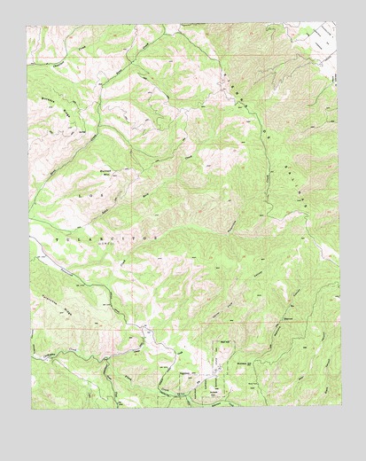
Rana Creek, CA USGS Topographic Map
Click on map above to begin viewing in our Map Viewer.

This topographic map contains these locations and features:
Feature Name Type Latitude Longitude GNIS ID View Map
Big CreekStreamN36.3797°W121.5624°269819View Map
Buckeye HillSummitN36.3886°W121.5391°270062View Map
Burned MountainSummitN36.4511°W121.5919°270087View Map
Cachagua Fire Protection District Station 3 Tassajara RoadBuildingN36.3974°W121.5793°2624080View Map
Casa Verde Gun Club (historical)LocaleN36.4155°W121.5969°1670909View Map
Conejo CreekStreamN36.3911°W121.5944°270578View Map
Corral Viejo CanyonValleyN36.3966°W121.5594°270609View Map
Finch CreekStreamN36.3911°W121.5944°271132View Map
Haystack HillSummitN36.3847°W121.5627°271524View Map
James CreekStreamN36.3889°W121.5938°271763View Map
Los TularcitosCivilN36.4319°W121.5924°272238View Map
Madrona CanyonValleyN36.3930°W121.5416°272303View Map
Red HillSummitN36.3952°W121.5472°1661290View Map
Robertson CreekStreamN36.3772°W121.5619°273299View Map
School HillSummitN36.3805°W121.5505°273606View Map
Trampa CanyonValleyN36.3922°W121.6249°274185View Map

Note: Coordinates in the location and feature list above are referenced to NAD83 datum.


Copyright (C) 2008-2025 Ryan Niemi / Sunset Dynamics ... All Rights Reserved