TopoQuest Logo
Do you find TopoQuest useful?
Help keep TopoQuest running and adding new maps/features by donating!
Bitcoin:  19c7KJd3qBynnjoSw5npx9KScwjBe4ifkT
Litecoin:  LXs6TkuXGGXo1vDsWCkWVdjQX94eUKd6ui
Home View Maps Find Maps Find Places Resources & Links


Carmel Valley, California Topographic Map

USGS Map Title: Carmel Valley, CA
USGS Map MRC: 36121D6
DRG (GeoTIFF) Download: o36121d6.tif


Neighboring USGS Topographic Map Quads:


  Seaside, CA  
36121E7
 

  Spreckels, CA  
36121E6
 

  Chualar, CA  
36121E5
 

  Mount Carmel, CA  
36121D7
 

  Carmel Valley, CA  
36121D6
 

  Rana Creek, CA  
36121D5
 

  Big Sur, CA  
36121C7
 

  Ventana Cones, CA  
36121C6
 

  Chews Ridge, CA  
36121C5


Map MRC Location:

N37°
W122°
N37°
W121°
H8 H7 H6 H5 H4 H3 H2 H1
G8 G7 G6 G5 G4 G3 G2 G1
F8 F7 F6 F5 F4 F3 F2 F1
E8 E7 E6 E5 E4 E3 E2 E1
D8 D7 D6 D5 D4 D3 D2 D1
C8 C7 C6 C5 C4 C3 C2 C1
B8 B7 B6 B5 B4 B3 B2 B1
A8 A7 A6 A5 A4 A3 A2 A1
N36°
W122°
N36°
W121°

Carmel Valley, CA USGS 1:24K Topographic Map Preview:
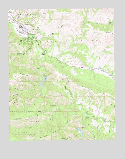
Carmel Valley, CA USGS Topographic Map
Click on map above to begin viewing in our Map Viewer.

This topographic map contains these locations and features:
Feature Name Type Latitude Longitude GNIS ID View Map
Agua Mala CreekStreamN36.4383°W121.6274°269445View Map
Black Rock CreekStreamN36.4225°W121.7377°269896View Map
Blue Rock RidgeRidgeN36.3814°W121.6986°269939View Map
Boronda AdobeBuildingN36.4939°W121.7483°1873377View Map
Boronda CreekStreamN36.3914°W121.6299°269973View Map
Buckeye RidgeRidgeN36.4755°W121.6288°270063View Map
Cachagua CreekStreamN36.4019°W121.6597°270125View Map
Cachagua Fire Protection District Station 1 Nason RoadBuildingN36.4000°W121.6604°2624086View Map
Camp StephaniLocaleN36.4702°W121.7191°270221View Map
Carmel River Guard StationLocaleN36.3958°W121.6608°270302View Map
Carmel ValleyPopulated PlaceN36.4797°W121.7324°1660439View Map
Carmel Valley Airport (historical)AirportN36.4816°W121.7311°1653317View Map
Carmel Valley Branch Monterey County Free LibrariesBuildingN36.4805°W121.7352°1873381View Map
Carmel Valley Chamber of CommerceBuildingN36.4827°W121.7366°1873382View Map
Carmel Valley Community ChapelChurchN36.4775°W121.7313°1873383View Map
Carmel Valley DivisionCivilN36.4064°W121.6698°1935041View Map
Carmel Valley Fire DepartmentBuildingN36.4817°W121.7319°2623868View Map
Carmel Valley Post OfficePost OfficeN36.4797°W121.7276°1873384View Map
Carmel Valley Shopping CenterLocaleN36.4783°W121.7319°1873385View Map
Carmel Valley Trail and Saddle ClubLocaleN36.4819°W121.7447°1873386View Map
Carmel Valley VillagePopulated PlaceN36.4861°W121.7238°1867002View Map
Carmel Valley Village Census Designated PlaceCensusN36.4823°W121.7198°2407966View Map
Chupines CreekStreamN36.4530°W121.6961°270455View Map
Danish Creek Recreation SiteLocaleN36.3791°W121.6855°1655248View Map
Department of Forestry and Fire Protection Cachagua Fire Protection District Station 2BuildingN36.4463°W121.6859°2624584View Map
Hitchcock CanyonValleyN36.4727°W121.7249°271584View Map
Holman RanchLocaleN36.4814°W121.7155°271608View Map
J Gardiners Tennis RanchLocaleN36.4833°W121.7411°1873421View Map
Klondike CanyonValleyN36.4705°W121.7133°271915View Map
Los Padres 642-004 DamDamN36.3850°W121.6677°1664000View Map
Los Padres DamDamN36.3858°W121.6683°272228View Map
Lower Pine Creek Rustic CampsiteLocaleN36.3991°W121.7022°1655247View Map
Osborne RidgeRidgeN36.4455°W121.7249°272815View Map
Pine CreekStreamN36.4077°W121.6913°272983View Map
Ponciano RidgeRidgeN36.3952°W121.7494°273074View Map
Princes CampLocaleN36.4008°W121.6597°273128View Map
Rana CreekStreamN36.4366°W121.6297°273185View Map
Rancho Del MonteLocaleN36.4936°W121.7458°1670914View Map
Rattlesnake CreekStreamN36.3764°W121.6849°273220View Map
Rattlesnake Creek TrailTrailN36.3777°W121.6811°273222View Map
Robles Del RioPopulated PlaceN36.4700°W121.7333°1661318View Map
San Clemente 642 DamDamN36.4350°W121.7077°1663997View Map
San Clemente CreekStreamN36.4316°W121.7138°273450View Map
San Clemente DamDamN36.4358°W121.7086°273451View Map
San Clemente TrailTrailN36.3964°W121.7277°273453View Map
Sleepy HollowBasinN36.4439°W121.7155°273745View Map
South Fork Black Rock CreekStreamN36.4180°W121.7430°273818View Map
Sycamore GulchValleyN36.4436°W121.6480°274010View Map
Tassajara School (historical)SchoolN36.3914°W121.6311°1670917View Map
Tularcitos CreekStreamN36.4644°W121.7141°274208View Map
Tularcitos Elementary SchoolSchoolN36.4833°W121.7348°274212View Map
Tularcitos Guard StationLocaleN36.4580°W121.7069°274209View Map
Tularcitos RanchLocaleN36.4425°W121.6433°274210View Map
Tularcitos RidgeRidgeN36.4236°W121.6583°274211View Map
Tularcitos School (historical)SchoolN36.4675°W121.7130°1670918View Map

Note: Coordinates in the location and feature list above are referenced to NAD83 datum.


Copyright (C) 2008-2024 Ryan Niemi / Sunset Dynamics ... All Rights Reserved