TopoQuest Logo
Do you find TopoQuest useful?
Help keep TopoQuest running and adding new maps/features by donating!
Bitcoin:  19c7KJd3qBynnjoSw5npx9KScwjBe4ifkT
Litecoin:  LXs6TkuXGGXo1vDsWCkWVdjQX94eUKd6ui
Home View Maps Find Maps Find Places Resources & Links


Randleman, North Carolina Topographic Map

USGS Map Title: Randleman, NC
USGS Map MRC: 35079G7
DRG (GeoTIFF) Download: o35079g7.tif


Neighboring USGS Topographic Map Quads:


  High Point East, NC  
35079H8
 

  Pleasant Garden, NC  
35079H7
 

  Climax, NC  
35079H6
 

  Glenola, NC  
35079G8
 

  Randleman, NC  
35079G7
 

  Grays Chapel, NC  
35079G6
 

  Farmer, NC  
35079F8
 

  Asheboro, NC  
35079F7
 

  Ramseur, NC  
35079F6


Map MRC Location:

N36°
W80°
N36°
W79°
H8 H7 H6 H5 H4 H3 H2 H1
G8 G7 G6 G5 G4 G3 G2 G1
F8 F7 F6 F5 F4 F3 F2 F1
E8 E7 E6 E5 E4 E3 E2 E1
D8 D7 D6 D5 D4 D3 D2 D1
C8 C7 C6 C5 C4 C3 C2 C1
B8 B7 B6 B5 B4 B3 B2 B1
A8 A7 A6 A5 A4 A3 A2 A1
N35°
W80°
N35°
W79°

Randleman, NC USGS 1:24K Topographic Map Preview:
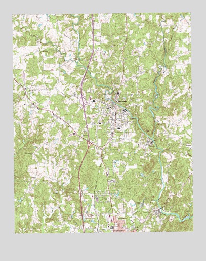
Randleman, NC USGS Topographic Map
Click on map above to begin viewing in our Map Viewer.

This topographic map contains these locations and features:
Feature Name Type Latitude Longitude GNIS ID View Map
Asheboro Fire Department Station 2BuildingN35.7574°W79.8058°2639031View Map
Asheboro QuarryMineN35.7631°W79.8225°2648425View Map
Bob BranchStreamN35.8540°W79.8436°981665View Map
Camp Nawaka LakeReservoirN35.8285°W79.7731°999534View Map
Camp Nawaka Lake Dam Number OneDamN35.8286°W79.7736°999535View Map
Carl Hamlett LakeReservoirN35.7567°W79.8201°999358View Map
Carl Hamlett Lake DamDamN35.7568°W79.8198°999359View Map
Central FallsPopulated PlaceN35.7621°W79.7761°1019597View Map
City of RandlemanCivilN35.8165°W79.8066°2404592View Map
Cox LakeReservoirN35.7585°W79.7531°999365View Map
Cox Lake DamDamN35.7579°W79.7524°999364View Map
Davis LakeReservoirN35.8687°W79.8555°999618View Map
Davis Lake DamDamN35.8685°W79.8564°999617View Map
DayspringPopulated PlaceN35.8296°W79.7934°1005941View Map
East ButtkeDamN35.8418°W79.8381°999558View Map
East Buttke DamReservoirN35.8417°W79.8387°999559View Map
East HamlettDamN35.7651°W79.7898°999382View Map
East Hamlett LakeReservoirN35.7655°W79.7913°999383View Map
Forest Park ChurchChurchN35.7826°W79.8095°985288View Map
Harshaw ChurchChurchN35.8057°W79.8261°986467View Map
Hasketts CreekStreamN35.7682°W79.7748°1011900View Map
Hylton DamDamN35.7685°W79.8364°999392View Map
Hylton LakeReservoirN35.7692°W79.8359°999393View Map
Little Polecat CreekStreamN35.8510°W79.7675°988738View Map
Midway ChurchChurchN35.8026°W79.8006°989827View Map
Muddy CreekStreamN35.8474°W79.8300°990759View Map
New MarketPopulated PlaceN35.8293°W79.8656°991072View Map
New Market Elementary SchoolSchoolN35.8326°W79.8656°1006760View Map
New Salem ChurchChurchN35.8410°W79.7856°991095View Map
Oakwinds DamDamN35.8185°W79.8631°999514View Map
Oakwinds LakeReservoirN35.8190°W79.8627°999513View Map
Old Union ChurchChurchN35.8340°W79.8575°991620View Map
Penwood BranchStreamN35.7590°W79.7928°1014329View Map
Polecat CreekStreamN35.8035°W79.7775°992638View Map
RandlemanPopulated PlaceN35.8179°W79.8031°1022145View Map
Randleman City LakeReservoirN35.8151°W79.7764°999496View Map
Randleman City Lake DamDamN35.8157°W79.7765°999497View Map
Randleman Elementary SchoolSchoolN35.8093°W79.8006°1006763View Map
Randleman Fire DepartmentBuildingN35.8174°W79.8048°2638148View Map
Randleman High SchoolSchoolN35.8268°W79.8209°1006761View Map
Randleman Middle SchoolSchoolN35.8254°W79.8181°1006762View Map
Randleman Police DepartmentBuildingN35.8177°W79.8050°2769775View Map
Randleman Post OfficePost OfficeN35.8203°W79.8173°2773898View Map
Randolph Memorial ParkCemeteryN35.7796°W79.8070°993029View Map
Richardson LakeReservoirN35.7714°W79.8026°999397View Map
Richardson Lake DamDamN35.7718°W79.8031°999396View Map
Saint Peters ChurchChurchN35.8607°W79.7953°994121View Map
SalemPopulated PlaceN35.8390°W79.7892°1022466View Map
SophiaPopulated PlaceN35.8232°W79.8609°1022702View Map
Sophia Post OfficePost OfficeN35.8263°W79.8628°2773949View Map
South Plainfield ChurchChurchN35.7954°W79.8614°995185View Map
Township of RandlemanCivilN35.8141°W79.8025°1027089View Map
Westside Volunteer Fire and Rescue Department Station 16BuildingN35.7777°W79.8646°2639246View Map
WFMY-TV (Greensboro)TowerN35.8704°W79.8400°1018600View Map
WGGT-TV (Greensboro)TowerN35.8704°W79.8400°1018601View Map
WGHP-TV (High Point)TowerN35.8129°W79.8431°1018599View Map
White Hall ChurchChurchN35.7951°W79.8153°997137View Map
WMAG-FM (High Point)TowerN35.8704°W79.8400°1018308View Map
WorthvillePopulated PlaceN35.8021°W79.7800°1023328View Map
Worthville LakeReservoirN35.8018°W79.7764°999476View Map
Worthville Lake DamDamN35.8018°W79.7764°999475View Map
WZOO-AM (Asheboro)TowerN35.7640°W79.8342°1018495View Map

Note: Coordinates in the location and feature list above are referenced to NAD83 datum.


Copyright (C) 2008-2024 Ryan Niemi / Sunset Dynamics ... All Rights Reserved