TopoQuest Logo
Do you find TopoQuest useful?
Help keep TopoQuest running and adding new maps/features by donating!
Bitcoin:  19c7KJd3qBynnjoSw5npx9KScwjBe4ifkT
Litecoin:  LXs6TkuXGGXo1vDsWCkWVdjQX94eUKd6ui
Home View Maps Find Maps Find Places Resources & Links


Rathbun, Pennsylvania Topographic Map

USGS Map Title: Rathbun, PA
USGS Map MRC: 41078D4
DRG (GeoTIFF) Download: o41078d4.tif


Neighboring USGS Topographic Map Quads:


  Glen Hazel, PA  
41078E5
 

  Wildwood Fire Tower, PA  
41078E4
 

  Rich Valley, PA  
41078E3
 

  Saint Marys, PA  
41078D5
 

  Rathbun, PA  
41078D4
 

  West Creek, PA  
41078D3
 

  Kersey, PA  
41078C5
 

  Weedville, PA  
41078C4
 

  Dents Run, PA  
41078C3


Map MRC Location:

N42°
W79°
N42°
W78°
H8 H7 H6 H5 H4 H3 H2 H1
G8 G7 G6 G5 G4 G3 G2 G1
F8 F7 F6 F5 F4 F3 F2 F1
E8 E7 E6 E5 E4 E3 E2 E1
D8 D7 D6 D5 D4 D3 D2 D1
C8 C7 C6 C5 C4 C3 C2 C1
B8 B7 B6 B5 B4 B3 B2 B1
A8 A7 A6 A5 A4 A3 A2 A1
N41°
W79°
N41°
W78°

Rathbun, PA USGS 1:24K Topographic Map Preview:
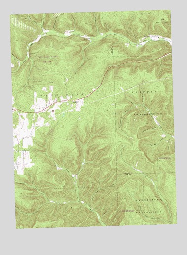
Rathbun, PA USGS Topographic Map
Click on map above to begin viewing in our Map Viewer.

This topographic map contains these locations and features:
Feature Name Type Latitude Longitude GNIS ID View Map
Bear RunStreamN41.4720°W78.4922°1199831View Map
Bear RunStreamN41.4723°W78.3845°1198376View Map
Bear Run CampLocaleN41.4762°W78.4997°1198379View Map
BeechwoodPopulated PlaceN41.4851°W78.3908°1198401View Map
Bell HollowValleyN41.4936°W78.4752°1198407View Map
Big Basin HollowValleyN41.4269°W78.3801°1198425View Map
Frenchmans BranchStreamN41.4456°W78.4033°1198774View Map
Friddle HollowValleyN41.4895°W78.4500°1198775View Map
Goetz SummitSummitN41.4481°W78.4478°1198810View Map
Hellfire RunStreamN41.3906°W78.4731°1198868View Map
Hemlock StationLocaleN41.4759°W78.4856°1207127View Map
Hoover HollowValleyN41.3797°W78.4334°1198909View Map
Jordan HollowValleyN41.4262°W78.3769°1199887View Map
Lecker RunStreamN41.3990°W78.4847°1199044View Map
Little Bear RunStreamN41.4759°W78.4984°1199047View Map
North Fork West CreekStreamN41.4892°W78.4722°1199232View Map
Rakestraw HollowValleyN41.4318°W78.3864°1199351View Map
RathbunPopulated PlaceN41.4851°W78.4384°1204463View Map
Rathbun SchoolSchoolN41.4906°W78.4656°1200826View Map
Rathbun StationLocaleN41.4851°W78.4381°1207128View Map
Reed HollowValleyN41.4810°W78.4011°1199367View Map
Rock Lick RunStreamN41.3881°W78.4431°1199399View Map
Sand Lick RunStreamN41.4851°W78.4347°1199478View Map
Sawdust RunStreamN41.3901°W78.4486°1199488View Map
Schoolhouse HollowValleyN41.4906°W78.4661°1199494View Map
Seeley HollowValleyN41.4870°W78.4303°1199505View Map
South Fork West CreekStreamN41.4753°W78.4875°1199568View Map
State Game Lands Number 293ParkN41.4751°W78.4747°1208382View Map
Steinhopper HollowValleyN41.4624°W78.4861°1199615View Map
Sugar Bush HollowValleyN41.4454°W78.3981°1199635View Map
SwissmontPopulated PlaceN41.4767°W78.4875°1204785View Map
Warner HollowValleyN41.4887°W78.4225°1199746View Map

Note: Coordinates in the location and feature list above are referenced to NAD83 datum.


Copyright (C) 2008-2025 Ryan Niemi / Sunset Dynamics ... All Rights Reserved