TopoQuest Logo
Do you find TopoQuest useful?
Help keep TopoQuest running and adding new maps/features by donating!
Bitcoin:  19c7KJd3qBynnjoSw5npx9KScwjBe4ifkT
Litecoin:  LXs6TkuXGGXo1vDsWCkWVdjQX94eUKd6ui
Home View Maps Find Maps Find Places Resources & Links


Dents Run, Pennsylvania Topographic Map

USGS Map Title: Dents Run, PA
USGS Map MRC: 41078C3
DRG (GeoTIFF) Download: o41078c3.tif


Neighboring USGS Topographic Map Quads:


  Rathbun, PA  
41078D4
 

  West Creek, PA  
41078D3
 

  Cameron, PA  
41078D2
 

  Weedville, PA  
41078C4
 

  Dents Run, PA  
41078C3
 

  Driftwood, PA  
41078C2
 

  Huntley, PA  
41078B4
 

  The Knobs, PA  
41078B3
 

  Devils Elbow, PA  
41078B2


Map MRC Location:

N42°
W79°
N42°
W78°
H8 H7 H6 H5 H4 H3 H2 H1
G8 G7 G6 G5 G4 G3 G2 G1
F8 F7 F6 F5 F4 F3 F2 F1
E8 E7 E6 E5 E4 E3 E2 E1
D8 D7 D6 D5 D4 D3 D2 D1
C8 C7 C6 C5 C4 C3 C2 C1
B8 B7 B6 B5 B4 B3 B2 B1
A8 A7 A6 A5 A4 A3 A2 A1
N41°
W79°
N41°
W78°

Dents Run, PA USGS 1:24K Topographic Map Preview:
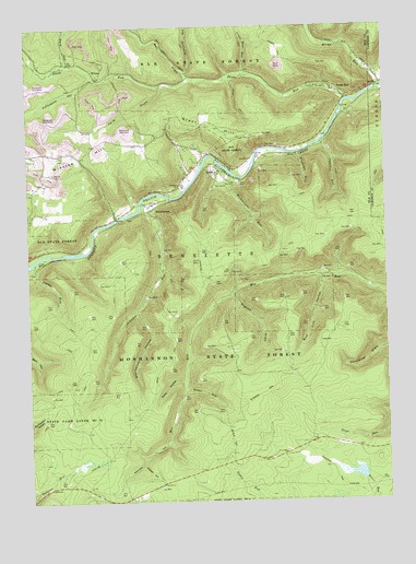
Dents Run, PA USGS Topographic Map
Click on map above to begin viewing in our Map Viewer.

This topographic map contains these locations and features:
Feature Name Type Latitude Longitude GNIS ID View Map
Bearwallow HollowValleyN41.2999°W78.3365°1168979View Map
Beaver Run Shallow Water ImpoundmentSwampN41.2575°W78.2658°1201821View Map
Bell DraftValleyN41.3616°W78.3184°1199834View Map
Bells Branch Dents RunStreamN41.3612°W78.3186°1212268View Map
Charlies RunStreamN41.3442°W78.2714°1171587View Map
Cole DraftValleyN41.3591°W78.3268°1172173View Map
Dark HollowValleyN41.3661°W78.3604°1172940View Map
Deible RunStreamN41.2798°W78.3203°1173115View Map
Dents RunPopulated PlaceN41.3581°W78.2672°1173167View Map
Dents RunStreamN41.3556°W78.2625°1173168View Map
Dry HollowValleyN41.3116°W78.3269°1173509View Map
Elk State ForestForestN41.3334°W78.2914°1209200View Map
English DraftValleyN41.3040°W78.3032°1192434View Map
GrantPopulated PlaceN41.3367°W78.3081°1202606View Map
Grant HillSummitN41.3495°W78.3183°1175961View Map
Hicks RunStreamN41.3587°W78.2517°1176985View Map
Hodag TrailTrailN41.3551°W78.3008°1177153View Map
Jimmy RunStreamN41.3134°W78.3728°1178086View Map
Johnson CemeteryCemeteryN41.3285°W78.3330°1209114View Map
Johnson ChurchChurchN41.3334°W78.3222°1200824View Map
Johnson RunStreamN41.3273°W78.3350°1178121View Map
Little Bear RunStreamN41.3620°W78.2964°1179465View Map
Marion Brooks Natural AreaAreaN41.2764°W78.2875°1209278View Map
Marion Brooks Natural AreaAreaN41.2751°W78.2914°1200743View Map
McDonald RunStreamN41.3612°W78.3175°1180694View Map
Mount Pleasant ChurchChurchN41.3412°W78.3556°1200823View Map
Mud Lick HollowValleyN41.3094°W78.2732°1182004View Map
Porcupine HollowValleyN41.3615°W78.3512°1184272View Map
Quehanna TrailTrailN41.2781°W78.3136°1209275View Map
Quehanna Wild AreaAreaN41.2742°W78.2567°1209276View Map
Ripper HollowValleyN41.2594°W78.3357°1185101View Map
Snooks TrailTrailN41.3692°W78.2856°1187944View Map
Spike HollowValleyN41.2822°W78.3211°1188173View Map
Stephens RunStreamN41.3417°W78.2797°1188609View Map
SumersonPopulated PlaceN41.3265°W78.3322°1204767View Map
Township of BenezetteCivilN41.3178°W78.3313°1216397View Map
Wainwright RunStreamN41.3390°W78.3072°1190486View Map
WilmerPopulated PlaceN41.3617°W78.3495°1204960View Map
Winslow HillSummitN41.3367°W78.3664°1191607View Map

Note: Coordinates in the location and feature list above are referenced to NAD83 datum.


Copyright (C) 2008-2025 Ryan Niemi / Sunset Dynamics ... All Rights Reserved