TopoQuest Logo
Do you find TopoQuest useful?
Help keep TopoQuest running and adding new maps/features by donating!
Bitcoin:  19c7KJd3qBynnjoSw5npx9KScwjBe4ifkT
Litecoin:  LXs6TkuXGGXo1vDsWCkWVdjQX94eUKd6ui
Home View Maps Find Maps Find Places Resources & Links


West Creek, Pennsylvania Topographic Map

USGS Map Title: West Creek, PA
USGS Map MRC: 41078D3
DRG (GeoTIFF) Download: o41078d3.tif


Neighboring USGS Topographic Map Quads:


  Wildwood Fire Tower, PA  
41078E4
 

  Rich Valley, PA  
41078E3
 

  Emporium, PA  
41078E2
 

  Rathbun, PA  
41078D4
 

  West Creek, PA  
41078D3
 

  Cameron, PA  
41078D2
 

  Weedville, PA  
41078C4
 

  Dents Run, PA  
41078C3
 

  Driftwood, PA  
41078C2


Map MRC Location:

N42°
W79°
N42°
W78°
H8 H7 H6 H5 H4 H3 H2 H1
G8 G7 G6 G5 G4 G3 G2 G1
F8 F7 F6 F5 F4 F3 F2 F1
E8 E7 E6 E5 E4 E3 E2 E1
D8 D7 D6 D5 D4 D3 D2 D1
C8 C7 C6 C5 C4 C3 C2 C1
B8 B7 B6 B5 B4 B3 B2 B1
A8 A7 A6 A5 A4 A3 A2 A1
N41°
W79°
N41°
W78°

West Creek, PA USGS 1:24K Topographic Map Preview:
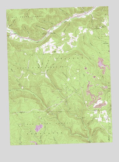
West Creek, PA USGS Topographic Map
Click on map above to begin viewing in our Map Viewer.

This topographic map contains these locations and features:
Feature Name Type Latitude Longitude GNIS ID View Map
Barr RunStreamN41.3901°W78.2833°1198362View Map
Beldin HollowValleyN41.4410°W78.3308°1198404View Map
Bell RunStreamN41.4392°W78.3286°1199835View Map
Big RunStreamN41.4784°W78.3667°1198436View Map
Bigger RunStreamN41.3973°W78.2870°1198442View Map
Boardinghouse HollowValleyN41.4995°W78.2677°1199839View Map
Bruner HollowValleyN41.4886°W78.2979°1198488View Map
Bryan HillSummitN41.4728°W78.2814°1198491View Map
Bryan Hill SchoolSchoolN41.4726°W78.2892°1201170View Map
Cards HollowValleyN41.4733°W78.3486°1198541View Map
Conway HollowValleyN41.4830°W78.3736°1198597View Map
Dry HollowValleyN41.4414°W78.3340°1198664View Map
East Branch Hicks RunStreamN41.3778°W78.2795°1198689View Map
Emporium Cable TV MastTowerN41.4923°W78.2547°1212773View Map
Gillis Bliss RunStreamN41.4898°W78.2970°1198800View Map
Hart RunStreamN41.4826°W78.3172°1198861View Map
Hercules HollowValleyN41.4939°W78.2717°1198875View Map
Hicks Run Camping AreaAreaN41.3792°W78.2806°1201820View Map
Horning HollowValleyN41.4786°W78.3239°1198912View Map
Howard SidingPopulated PlaceN41.4765°W78.3233°1198915View Map
Hubbard HollowValleyN41.4841°W78.3731°1198916View Map
Little Dry HollowValleyN41.4443°W78.3304°1199052View Map
Middle Branch Hicks RunStreamN41.4253°W78.3600°1199149View Map
Moore HillSummitN41.4598°W78.3181°1199187View Map
Moore Hill SchoolSchoolN41.4659°W78.3231°1201171View Map
Mud RunStreamN41.4723°W78.3492°1212774View Map
Pine Tree Trail Natural AreaAreaN41.3934°W78.3492°1212267View Map
Sand Spring RunStreamN41.3803°W78.2792°1199481View Map
Shaffer DraftValleyN41.3787°W78.3378°1199967View Map
State Game Lands Number 14ParkN41.4459°W78.3475°1199597View Map
Towner RunStreamN41.4937°W78.2781°1199689View Map
TrumanPopulated PlaceN41.4770°W78.3686°1199698View Map
West Branch Hicks RunStreamN41.3778°W78.2792°1199760View Map
West CreekPopulated PlaceN41.4948°W78.2781°1199765View Map
Whippoorwill CampLocaleN41.3973°W78.2858°1199778View Map
Whippoorwill HollowValleyN41.4168°W78.2850°1199779View Map
Whittimore HillSummitN41.4812°W78.2595°1199791View Map
Whittimore SchoolSchoolN41.4823°W78.2522°1200825View Map

Note: Coordinates in the location and feature list above are referenced to NAD83 datum.


Copyright (C) 2008-2025 Ryan Niemi / Sunset Dynamics ... All Rights Reserved