TopoQuest Logo
Do you find TopoQuest useful?
Help keep TopoQuest running and adding new maps/features by donating!
Bitcoin:  19c7KJd3qBynnjoSw5npx9KScwjBe4ifkT
Litecoin:  LXs6TkuXGGXo1vDsWCkWVdjQX94eUKd6ui
Home View Maps Find Maps Find Places Resources & Links


Ratio Mountain, Montana Topographic Map

USGS Map Title: Ratio Mountain, MT
USGS Map MRC: 46112A2
DRG (GeoTIFF) Download: o46112a2.tif


Neighboring USGS Topographic Map Quads:


  Bison Canyon, MT  
46112B3
 

  Boulder West, MT  
46112B2
 

  Boulder East, MT  
46112B1
 

  Whitetail Peak, MT  
46112A3
 

  Ratio Mountain, MT  
46112A2
 

  Wilson Park, MT  
46112A1
 

  Delmoe Lake, MT  
45112H3
 

  Dry Mountain, MT  
45112H2
 

  Black Butte, MT  
45112H1


Map MRC Location:

N47°
W113°
N47°
W112°
H8 H7 H6 H5 H4 H3 H2 H1
G8 G7 G6 G5 G4 G3 G2 G1
F8 F7 F6 F5 F4 F3 F2 F1
E8 E7 E6 E5 E4 E3 E2 E1
D8 D7 D6 D5 D4 D3 D2 D1
C8 C7 C6 C5 C4 C3 C2 C1
B8 B7 B6 B5 B4 B3 B2 B1
A8 A7 A6 A5 A4 A3 A2 A1
N46°
W113°
N46°
W112°

Ratio Mountain, MT USGS 1:24K Topographic Map Preview:
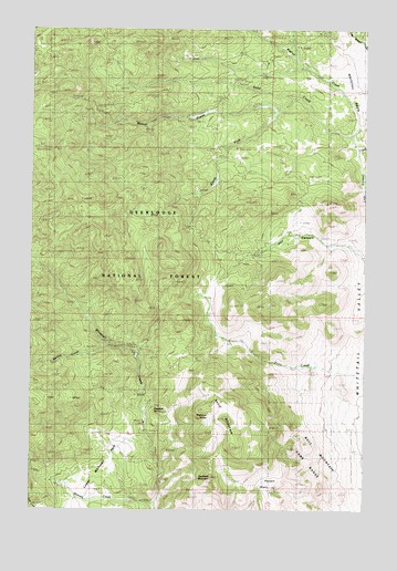
Ratio Mountain, MT USGS Topographic Map
Click on map above to begin viewing in our Map Viewer.

This topographic map contains these locations and features:
Feature Name Type Latitude Longitude GNIS ID View Map
Ajax MineMineN46.1044°W112.1842°778891View Map
Attowa MineMineN46.1010°W112.1914°779190View Map
Beaver CreekStreamN46.1044°W112.1597°779591View Map
Beaver Creek MineMineN46.1019°W112.1986°803294View Map
Beaver Placer MineMineN46.1024°W112.1975°779629View Map
Big Foot (historical)Populated PlaceN46.1244°W112.1508°1762516View Map
Bigfoot CreekStreamN46.0938°W112.1292°779896View Map
Goodwin MountainSummitN46.0085°W112.1828°784101View Map
Grouse CreekStreamN46.0019°W112.2039°784378View Map
Hay CanyonValleyN46.0663°W112.1283°784639View Map
Lower Whitetail ParkFlatN46.0080°W112.2219°786686View Map
Mountain Queen MineMineN46.0727°W112.1939°803481View Map
Mountain Queen MineMineN46.0730°W112.1933°787759View Map
NE SW Section 3 MineMineN46.0438°W112.2147°803564View Map
NW NW Section 21 MineMineN46.0935°W112.2419°803482View Map
Poison FlatsFlatN46.0069°W112.1614°806228View Map
Ratio MountainSummitN46.0230°W112.1778°789397View Map
Roadside SpringSpringN46.0265°W112.2038°806230View Map
Saint Anthony MineMineN46.0427°W112.2164°789925View Map
Shedhorn CreekStreamN46.1150°W112.1483°2582469View Map
South Fork State CreekStreamN46.1066°W112.1542°791059View Map
Spring CreekStreamN46.0421°W112.2211°791242View Map
State CreekStreamN46.0974°W112.1311°791459View Map
State MineMineN46.1033°W112.2253°803259View Map
State MineMineN46.1060°W112.2275°791462View Map
Upper Whitetail Park TrailTrailN46.0363°W112.2286°792661View Map
Wildhorse SpringSpringN46.0244°W112.1840°806229View Map

Note: Coordinates in the location and feature list above are referenced to NAD83 datum.


Copyright (C) 2008-2024 Ryan Niemi / Sunset Dynamics ... All Rights Reserved