TopoQuest Logo
Do you find TopoQuest useful?
Help keep TopoQuest running and adding new maps/features by donating!
Bitcoin:  19c7KJd3qBynnjoSw5npx9KScwjBe4ifkT
Litecoin:  LXs6TkuXGGXo1vDsWCkWVdjQX94eUKd6ui
Home View Maps Find Maps Find Places Resources & Links


Big Foot Mountain, California Topographic Map

USGS Map Title: Big Foot Mountain, CA
USGS Map MRC: 38123G2
DRG (GeoTIFF) Download: o38123g2.tif


Neighboring USGS Topographic Map Quads:


  Ornbaun Valley, CA  
38123H3
 

  Yorkville, CA  
38123H2
 

  Hopland, CA  
38123H1
 

  Gube Mountain, CA  
38123G3
 

  Big Foot Mountain, CA  
38123G2
 

  Cloverdale, CA  
38123G1
 

  Annapolis, CA  
38123F3
 

  Tombs Creek, CA  
38123F2
 

  Warm Springs Dam, CA  
38123F1


Map MRC Location:

N39°
W124°
N39°
W123°
H8 H7 H6 H5 H4 H3 H2 H1
G8 G7 G6 G5 G4 G3 G2 G1
F8 F7 F6 F5 F4 F3 F2 F1
E8 E7 E6 E5 E4 E3 E2 E1
D8 D7 D6 D5 D4 D3 D2 D1
C8 C7 C6 C5 C4 C3 C2 C1
B8 B7 B6 B5 B4 B3 B2 B1
A8 A7 A6 A5 A4 A3 A2 A1
N38°
W124°
N38°
W123°

Big Foot Mountain, CA USGS 1:24K Topographic Map Preview:
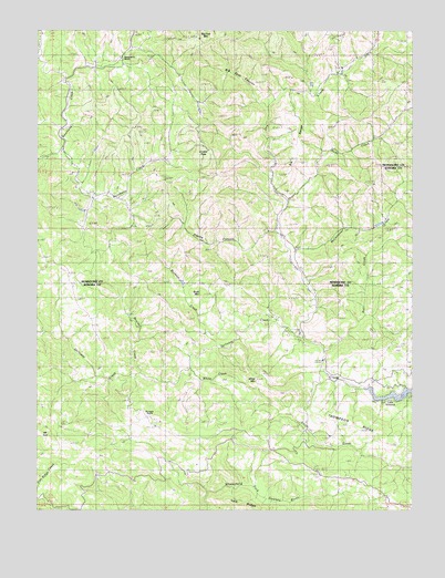
Big Foot Mountain, CA USGS Topographic Map
Click on map above to begin viewing in our Map Viewer.

This topographic map contains these locations and features:
Feature Name Type Latitude Longitude GNIS ID View Map
Big Foot CanyonValleyN38.8549°W123.1747°219189View Map
Big Foot MountainSummitN38.8727°W123.1967°219190View Map
Boulder CreekStreamN38.7855°W123.2167°219682View Map
Buck MountainSummitN38.8060°W123.1958°219996View Map
Buckeye CreekStreamN38.7919°W123.1889°220025View Map
Crystal PeakSummitN38.8446°W123.1964°1658356View Map
Diamond D RanchLocaleN38.8685°W123.2233°253206View Map
Elk RangeRidgeN38.8441°W123.1650°223122View Map
Elkhorn CreekStreamN38.8621°W123.2420°253205View Map
Franks CanyonValleyN38.8221°W123.1706°223837View Map
Galloway CreekStreamN38.7971°W123.1653°224021View Map
Hoods Springs RanchLocaleN38.7999°W123.1714°1653137View Map
Mathews RanchLocaleN38.8177°W123.1650°1653063View Map
McChristian CreekStreamN38.8171°W123.1664°228293View Map
Mount TomSummitN38.7666°W123.2397°1660013View Map
Old Noble Place (historical)LocaleN38.8032°W123.2372°1653141View Map
Rail CreekStreamN38.7916°W123.1553°231170View Map
Redwood GulchValleyN38.7982°W123.1742°253204View Map
Rockpile RanchLocaleN38.7741°W123.2142°253207View Map
Soda Spring CreekStreamN38.8307°W123.1678°1662315View Map
Thompson RidgeRidgeN38.7707°W123.1425°236283View Map
White CreekStreamN38.7869°W123.2003°237639View Map
White MountainSummitN38.7857°W123.1753°1660167View Map

Note: Coordinates in the location and feature list above are referenced to NAD83 datum.


Copyright (C) 2008-2025 Ryan Niemi / Sunset Dynamics ... All Rights Reserved