TopoQuest Logo
Do you find TopoQuest useful?
Help keep TopoQuest running and adding new maps/features by donating!
Bitcoin:  19c7KJd3qBynnjoSw5npx9KScwjBe4ifkT
Litecoin:  LXs6TkuXGGXo1vDsWCkWVdjQX94eUKd6ui
Home View Maps Find Maps Find Places Resources & Links


Tombs Creek, California Topographic Map

USGS Map Title: Tombs Creek, CA
USGS Map MRC: 38123F2
DRG (GeoTIFF) Download: o38123f2.tif


Neighboring USGS Topographic Map Quads:


  Gube Mountain, CA  
38123G3
 

  Big Foot Mountain, CA  
38123G2
 

  Cloverdale, CA  
38123G1
 

  Annapolis, CA  
38123F3
 

  Tombs Creek, CA  
38123F2
 

  Warm Springs Dam, CA  
38123F1
 

  Plantation, CA  
38123E3
 

  Fort Ross, CA  
38123E2
 

  Cazadero, CA  
38123E1


Map MRC Location:

N39°
W124°
N39°
W123°
H8 H7 H6 H5 H4 H3 H2 H1
G8 G7 G6 G5 G4 G3 G2 G1
F8 F7 F6 F5 F4 F3 F2 F1
E8 E7 E6 E5 E4 E3 E2 E1
D8 D7 D6 D5 D4 D3 D2 D1
C8 C7 C6 C5 C4 C3 C2 C1
B8 B7 B6 B5 B4 B3 B2 B1
A8 A7 A6 A5 A4 A3 A2 A1
N38°
W124°
N38°
W123°

Tombs Creek, CA USGS 1:24K Topographic Map Preview:
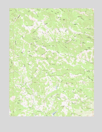
Tombs Creek, CA USGS Topographic Map
Click on map above to begin viewing in our Map Viewer.

This topographic map contains these locations and features:
Feature Name Type Latitude Longitude GNIS ID View Map
Allen CreekStreamN38.6355°W123.2289°218142View Map
Bald HillSummitN38.6963°W123.2014°1657978View Map
Bee FlatFlatN38.6960°W123.2297°218960View Map
Bee KnollSummitN38.6996°W123.2233°218962View Map
Big MountainSummitN38.7102°W123.1450°219219View Map
Black Oak RidgeRidgeN38.7213°W123.1972°219390View Map
Britain CreekStreamN38.6555°W123.1800°219851View Map
Britain RidgeRidgeN38.6638°W123.1614°219852View Map
Buck MountainSummitN38.7394°W123.1811°1658151View Map
Buckhorn RidgeRidgeN38.6644°W123.1778°220062View Map
Bull FlatFlatN38.6541°W123.1561°220105View Map
Bull OpeningFlatN38.7166°W123.2097°220114View Map
Burnt RidgeRidgeN38.6902°W123.2358°220232View Map
Buzzard CreekStreamN38.6846°W123.1917°220314View Map
Cedar CreekStreamN38.6524°W123.1692°220760View Map
Cedar RidgeRidgeN38.6546°W123.1531°220794View Map
Centennial MountainSummitN38.7019°W123.1344°220814View Map
Cerri CabinBuildingN38.7127°W123.1408°1656944View Map
Coleman FieldFlatN38.6263°W123.2139°221366View Map
Cow CreekStreamN38.6346°W123.1922°221691View Map
Crane PeakSummitN38.7360°W123.1733°1658344View Map
Danfield CreekStreamN38.6288°W123.1978°222007View Map
Danfield RidgeRidgeN38.6505°W123.1842°222008View Map
Deadman CliffCliffN38.7410°W123.1469°222112View Map
Dickson RanchLocaleN38.6663°W123.1878°1656947View Map
Doe RidgeRidgeN38.6582°W123.2361°222460View Map
Eddicut FlatFlatN38.6996°W123.2320°222963View Map
Elkhead CreekStreamN38.7160°W123.2158°223131View Map
Fern MountainSummitN38.6427°W123.1508°223462View Map
Gibson RidgeRidgeN38.7277°W123.2245°224157View Map
Hedgpeth LakeReservoirN38.6286°W123.1848°225115View Map
Hedgpeth RanchLocaleN38.6555°W123.2150°1656950View Map
Hillside Ranch 4420 DamDamN38.6566°W123.1811°1664390View Map
Holt HillSummitN38.6469°W123.2261°225473View Map
Horse OpeningFlatN38.6405°W123.2395°225616View Map
House CreekStreamN38.6624°W123.2339°225688View Map
Johnny Brown SpringsSpringN38.7310°W123.1567°226285View Map
Kitty RidgeRidgeN38.6902°W123.2086°226641View Map
Las LomasPopulated PlaceN38.6771°W123.1353°1658945View Map
Lee Nobles RanchLocaleN38.6660°W123.2336°1656953View Map
Lookout PointSummitN38.7088°W123.2211°1659013View Map
Lookout RockSummitN38.7171°W123.1561°1659014View Map
Lyle RidgeRidgeN38.7485°W123.1758°227856View Map
Moffitt RanchLocaleN38.7235°W123.1667°228898View Map
Neese RidgeRidgeN38.6799°W123.2086°229446View Map
Oak MountainSummitN38.6371°W123.1697°229868View Map
Panther DenFlatN38.7196°W123.1497°230306View Map
Pepperwood CreekStreamN38.6352°W123.2178°230514View Map
Quicksilver FlatFlatN38.7110°W123.2136°231135View Map
Ranchero HillSummitN38.6946°W123.2183°231222View Map
Red HillSummitN38.6649°W123.1386°1659480View Map
Sheep Repose RidgeRidgeN38.7444°W123.2142°232903View Map
Skyline RidgeRidgeN38.6285°W123.2489°233225View Map
Soda Spring CreekStreamN38.6488°W123.2336°234845View Map
Spanish CreekStreamN38.6788°W123.1961°235148View Map
Staley SpringSpringN38.7235°W123.1792°235353View Map
SugarloafSummitN38.7124°W123.1639°235649View Map
Sugarloaf CreekStreamN38.7080°W123.1733°235659View Map
The GirdleRangeN38.7119°W123.1553°236171View Map
The NubbleSummitN38.7007°W123.2131°236206View Map
Tombs CreekStreamN38.7177°W123.2417°236448View Map
Walters RidgeRidgeN38.7010°W123.1939°237218View Map
Wether RidgeRidgeN38.7449°W123.1870°237582View Map
Wickersham RanchLocaleN38.7321°W123.2008°237724View Map
Wild Horse RidgeRidgeN38.7060°W123.2139°237762View Map
Windy PointSummitN38.6752°W123.1983°1660192View Map
Wolf CreekStreamN38.6694°W123.2170°238086View Map
Yellowjacket SpringsSpringN38.7042°W123.1303°238253View Map

Note: Coordinates in the location and feature list above are referenced to NAD83 datum.


Copyright (C) 2008-2024 Ryan Niemi / Sunset Dynamics ... All Rights Reserved