TopoQuest Logo
Do you find TopoQuest useful?
Help keep TopoQuest running and adding new maps/features by donating!
Bitcoin:  19c7KJd3qBynnjoSw5npx9KScwjBe4ifkT
Litecoin:  LXs6TkuXGGXo1vDsWCkWVdjQX94eUKd6ui
Home View Maps Find Maps Find Places Resources & Links


Ravia, Oklahoma Topographic Map

USGS Map Title: Ravia, OK
USGS Map MRC: 34096B7
DRG (GeoTIFF) Download: o34096b7.tif


Neighboring USGS Topographic Map Quads:


  Nebo, OK  
34096C8
 

  Troy, OK  
34096C7
 

  Reagan, OK  
34096C6
 

  Mannsville, OK  
34096B8
 

  Ravia, OK  
34096B7
 

  Tishomingo, OK  
34096B6
 

  McMillan, OK  
34096A8
 

  Madill, OK  
34096A7
 

  Kingston North, OK  
34096A6


Map MRC Location:

N35°
W97°
N35°
W96°
H8 H7 H6 H5 H4 H3 H2 H1
G8 G7 G6 G5 G4 G3 G2 G1
F8 F7 F6 F5 F4 F3 F2 F1
E8 E7 E6 E5 E4 E3 E2 E1
D8 D7 D6 D5 D4 D3 D2 D1
C8 C7 C6 C5 C4 C3 C2 C1
B8 B7 B6 B5 B4 B3 B2 B1
A8 A7 A6 A5 A4 A3 A2 A1
N34°
W97°
N34°
W96°

Ravia, OK USGS 1:24K Topographic Map Preview:
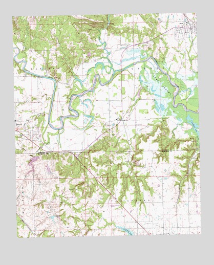
Ravia, OK USGS Topographic Map
Click on map above to begin viewing in our Map Viewer.

This topographic map contains these locations and features:
Feature Name Type Latitude Longitude GNIS ID View Map
Camp CreekStreamN34.1943°W96.8517°1090844View Map
Carter LakeReservoirN34.1260°W96.7995°1091008View Map
Cedar CreekStreamN34.1632°W96.8633°1091086View Map
Cedar Hill CemeteryCemeteryN34.1445°W96.8455°1091120View Map
Courtney CreekStreamN34.2198°W96.8086°1091762View Map
John O'Banion 10 DamDamN34.1351°W96.8169°1754238View Map
John O'Banion 10 ReservoirReservoirN34.1351°W96.8169°1754239View Map
Lake OtekaReservoirN34.1701°W96.8620°1757666View Map
Lake Oteka DamDamN34.1701°W96.8620°1757665View Map
Madill Municipal AirportAirportN34.1392°W96.8132°1102546View Map
Mannsville CemeteryCemeteryN34.1897°W96.8639°2709406View Map
Mannsville Elementary SchoolSchoolN34.1915°W96.8749°1803511View Map
Mill CreekStreamN34.2179°W96.8061°1095400View Map
Norton CemeteryCemeteryN34.2319°W96.8531°2747465View Map
Oil CreekStreamN34.1804°W96.7503°1096186View Map
Oknoname 095004 DamDamN34.1368°W96.8503°1753423View Map
Oknoname 095004 ReservoirReservoirN34.1368°W96.8503°1753424View Map
Randolph LakeLakeN34.1857°W96.7522°1097043View Map
RaviaPopulated PlaceN34.2418°W96.7514°1097062View Map
Ravia CemeteryCemeteryN34.2378°W96.7647°2709409View Map
Ravia Elementary SchoolSchoolN34.2444°W96.7571°1790771View Map
Ravia Post OfficePost OfficeN34.2417°W96.7525°1818403View Map
Ravia Volunteer Fire DepartmentBuildingN34.2418°W96.7532°2657039View Map
RussettPopulated PlaceN34.1901°W96.8050°1097547View Map
Russett CemeteryCemeteryN34.1817°W96.8102°1097548View Map
Russett ChurchChurchN34.1876°W96.8108°1097549View Map
Sycamore CreekStreamN34.2248°W96.8697°1098705View Map
Town of RaviaCivilN34.2407°W96.7565°2412532View Map
Turkey CreekStreamN34.1857°W96.8453°1099025View Map
W M Chapman DamDamN34.1684°W96.8370°1754230View Map
W M Chapman ReservoirReservoirN34.1684°W96.8370°1754231View Map
Washita Arm Public Hunting AreaReserveN34.2162°W96.7761°1763635View Map

Note: Coordinates in the location and feature list above are referenced to NAD83 datum.


Copyright (C) 2008-2025 Ryan Niemi / Sunset Dynamics ... All Rights Reserved