TopoQuest Logo
Do you find TopoQuest useful?
Help keep TopoQuest running and adding new maps/features by donating!
Bitcoin:  19c7KJd3qBynnjoSw5npx9KScwjBe4ifkT
Litecoin:  LXs6TkuXGGXo1vDsWCkWVdjQX94eUKd6ui
Home View Maps Find Maps Find Places Resources & Links


Raymond, Illinois Topographic Map

USGS Map Title: Raymond, IL
USGS Map MRC: 39089C5
DRG (GeoTIFF) Download: o39089c5.tif


Neighboring USGS Topographic Map Quads:


  Farmersville, IL  
39089D6
 

  Raymond NE, IL  
39089D5
 

  Morrisonville, IL  
39089D4
 

  Atwater, IL  
39089C6
 

  Raymond, IL  
39089C5
 

  Nokomis SW, IL  
39089C4
 

  Litchfield, IL  
39089B6
 

  Butler, IL  
39089B5
 

  Hillsboro, IL  
39089B4


Map MRC Location:

N40°
W90°
N40°
W89°
H8 H7 H6 H5 H4 H3 H2 H1
G8 G7 G6 G5 G4 G3 G2 G1
F8 F7 F6 F5 F4 F3 F2 F1
E8 E7 E6 E5 E4 E3 E2 E1
D8 D7 D6 D5 D4 D3 D2 D1
C8 C7 C6 C5 C4 C3 C2 C1
B8 B7 B6 B5 B4 B3 B2 B1
A8 A7 A6 A5 A4 A3 A2 A1
N39°
W90°
N39°
W89°

Raymond, IL USGS 1:24K Topographic Map Preview:
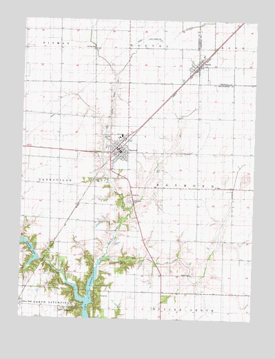
Raymond, IL USGS Topographic Map
Click on map above to begin viewing in our Map Viewer.

This topographic map contains these locations and features:
Feature Name Type Latitude Longitude GNIS ID View Map
Asbury CemeteryCemeteryN39.3014°W89.5662°403648View Map
Blue Grass CreekStreamN39.2753°W89.5795°404587View Map
Blue Grass School (historical)SchoolN39.2725°W89.5456°1772064View Map
Blue Mound Church (historical)ChurchN39.3050°W89.5120°1772065View Map
Burnett School (historical)SchoolN39.3709°W89.6059°1772069View Map
Cass CemeteryCemeteryN39.2734°W89.5684°405687View Map
Five Mile BridgeBridgeN39.2689°W89.6037°1821737View Map
Fivemile LakeReservoirN39.2817°W89.6249°408423View Map
Guthrie School (historical)SchoolN39.3626°W89.5681°1772086View Map
Harmony School (historical)SchoolN39.2756°W89.5165°1772088View Map
HarvelPopulated PlaceN39.3562°W89.5323°409902View Map
Harvel CemeteryCemeteryN39.3498°W89.5254°1953219View Map
Harvel Post OfficePost OfficeN39.3564°W89.5319°2788177View Map
Hazel Green School (historical)SchoolN39.2909°W89.6087°1772090View Map
Honey BendPopulated PlaceN39.2553°W89.6229°422819View Map
Independent School (historical)SchoolN39.3048°W89.5584°1772094View Map
Lebeck Landing Strip (historical)AirportN39.3670°W89.5551°1772101View Map
Liberty School (historical)SchoolN39.3228°W89.5304°1772102View Map
Lilly School (historical)SchoolN39.3278°W89.6054°1772103View Map
Lincolnwood High SchoolSchoolN39.3267°W89.5715°1772141View Map
RaymondPopulated PlaceN39.3195°W89.5720°416427View Map
Raymond - Harville Fire DepartmentBuildingN39.3210°W89.5741°2640393View Map
Raymond Christian ChurchChurchN39.3187°W89.5734°1967358View Map
Raymond City CemeteryCemeteryN39.3203°W89.5809°1953393View Map
Raymond Grade SchoolSchoolN39.3259°W89.5726°1821770View Map
Raymond Harville Ambulance ServiceBuildingN39.3210°W89.5741°2674064View Map
Raymond Post OfficePost OfficeN39.3197°W89.5713°2788809View Map
Raymond United Methodist ChurchChurchN39.3228°W89.5740°1967359View Map
Roberts CemeteryCemeteryN39.2531°W89.6009°416756View Map
Roberts Cemetery Savanna Nature PreserveParkN39.2531°W89.6023°1821771View Map
Saint Raymond's CemeteryCemeteryN39.2992°W89.5665°417780View Map
Shoal Creek FarmLocaleN39.3292°W89.5833°2559591View Map
Shoal Creek Watershed Structure Number 2 DamDamN39.2734°W89.6118°1691820View Map
Threemile BranchStreamN39.2575°W89.5898°419698View Map
Township of RaymondCivilN39.3051°W89.5298°429622View Map
Village of HarvelCivilN39.3577°W89.5323°2398261View Map
Village of RaymondCivilN39.3197°W89.5751°2399049View Map
WSMI-FM (Litchfield)TowerN39.2559°W89.6134°428510View Map

Note: Coordinates in the location and feature list above are referenced to NAD83 datum.


Copyright (C) 2008-2025 Ryan Niemi / Sunset Dynamics ... All Rights Reserved