TopoQuest Logo
Do you find TopoQuest useful?
Help keep TopoQuest running and adding new maps/features by donating!
Bitcoin:  19c7KJd3qBynnjoSw5npx9KScwjBe4ifkT
Litecoin:  LXs6TkuXGGXo1vDsWCkWVdjQX94eUKd6ui
Home View Maps Find Maps Find Places Resources & Links


Farmersville, Illinois Topographic Map

USGS Map Title: Farmersville, IL
USGS Map MRC: 39089D6
DRG (GeoTIFF) Download: o39089d6.tif


Neighboring USGS Topographic Map Quads:


  Virden North, IL  
39089E7
 

  Divernon, IL  
39089E6
 

  Pawnee, IL  
39089E5
 

  Virden South, IL  
39089D7
 

  Farmersville, IL  
39089D6
 

  Raymond NE, IL  
39089D5
 

  Carlinville East, IL  
39089C7
 

  Atwater, IL  
39089C6
 

  Raymond, IL  
39089C5


Map MRC Location:

N40°
W90°
N40°
W89°
H8 H7 H6 H5 H4 H3 H2 H1
G8 G7 G6 G5 G4 G3 G2 G1
F8 F7 F6 F5 F4 F3 F2 F1
E8 E7 E6 E5 E4 E3 E2 E1
D8 D7 D6 D5 D4 D3 D2 D1
C8 C7 C6 C5 C4 C3 C2 C1
B8 B7 B6 B5 B4 B3 B2 B1
A8 A7 A6 A5 A4 A3 A2 A1
N39°
W90°
N39°
W89°

Farmersville, IL USGS 1:24K Topographic Map Preview:
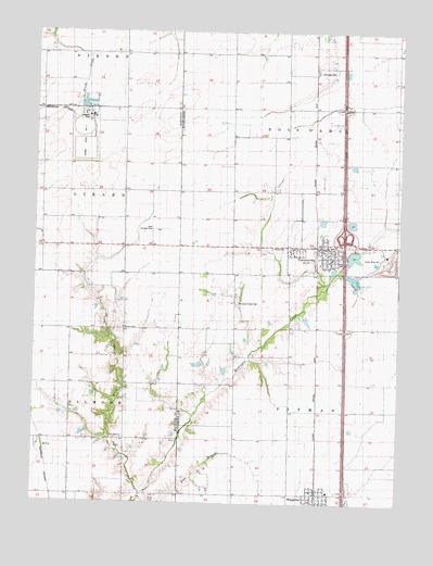
Farmersville, IL USGS Topographic Map
Click on map above to begin viewing in our Map Viewer.

This topographic map contains these locations and features:
Feature Name Type Latitude Longitude GNIS ID View Map
Ball School (historical)SchoolN39.4578°W89.7201°1764579View Map
Bartlett School (historical)SchoolN39.4981°W89.6826°1772060View Map
Boston Chapel Christian ChurchChurchN39.4212°W89.7198°404712View Map
Boston Chapel School (historical)SchoolN39.4212°W89.7201°1764584View Map
Crown Mine Number 1MineN39.4409°W89.6304°424799View Map
Crown Mine Number 2MineN39.4720°W89.7343°424800View Map
Crown Mine PondReservoirN39.4406°W89.6406°1691817View Map
Crown Mine Pond DamDamN39.4384°W89.6401°1691816View Map
East Union School (historical)SchoolN39.3776°W89.6812°1772077View Map
FarmersvillePopulated PlaceN39.4434°W89.6518°408285View Map
Farmersville - Waggoner Area Ambulance ServiceBuildingN39.4413°W89.6513°2673984View Map
Farmersville - Waggoner Volunteer Fire DepartmentBuildingN39.4397°W89.6496°2640503View Map
Farmersville Elementary SchoolSchoolN39.4398°W89.6479°1821727View Map
Farmersville Post OfficePost OfficeN39.4423°W89.6518°2788349View Map
Horse CreekStreamN39.3773°W89.7126°410550View Map
Interchange 72CrossingN39.4462°W89.6412°1821752View Map
Lake School (historical)SchoolN39.4170°W89.6818°1772100View Map
Lloyd Airport (historical)AirportN39.4478°W89.7065°427323View Map
McCoupin Creek CemeteryCemeteryN39.4278°W89.6812°412813View Map
McVeyPopulated PlaceN39.3898°W89.7465°422967View Map
New Hope ChurchChurchN39.3920°W89.7195°414427View Map
New Hope School (historical)SchoolN39.3920°W89.7187°1764669View Map
Prairiedale School (historical)SchoolN39.4570°W89.7473°1764684View Map
Rovey CemeteryCemeteryN39.4428°W89.6684°417007View Map
Saint Marys Catholic ChurchChurchN39.4417°W89.6476°1962281View Map
South Bois d'Arc School (historical)SchoolN39.4576°W89.6454°1772151View Map
Star School (historical)SchoolN39.4937°W89.7243°1764707View Map
Studebaker School (historical)SchoolN39.4573°W89.6829°1772155View Map
ThomasvillePopulated PlaceN39.4898°W89.6545°423238View Map
Township of PitmanCivilN39.3922°W89.6436°429571View Map
Village of FarmersvilleCivilN39.4427°W89.6525°2398863View Map
Village of WaggonerCivilN39.3776°W89.6528°2400080View Map
WaggonerPopulated PlaceN39.3776°W89.6531°420367View Map
White School (historical)SchoolN39.4139°W89.6470°1772165View Map
Zion Lutheran ChurchChurchN39.4412°W89.6504°1962282View Map

Note: Coordinates in the location and feature list above are referenced to NAD83 datum.


Copyright (C) 2008-2025 Ryan Niemi / Sunset Dynamics ... All Rights Reserved