TopoQuest Logo
Do you find TopoQuest useful?
Help keep TopoQuest running and adding new maps/features by donating!
Bitcoin:  19c7KJd3qBynnjoSw5npx9KScwjBe4ifkT
Litecoin:  LXs6TkuXGGXo1vDsWCkWVdjQX94eUKd6ui
Home View Maps Find Maps Find Places Resources & Links


Nokomis SW, Illinois Topographic Map

USGS Map Title: Nokomis SW, IL
USGS Map MRC: 39089C4
DRG (GeoTIFF) Download: o39089c4.tif


Neighboring USGS Topographic Map Quads:


  Raymond NE, IL  
39089D5
 

  Morrisonville, IL  
39089D4
 

  Clarksdale, IL  
39089D3
 

  Raymond, IL  
39089C5
 

  Nokomis SW, IL  
39089C4
 

  Nokomis, IL  
39089C3
 

  Butler, IL  
39089B5
 

  Hillsboro, IL  
39089B4
 

  Bald Knob, IL  
39089B3


Map MRC Location:

N40°
W90°
N40°
W89°
H8 H7 H6 H5 H4 H3 H2 H1
G8 G7 G6 G5 G4 G3 G2 G1
F8 F7 F6 F5 F4 F3 F2 F1
E8 E7 E6 E5 E4 E3 E2 E1
D8 D7 D6 D5 D4 D3 D2 D1
C8 C7 C6 C5 C4 C3 C2 C1
B8 B7 B6 B5 B4 B3 B2 B1
A8 A7 A6 A5 A4 A3 A2 A1
N39°
W90°
N39°
W89°

Nokomis SW, IL USGS 1:24K Topographic Map Preview:
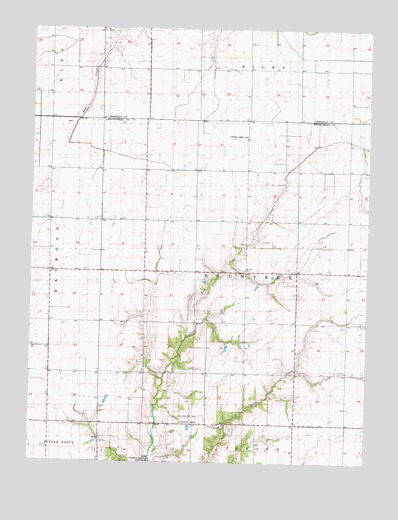
Nokomis SW, IL USGS Topographic Map
Click on map above to begin viewing in our Map Viewer.

This topographic map contains these locations and features:
Feature Name Type Latitude Longitude GNIS ID View Map
Alan B Janssen AirportAirportN39.3430°W89.4206°427571View Map
Ash Grove SchoolSchoolN39.3634°W89.4201°403664View Map
Craig SchoolSchoolN39.3628°W89.3826°406721View Map
Fawn Creek SchoolSchoolN39.2762°W89.4209°408304View Map
Gragg SchoolSchoolN39.3048°W89.3920°409238View Map
Green Valley SchoolSchoolN39.2753°W89.3818°409407View Map
Hillsboro Gas Storage AreaOilfieldN39.2625°W89.4406°1772092View Map
Lakeside SchoolSchoolN39.3131°W89.4926°411752View Map
Miller SchoolSchoolN39.3637°W89.4568°413593View Map
Mount Zion ChurchChurchN39.3053°W89.4209°414132View Map
Oak Grove SchoolSchoolN39.2539°W89.4154°414797View Map
Prairie SchoolSchoolN39.3334°W89.4573°416157View Map
Saint John ChurchChurchN39.2606°W89.4287°417345View Map
Saint John's CemeteryCemeteryN39.2606°W89.4279°1953394View Map
Shoal Creek SchoolSchoolN39.3342°W89.3831°418446View Map
Shore SchoolSchoolN39.3039°W89.4487°418460View Map
Tester SchoolSchoolN39.3334°W89.4198°419608View Map
Township of RountreeCivilN39.3050°W89.4188°429679View Map
Union Brick SchoolSchoolN39.2612°W89.4818°420011View Map
Union SchoolSchoolN39.3484°W89.4937°420102View Map

Note: Coordinates in the location and feature list above are referenced to NAD83 datum.


Copyright (C) 2008-2024 Ryan Niemi / Sunset Dynamics ... All Rights Reserved