TopoQuest Logo
Do you find TopoQuest useful?
Help keep TopoQuest running and adding new maps/features by donating!
Bitcoin:  19c7KJd3qBynnjoSw5npx9KScwjBe4ifkT
Litecoin:  LXs6TkuXGGXo1vDsWCkWVdjQX94eUKd6ui
Home View Maps Find Maps Find Places Resources & Links


Morrisonville, Illinois Topographic Map

USGS Map Title: Morrisonville, IL
USGS Map MRC: 39089D4
DRG (GeoTIFF) Download: o39089d4.tif


Neighboring USGS Topographic Map Quads:


  Pawnee, IL  
39089E5
 

  Kincaid, IL  
39089E4
 

  Taylorville, IL  
39089E3
 

  Raymond NE, IL  
39089D5
 

  Morrisonville, IL  
39089D4
 

  Clarksdale, IL  
39089D3
 

  Raymond, IL  
39089C5
 

  Nokomis SW, IL  
39089C4
 

  Nokomis, IL  
39089C3


Map MRC Location:

N40°
W90°
N40°
W89°
H8 H7 H6 H5 H4 H3 H2 H1
G8 G7 G6 G5 G4 G3 G2 G1
F8 F7 F6 F5 F4 F3 F2 F1
E8 E7 E6 E5 E4 E3 E2 E1
D8 D7 D6 D5 D4 D3 D2 D1
C8 C7 C6 C5 C4 C3 C2 C1
B8 B7 B6 B5 B4 B3 B2 B1
A8 A7 A6 A5 A4 A3 A2 A1
N39°
W90°
N39°
W89°

Morrisonville, IL USGS 1:24K Topographic Map Preview:
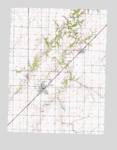
Morrisonville, IL USGS Topographic Map
Click on map above to begin viewing in our Map Viewer.

This topographic map contains these locations and features:
Feature Name Type Latitude Longitude GNIS ID View Map
Anderson CemeteryCemeteryN39.4928°W89.4137°403507View Map
Boyd LakeReservoirN39.3997°W89.4278°1691801View Map
Boyd Lake DamDamN39.4017°W89.4284°1691800View Map
Brookside School (historical)SchoolN39.4587°W89.4456°1747876View Map
Central School (historical)SchoolN39.3928°W89.4209°1747883View Map
D'Arcy School (historical)SchoolN39.4203°W89.4943°1747886View Map
Durbin CemeteryCemeteryN39.4912°W89.4193°407520View Map
First Baptist ChurchChurchN39.4234°W89.4573°1986020View Map
MorrisonvillePopulated PlaceN39.4201°W89.4556°413850View Map
Morrisonville CemeteryCemeteryN39.4309°W89.4768°413851View Map
Morrisonville Community Ambulance ServiceBuildingN39.4209°W89.4533°2673989View Map
Morrisonville Grade SchoolSchoolN39.4239°W89.4576°1986021View Map
Morrisonville High SchoolSchoolN39.4223°W89.4576°1986022View Map
Morrisonville Palmer Fire Protection DistrictBuildingN39.4203°W89.4564°2640363View Map
Morrisonville Post OfficePost OfficeN39.4209°W89.4565°2788538View Map
PalmerPopulated PlaceN39.4578°W89.4040°415312View Map
Palmer CemeteryCemeteryN39.4542°W89.4276°415315View Map
Palmer Post OfficePost OfficeN39.4581°W89.4043°2788624View Map
Paradise LakeReservoirN39.4158°W89.4373°1691847View Map
Paradise Lake DamDamN39.4156°W89.4373°1691846View Map
Prairie ForkStreamN39.4839°W89.4262°416139View Map
Prosperity School (historical)SchoolN39.3776°W89.4929°1747925View Map
Saint Maurice Catholic CemeteryCemeteryN39.3967°W89.4573°417634View Map
Saint Maurice Catholic ChurchChurchN39.4148°W89.4523°1986023View Map
Saint Maurice SchoolSchoolN39.4153°W89.4520°1986024View Map
Silver Grove School (historical)SchoolN39.3928°W89.3831°1747932View Map
Township of Bear CreekCivilN39.4806°W89.4211°428642View Map
Township of RicksCivilN39.3927°W89.4195°429637View Map
Trulock LakeReservoirN39.4282°W89.4453°419904View Map
United Methodist Church of MorrisonvilleChurchN39.4206°W89.4573°1986025View Map
Vancil FarmLocaleN39.3980°W89.3819°2629389View Map
Village of MorrisonvilleCivilN39.4217°W89.4590°2399398View Map
Village of PalmerCivilN39.4587°W89.4079°2399612View Map
Willow Vale School (historical)SchoolN39.3925°W89.4573°1747945View Map

Note: Coordinates in the location and feature list above are referenced to NAD83 datum.


Copyright (C) 2008-2024 Ryan Niemi / Sunset Dynamics ... All Rights Reserved