TopoQuest Logo
Do you find TopoQuest useful?
Help keep TopoQuest running and adding new maps/features by donating!
Bitcoin:  19c7KJd3qBynnjoSw5npx9KScwjBe4ifkT
Litecoin:  LXs6TkuXGGXo1vDsWCkWVdjQX94eUKd6ui
Home View Maps Find Maps Find Places Resources & Links


Red Leaf, Arkansas Topographic Map

USGS Map Title: Red Leaf, AR
USGS Map MRC: 33091C2
DRG (GeoTIFF) Download: o33091c2.tif


Neighboring USGS Topographic Map Quads:


  Macon Lake, AR  
33091D3
 

  Luna, AR  
33091D2
 

  Greenville, MS  
33091D1
 

  Lake Village, AR  
33091C3
 

  Red Leaf, AR  
33091C2
 

  Wayside, MS  
33091C1
 

  Eudora North, AR  
33091B3
 

  Eminence, AR  
33091B2
 

  Avon, MS  
33091B1


Map MRC Location:

N34°
W92°
N34°
W91°
H8 H7 H6 H5 H4 H3 H2 H1
G8 G7 G6 G5 G4 G3 G2 G1
F8 F7 F6 F5 F4 F3 F2 F1
E8 E7 E6 E5 E4 E3 E2 E1
D8 D7 D6 D5 D4 D3 D2 D1
C8 C7 C6 C5 C4 C3 C2 C1
B8 B7 B6 B5 B4 B3 B2 B1
A8 A7 A6 A5 A4 A3 A2 A1
N33°
W92°
N33°
W91°

Red Leaf, AR USGS 1:24K Topographic Map Preview:
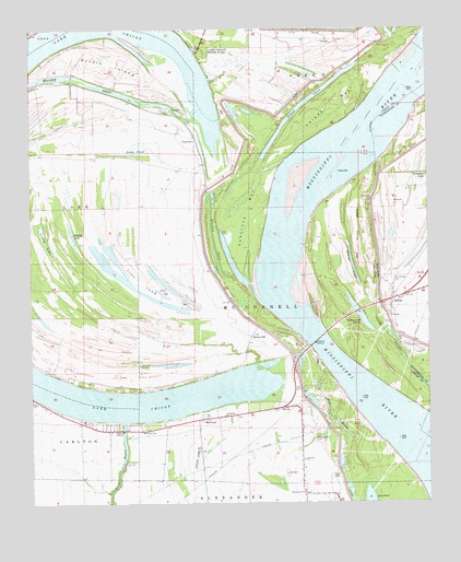
Red Leaf, AR USGS Topographic Map
Click on map above to begin viewing in our Map Viewer.

This topographic map contains these locations and features:
Feature Name Type Latitude Longitude GNIS ID View Map
Beaver LakeLakeN33.3133°W91.1488°75637View Map
Blue BayouLakeN33.2763°W91.1573°75654View Map
Cottonwood ChuteLakeN33.2998°W91.1467°75683View Map
Ditch Bayou Station DamDamN33.2601°W91.2218°80769View Map
Fawnwood Volunteer Fire DepartmentBuildingN33.2817°W91.2284°2116425View Map
Grassy LakeLakeN33.3190°W91.2457°75722View Map
Island Number 84AreaN33.3168°W91.1543°61745View Map
Jerusalem ChurchChurchN33.2732°W91.1896°50633View Map
KUUZ-FM (Lake Village)TowerN33.3354°W91.1259°85403View Map
KUUZ-FM (Lake Village)TowerN33.3529°W91.2046°85404View Map
Lake ChicotReservoirN33.2601°W91.2218°80770View Map
Lake Chicot State ParkParkN33.3701°W91.1968°50941View Map
Lakeport ChurchChurchN33.2615°W91.1646°77437View Map
Lakeport Volunteer Fire DepartmentBuildingN33.2758°W91.1676°2116692View Map
LelandPopulated PlaceN33.3723°W91.1565°58054View Map
Leland BarBarN33.3537°W91.1557°51060View Map
Leland Bar DikesLeveeN33.3557°W91.1393°70001View Map
Leland ChuteLakeN33.3568°W91.1615°75757View Map
Mount Pleasant ChurchChurchN33.2526°W91.1646°52390View Map
Muddy LakeLakeN33.3211°W91.2369°75795View Map
Old Lakeport CemeteryCemeteryN33.2679°W91.1604°53003View Map
Old Refuge CemeteryCemeteryN33.3104°W91.1348°675228View Map
Red LeafPopulated PlaceN33.2723°W91.1965°78145View Map
Red Leaf CemeteryCemeteryN33.2698°W91.2154°53952View Map
RefugePopulated PlaceN33.3037°W91.1365°676590View Map
Refuge LandingLocaleN33.2790°W91.1354°61748View Map
ShivesPopulated PlaceN33.2754°W91.1709°58620View Map
Stuart IslandIslandN33.3662°W91.2246°78477View Map
SunnysidePopulated PlaceN33.2946°W91.1807°78503View Map
Sunnyside LandingLocaleN33.2921°W91.1632°61746View Map
Sunnyside RevetmentLeveeN33.2926°W91.1640°61747View Map
Swan PondLakeN33.3436°W91.2163°75863View Map
Township of Lake (historical)CivilN33.3251°W91.2418°82600View Map
Township of McConnell (historical)CivilN33.3043°W91.1751°70005View Map
Vacluse LandingLocaleN33.3296°W91.1821°61743View Map
Vacluse RevetmentLeveeN33.3321°W91.1807°61742View Map
VauclusePopulated PlaceN33.3465°W91.1987°58796View Map
Vaucluse BarBarN33.3276°W91.1821°55891View Map
Walker BendBendN33.3085°W91.1751°61744View Map
Warfield PointCapeN33.3440°W91.1446°687335View Map
Washington County Regional Correctional FacilityBuildingN33.3341°W91.1360°2739807View Map
Whiskey ChuteLakeN33.3165°W91.1915°75884View Map
Whiskey Chute ReservoirReservoirN33.3621°W91.2440°81271View Map

Note: Coordinates in the location and feature list above are referenced to NAD83 datum.


Copyright (C) 2008-2025 Ryan Niemi / Sunset Dynamics ... All Rights Reserved