TopoQuest Logo
Do you find TopoQuest useful?
Help keep TopoQuest running and adding new maps/features by donating!
Bitcoin:  19c7KJd3qBynnjoSw5npx9KScwjBe4ifkT
Litecoin:  LXs6TkuXGGXo1vDsWCkWVdjQX94eUKd6ui
Home View Maps Find Maps Find Places Resources & Links


Redrock, New Mexico Topographic Map

USGS Map Title: Redrock, NM
USGS Map MRC: 32108F6
DRG (GeoTIFF) Download: o32108f6.tif


Neighboring USGS Topographic Map Quads:


  Walker Canyon, NM  
32108G7
 

  Brushy Mountain, NM  
32108G6
 

  Mangas Springs, NM  
32108G5
 

  Nichols Canyon, NM  
32108F7
 

  Redrock, NM  
32108F6
 

  Bullard Peak, NM  
32108F5
 

  Caprock Mountain, NM  
32108E7
 

  Willow Draw, NM  
32108E6
 

  Eagle Eye Peak, NM  
32108E5


Map MRC Location:

N33°
W109°
N33°
W108°
H8 H7 H6 H5 H4 H3 H2 H1
G8 G7 G6 G5 G4 G3 G2 G1
F8 F7 F6 F5 F4 F3 F2 F1
E8 E7 E6 E5 E4 E3 E2 E1
D8 D7 D6 D5 D4 D3 D2 D1
C8 C7 C6 C5 C4 C3 C2 C1
B8 B7 B6 B5 B4 B3 B2 B1
A8 A7 A6 A5 A4 A3 A2 A1
N32°
W109°
N32°
W108°

Redrock, NM USGS 1:24K Topographic Map Preview:
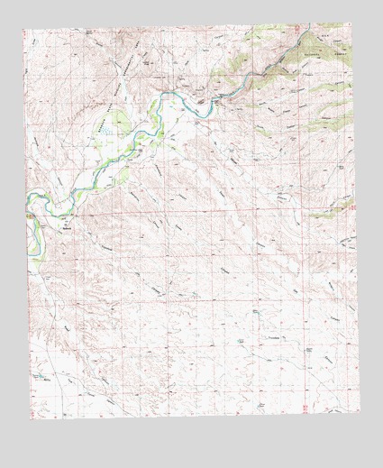
Redrock, NM USGS Topographic Map
Click on map above to begin viewing in our Map Viewer.

This topographic map contains these locations and features:
Feature Name Type Latitude Longitude GNIS ID View Map
10212 Water WellWellN32.7026°W108.7173°919203View Map
Ash CreekStreamN32.7126°W108.7101°903438View Map
Blue Eagle ProspectMineN32.7451°W108.7117°914964View Map
Buck TankReservoirN32.7040°W108.6321°904137View Map
CCC TankReservoirN32.6489°W108.6713°904272View Map
China TankReservoirN32.6290°W108.6662°905112View Map
Clyde CanyonValleyN32.7162°W108.7106°905217View Map
Corner TankReservoirN32.7345°W108.6251°899217View Map
Cottonwood CanyonValleyN32.6795°W108.6334°905407View Map
Double TanksReservoirN32.6454°W108.6461°905836View Map
Drew TankReservoirN32.6576°W108.6634°905854View Map
Edgar CanyonValleyN32.6795°W108.6337°906015View Map
Gila Middle BoxValleyN32.7240°W108.6845°906541View Map
Graveyard CanyonValleyN32.7126°W108.7028°906719View Map
Grey Eagle MineMineN32.7248°W108.6770°906742View Map
H Bar M WindmillLocaleN32.6895°W108.6412°906796View Map
Harper ProspectMineN32.7437°W108.7114°914958View Map
Hope ProspectMineN32.7109°W108.6792°914966View Map
House CanyonValleyN32.7212°W108.6884°907125View Map
Jack CanyonValleyN32.7287°W108.6928°907283View Map
Jennie MinesMineN32.7281°W108.6512°907348View Map
Joe Harris CanyonValleyN32.6904°W108.6473°907383View Map
Lydian PeakSummitN32.7384°W108.7028°908327View Map
Middle Copper CanyonValleyN32.7226°W108.6614°908686View Map
Mulberry CanyonValleyN32.6670°W108.6392°908966View Map
North Copper CanyonValleyN32.7245°W108.6714°909131View Map
Oak CanyonValleyN32.6801°W108.6664°909237View Map
Old Indian VillageLocaleN32.7098°W108.7062°915931View Map
RedrockPopulated PlaceN32.6862°W108.7381°910095View Map
Redrock CanyonValleyN32.6954°W108.7359°910097View Map
Redrock CemeteryCemeteryN32.7084°W108.7031°910099View Map
Redrock Weather StationLocaleN32.6862°W108.7381°931657View Map
Road CanyonValleyN32.6734°W108.7489°910333View Map
Rough CanyonValleyN32.7473°W108.6428°910437View Map
Skating Rink CanyonValleyN32.7370°W108.6556°911109View Map
Smith CanyonValleyN32.7392°W108.7162°911148View Map
Smith SpringSpringN32.7485°W108.7269°911156View Map
South Copper CanyonValleyN32.7245°W108.6714°911222View Map
Starvation CanyonValleyN32.7004°W108.7148°911393View Map
Swan CanyonValleyN32.7120°W108.6967°911502View Map
Toney CanyonValleyN32.7009°W108.7106°911745View Map
Trusdale CanyonValleyN32.6895°W108.7334°911841View Map
Turner WindmillLocaleN32.6720°W108.6492°911916View Map
Tyrone TankReservoirN32.6390°W108.7462°911947View Map

Note: Coordinates in the location and feature list above are referenced to NAD83 datum.


Copyright (C) 2008-2025 Ryan Niemi / Sunset Dynamics ... All Rights Reserved