TopoQuest Logo
Do you find TopoQuest useful?
Help keep TopoQuest running and adding new maps/features by donating!
Bitcoin:  19c7KJd3qBynnjoSw5npx9KScwjBe4ifkT
Litecoin:  LXs6TkuXGGXo1vDsWCkWVdjQX94eUKd6ui
Home View Maps Find Maps Find Places Resources & Links


Eagle Eye Peak, New Mexico Topographic Map

USGS Map Title: Eagle Eye Peak, NM
USGS Map MRC: 32108E5
DRG (GeoTIFF) Download: o32108e5.tif


Neighboring USGS Topographic Map Quads:


  Redrock, NM  
32108F6
 

  Bullard Peak, NM  
32108F5
 

  Wind Mountain, NM  
32108F4
 

  Willow Draw, NM  
32108E6
 

  Eagle Eye Peak, NM  
32108E5
 

  Burro Peak, NM  
32108E4
 

  Culberson Ranch, NM  
32108D6
 

  Gold Hill, NM  
32108D5
 

  C Bar Ranch, NM  
32108D4


Map MRC Location:

N33°
W109°
N33°
W108°
H8 H7 H6 H5 H4 H3 H2 H1
G8 G7 G6 G5 G4 G3 G2 G1
F8 F7 F6 F5 F4 F3 F2 F1
E8 E7 E6 E5 E4 E3 E2 E1
D8 D7 D6 D5 D4 D3 D2 D1
C8 C7 C6 C5 C4 C3 C2 C1
B8 B7 B6 B5 B4 B3 B2 B1
A8 A7 A6 A5 A4 A3 A2 A1
N32°
W109°
N32°
W108°

Eagle Eye Peak, NM USGS 1:24K Topographic Map Preview:
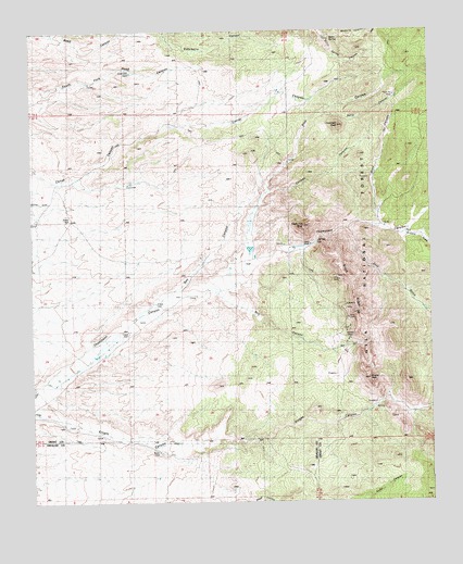
Eagle Eye Peak, NM USGS Topographic Map
Click on map above to begin viewing in our Map Viewer.

This topographic map contains these locations and features:
Feature Name Type Latitude Longitude GNIS ID View Map
Arrastre GulchValleyN32.5712°W108.5103°903280View Map
Barrel CanyonValleyN32.6034°W108.5331°903581View Map
Bootleg TankReservoirN32.6073°W108.5109°1853752View Map
Brock Ranch (historical)LocaleN32.5648°W108.5731°904086View Map
Brock RidgeRidgeN32.5581°W108.5256°904087View Map
Burro SpringSpringN32.6226°W108.5345°904243View Map
Chicken CanyonValleyN32.5826°W108.5512°905084View Map
Chocolate PeakSummitN32.5995°W108.5292°905122View Map
Chocolate Peak DamDamN32.5931°W108.5367°1853751View Map
Cureton RanchLocaleN32.5170°W108.5562°905561View Map
Cureton Ranch Weather StationLocaleN32.5170°W108.5562°931662View Map
Eagle Eye PeakSummitN32.5731°W108.5412°905932View Map
Fence TankReservoirN32.5049°W108.5138°899189View Map
Fred L GroupMineN32.5167°W108.5381°915226View Map
Gold GulchValleyN32.5717°W108.5270°906608View Map
Knight PeakSummitN32.5326°W108.5206°907578View Map
Live Oak TankReservoirN32.6141°W108.5940°908076View Map
Lost Prospector MineMineN32.5167°W108.5423°921044View Map
Malone (historical)Populated PlaceN32.5437°W108.5273°919976View Map
Malone MinesMineN32.5437°W108.5273°908378View Map
McCauley RanchLocaleN32.5734°W108.5156°908495View Map
Mill CanyonValleyN32.5548°W108.5662°908740View Map
Miller SpringSpringN32.5134°W108.5298°915930View Map
Mulberry CanyonValleyN32.6226°W108.5303°908965View Map
Pine CanyonValleyN32.5829°W108.5542°909654View Map
Ray CanyonValleyN32.5562°W108.5812°910032View Map
Ray RanchLocaleN32.5640°W108.5726°899190View Map
Road CanyonValleyN32.5748°W108.5170°910332View Map
Seep Canyon TankReservoirN32.6066°W108.5380°899191View Map
Thomson Canyon Perlite DepositMineN32.5692°W108.5373°914908View Map
Three Js ClaimsMineN32.5167°W108.5423°939636View Map
Yankee Girl MineMineN32.5167°W108.5423°939640View Map

Note: Coordinates in the location and feature list above are referenced to NAD83 datum.


Copyright (C) 2008-2024 Ryan Niemi / Sunset Dynamics ... All Rights Reserved