TopoQuest Logo
Do you find TopoQuest useful?
Help keep TopoQuest running and adding new maps/features by donating!
Bitcoin:  19c7KJd3qBynnjoSw5npx9KScwjBe4ifkT
Litecoin:  LXs6TkuXGGXo1vDsWCkWVdjQX94eUKd6ui
Home View Maps Find Maps Find Places Resources & Links


Walker Canyon, New Mexico Topographic Map

USGS Map Title: Walker Canyon, NM
USGS Map MRC: 32108G7
DRG (GeoTIFF) Download: o32108g7.tif


Neighboring USGS Topographic Map Quads:


  Crookson Peak, NM  
32108H8
 

  Applegate Mountain, NM  
32108H7
 

  Antelope Ridge, NM  
32108H6
 

  Steeple Rock, NM  
32108G8
 

  Walker Canyon, NM  
32108G7
 

  Brushy Mountain, NM  
32108G6
 

  Canador Peak, NM  
32108F8
 

  Nichols Canyon, NM  
32108F7
 

  Redrock, NM  
32108F6


Map MRC Location:

N33°
W109°
N33°
W108°
H8 H7 H6 H5 H4 H3 H2 H1
G8 G7 G6 G5 G4 G3 G2 G1
F8 F7 F6 F5 F4 F3 F2 F1
E8 E7 E6 E5 E4 E3 E2 E1
D8 D7 D6 D5 D4 D3 D2 D1
C8 C7 C6 C5 C4 C3 C2 C1
B8 B7 B6 B5 B4 B3 B2 B1
A8 A7 A6 A5 A4 A3 A2 A1
N32°
W109°
N32°
W108°

Walker Canyon, NM USGS 1:24K Topographic Map Preview:
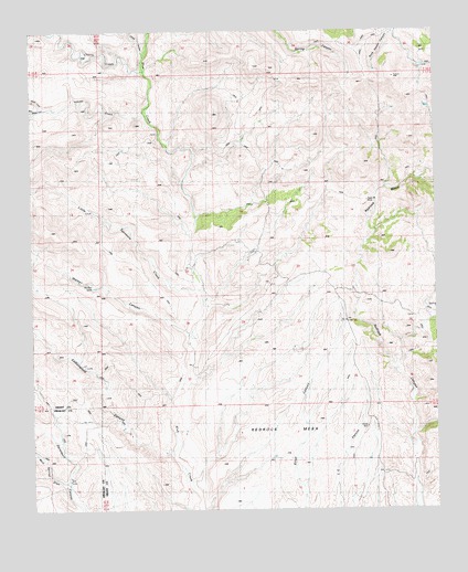
Walker Canyon, NM USGS Topographic Map
Click on map above to begin viewing in our Map Viewer.

This topographic map contains these locations and features:
Feature Name Type Latitude Longitude GNIS ID View Map
Adams CreekStreamN32.8534°W108.8398°885554View Map
Anderson RanchLocaleN32.8509°W108.8034°885740View Map
BlakelyLocaleN32.8179°W108.8084°929694View Map
Blakey RanchLocaleN32.8168°W108.8084°886479View Map
Blakey WindmillLocaleN32.7937°W108.8267°886480View Map
Bud Wright CanyonValleyN32.8540°W108.8731°886846View Map
Cherry CreekStreamN32.8651°W108.8401°905078View Map
Chick CanyonValleyN32.8698°W108.8401°887502View Map
Cottonwood CanyonValleyN32.7651°W108.8328°900153View Map
Dutch John WindmillLocaleN32.8148°W108.8267°888594View Map
Gunn Place (historical)LocaleN32.8565°W108.8378°899659View Map
Kemp CreekStreamN32.8551°W108.8717°890663View Map
Little Sycamore CreekStreamN32.8079°W108.8228°891184View Map
Martin RanchLocaleN32.7642°W108.7576°891633View Map
Matthew PlaceLocaleN32.8492°W108.8359°899755View Map
Mouth of Cottonwood WindmillLocaleN32.7698°W108.8448°892297View Map
Mud Springs DrawValleyN32.7587°W108.8662°892309View Map
Mud Springs RanchLocaleN32.7581°W108.8645°892312View Map
Redrock BasinBasinN32.8370°W108.7570°910096View Map
Redrock BasinBasinN32.8279°W108.7701°924811View Map
Redrock MesaSummitN32.7751°W108.8134°929302View Map
Redrock MesaSummitN32.7623°W108.8170°893839View Map
Walker CanyonValleyN32.7962°W108.8273°896193View Map
Walker TankReservoirN32.8083°W108.8560°896196View Map

Note: Coordinates in the location and feature list above are referenced to NAD83 datum.


Copyright (C) 2008-2025 Ryan Niemi / Sunset Dynamics ... All Rights Reserved