TopoQuest Logo
Do you find TopoQuest useful?
Help keep TopoQuest running and adding new maps/features by donating!
Bitcoin:  19c7KJd3qBynnjoSw5npx9KScwjBe4ifkT
Litecoin:  LXs6TkuXGGXo1vDsWCkWVdjQX94eUKd6ui
Home View Maps Find Maps Find Places Resources & Links


Big Levels, Virginia Topographic Map

USGS Map Title: Big Levels, VA
USGS Map MRC: 37079H1
DRG (GeoTIFF) Download: o37079h1.tif


Neighboring USGS Topographic Map Quads:


  Greenville, VA  
38079A2
 

  Stuarts Draft, VA  
38079A1
 

  Waynesboro West, VA  
38078A8
 

  Vesuvius, VA  
37079H2
 

  Big Levels, VA  
37079H1
 

  Sherando, VA  
37078H8
 

  Montebello, VA  
37079G2
 

  Massies Mill, VA  
37079G1
 

  Horseshoe Mountain, VA  
37078G8


Map MRC Location:

N38°
W80°
N38°
W79°
H8 H7 H6 H5 H4 H3 H2 H1
G8 G7 G6 G5 G4 G3 G2 G1
F8 F7 F6 F5 F4 F3 F2 F1
E8 E7 E6 E5 E4 E3 E2 E1
D8 D7 D6 D5 D4 D3 D2 D1
C8 C7 C6 C5 C4 C3 C2 C1
B8 B7 B6 B5 B4 B3 B2 B1
A8 A7 A6 A5 A4 A3 A2 A1
N37°
W80°
N37°
W79°

Big Levels, VA USGS 1:24K Topographic Map Preview:
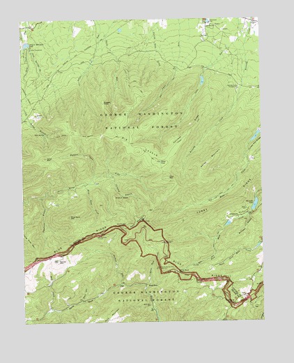
Big Levels, VA USGS Topographic Map
Click on map above to begin viewing in our Map Viewer.

This topographic map contains these locations and features:
Feature Name Type Latitude Longitude GNIS ID View Map
Bald MountainSummitN37.9171°W79.0631°1481427View Map
Bald Mountain OverlookLocaleN37.9151°W79.0717°1481429View Map
Bear BranchStreamN37.9326°W79.0906°1488815View Map
Big LevelsFlatN37.9471°W79.0672°1481747View Map
Camp ThunderbirdLocaleN37.9882°W79.1203°1482279View Map
Cellar MountainSummitN37.9429°W79.1128°1492737View Map
Chimney BranchStreamN37.9351°W79.0795°1482515View Map
Cold SpringSpringN37.9526°W79.1134°1482622View Map
Cold Spring Bald Mountain TrailTrailN37.9521°W79.0853°1482625View Map
Cold Spring BranchStreamN37.9890°W79.1236°1482626View Map
Coles Run DamDamN37.9768°W79.0297°1489198View Map
Coles Run ReservoirReservoirN37.9744°W79.0302°1489199View Map
Copelands RocksSummitN37.9012°W79.0661°1488557View Map
Donald Fauber MountainSummitN37.9635°W79.0492°1488812View Map
Durham RunStreamN37.8907°W79.0736°1483182View Map
Flint MountainSummitN37.9343°W79.0486°1492948View Map
Fork Mountain OverlookLocaleN37.9110°W79.0853°1483487View Map
Green PondLakeN37.9410°W79.0524°1483808View Map
Gum Springs BranchStreamN37.9896°W79.1206°1483867View Map
Hogback CreekStreamN37.9349°W79.0875°1484140View Map
Hunting CampLocaleN37.9826°W79.0875°1739616View Map
Kelley MountainSummitN37.9421°W79.0259°1493159View Map
Kennedy Fields CampgroundsLocaleN37.9710°W79.0114°1484553View Map
Kennedy MineMineN37.9546°W79.0036°1739631View Map
Kennedy RidgeRidgeN37.9537°W79.0364°1484554View Map
Kennedy Ridge TrailTrailN37.9551°W79.0350°1484555View Map
Knob of RocksSummitN37.9265°W79.0770°1493171View Map
Lake QuarlesLakeN37.9957°W79.0727°1739656View Map
Long Drive MountainSummitN37.9071°W79.1189°1493223View Map
LovePopulated PlaceN37.8854°W79.0100°1493229View Map
Mill CreekStreamN37.8801°W79.1098°1485420View Map
Mills Creek TrailTrailN37.9285°W79.0189°1485476View Map
Mine Bank CreekStreamN37.9326°W79.0925°1485482View Map
Mine Bank MountainSummitN37.9187°W79.1000°1485483View Map
Mountain LakeLakeN37.9990°W79.0270°1739646View Map
Mountain Top ChurchChurchN37.8824°W79.0159°1485688View Map
Pine Spring Camp (historical)LocaleN37.9562°W79.0703°1739654View Map
Rankin ChurchChurchN37.9976°W79.0036°1486506View Map
Rankin RunStreamN37.9885°W79.0081°1739657View Map
Red Mountain MineMineN37.9326°W79.0870°1739659View Map
Rhema LakeReservoirN37.9918°W79.1214°1489183View Map
Round MountainSummitN37.9004°W79.1070°1493509View Map
Russell RockSummitN37.9668°W79.0814°1486831View Map
Saint Mary's WildernessReserveN37.9273°W79.1067°2035279View Map
Sengers Mountain LakeReservoirN37.9910°W79.1225°1486996View Map
Shenandoah AcresLocaleN37.9985°W79.0259°1487176View Map
Sherando DamDamN37.9257°W79.0034°1489200View Map
Sherando LakeReservoirN37.9231°W79.0037°1502123View Map
Sherando Lake CampgroundLocaleN37.9193°W79.0131°1488558View Map
South River Number 10a DamDamN37.9518°W79.0014°1489177View Map
South River Number 27 DamDamN37.9151°W79.0181°1489175View Map
South River Number Six DamDamN37.9918°W79.1214°1489182View Map
Stony Run TrailTrailN37.9710°W79.0670°1487642View Map
Sugartree BranchStreamN37.9268°W79.1153°1487707View Map
The Priest OverlookLocaleN37.8918°W79.0328°1487848View Map
The Slacks OverlookLocaleN37.9082°W79.0509°1487853View Map
Torry RidgeRidgeN37.9240°W79.0189°1487956View Map
Twenty Minute Cliff OverlookLocaleN37.8974°W79.0536°1488046View Map
Upper Sherando LakeReservoirN37.9153°W79.0179°1489176View Map
White RockPopulated PlaceN37.8904°W79.0606°1493796View Map
White Rock CemeteryCemeteryN37.8818°W79.0589°1488306View Map
White Rock CreekStreamN37.8901°W79.0617°1488309View Map
White Rock GapGapN37.8957°W79.0447°1488314View Map
White Rock Gap TrailTrailN37.9043°W79.0256°1488315View Map
Williams BranchStreamN37.9204°W79.0053°1488387View Map
Wolf HollowValleyN37.8842°W79.0948°1488448View Map

Note: Coordinates in the location and feature list above are referenced to NAD83 datum.


Copyright (C) 2008-2025 Ryan Niemi / Sunset Dynamics ... All Rights Reserved