TopoQuest Logo
Do you find TopoQuest useful?
Help keep TopoQuest running and adding new maps/features by donating!
Bitcoin:  19c7KJd3qBynnjoSw5npx9KScwjBe4ifkT
Litecoin:  LXs6TkuXGGXo1vDsWCkWVdjQX94eUKd6ui
Home View Maps Find Maps Find Places Resources & Links


Big Lookout Mountain, Oregon Topographic Map

USGS Map Title: Big Lookout Mountain, OR
USGS Map MRC: 44117E3
DRG (GeoTIFF) Download: o44117e3.tif


Neighboring USGS Topographic Map Quads:


  Lawrence Creek, OR  
44117F4
 

  Little Lookout Mountain, OR  
44117F3
 

  Daly Creek, OR  
44117F2
 

  Durkee, OR  
44117E4
 

  Big Lookout Mountain, OR  
44117E3
 

  Connor Creek, OR  
44117E2
 

  Rye Valley, OR  
44117D4
 

  Lime, OR  
44117D3
 

  Henley Basin, ID  
44117D2


Map MRC Location:

N45°
W118°
N45°
W117°
H8 H7 H6 H5 H4 H3 H2 H1
G8 G7 G6 G5 G4 G3 G2 G1
F8 F7 F6 F5 F4 F3 F2 F1
E8 E7 E6 E5 E4 E3 E2 E1
D8 D7 D6 D5 D4 D3 D2 D1
C8 C7 C6 C5 C4 C3 C2 C1
B8 B7 B6 B5 B4 B3 B2 B1
A8 A7 A6 A5 A4 A3 A2 A1
N44°
W118°
N44°
W117°

Big Lookout Mountain, OR USGS 1:24K Topographic Map Preview:
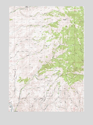
Big Lookout Mountain, OR USGS Topographic Map
Click on map above to begin viewing in our Map Viewer.

This topographic map contains these locations and features:
Feature Name Type Latitude Longitude GNIS ID View Map
Barnes SpringSpringN44.5497°W117.3685°1133309View Map
Big Lookout MountainSummitN44.6091°W117.2785°1117642View Map
Chicken CreekStreamN44.5274°W117.3513°1118879View Map
Drindarry GulchValleyN44.5435°W117.3307°1120089View Map
Gold Cliff GulchValleyN44.5138°W117.3569°1121197View Map
Hawks Nest SpringSpringN44.5152°W117.3231°1133310View Map
Marshall CreekStreamN44.5077°W117.3107°1123789View Map
Mud SpringSpringN44.5714°W117.3475°1124489View Map
Nelson PlaceLocaleN44.5777°W117.3113°1133308View Map
Nodine CreekStreamN44.6235°W117.3469°1124703View Map
Pearce GulchValleyN44.5154°W117.3738°1125259View Map
Posthole CreekStreamN44.5074°W117.3216°1125600View Map
Raster GulchValleyN44.5413°W117.3338°1125812View Map
Summit CreekStreamN44.5077°W117.3107°1127714View Map
Timber GulchValleyN44.6204°W117.3569°1128106View Map
Weatherby School (historical)SchoolN44.5207°W117.3546°1136883View Map

Note: Coordinates in the location and feature list above are referenced to NAD83 datum.


Copyright (C) 2008-2024 Ryan Niemi / Sunset Dynamics ... All Rights Reserved