TopoQuest Logo
Do you find TopoQuest useful?
Help keep TopoQuest running and adding new maps/features by donating!
Bitcoin:  19c7KJd3qBynnjoSw5npx9KScwjBe4ifkT
Litecoin:  LXs6TkuXGGXo1vDsWCkWVdjQX94eUKd6ui
Home View Maps Find Maps Find Places Resources & Links


Lawrence Creek, Oregon Topographic Map

USGS Map Title: Lawrence Creek, OR
USGS Map MRC: 44117F4
DRG (GeoTIFF) Download: o44117f4.tif


Neighboring USGS Topographic Map Quads:


  Keating, OR  
44117G5
 

  Glasgow Butte, OR  
44117G4
 

  Sparta, OR  
44117G3
 

  Oxman, OR  
44117F5
 

  Lawrence Creek, OR  
44117F4
 

  Little Lookout Mountain, OR  
44117F3
 

  Lost Basin, OR  
44117E5
 

  Durkee, OR  
44117E4
 

  Big Lookout Mountain, OR  
44117E3


Map MRC Location:

N45°
W118°
N45°
W117°
H8 H7 H6 H5 H4 H3 H2 H1
G8 G7 G6 G5 G4 G3 G2 G1
F8 F7 F6 F5 F4 F3 F2 F1
E8 E7 E6 E5 E4 E3 E2 E1
D8 D7 D6 D5 D4 D3 D2 D1
C8 C7 C6 C5 C4 C3 C2 C1
B8 B7 B6 B5 B4 B3 B2 B1
A8 A7 A6 A5 A4 A3 A2 A1
N44°
W118°
N44°
W117°

Lawrence Creek, OR USGS 1:24K Topographic Map Preview:
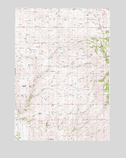
Lawrence Creek, OR USGS Topographic Map
Click on map above to begin viewing in our Map Viewer.

This topographic map contains these locations and features:
Feature Name Type Latitude Longitude GNIS ID View Map
Ayers CreekStreamN44.6682°W117.4769°1117112View Map
Bedspring Flat Spring (historical)SpringN44.6951°W117.4827°1133301View Map
Bedsprings Flat ReservoirReservoirN44.6952°W117.4826°1157378View Map
Black SpringsSpringN44.7063°W117.4012°1117783View Map
Black Springs CreekStreamN44.6949°W117.4544°1117784View Map
Cattrill CreekStreamN44.6321°W117.4202°1118704View Map
Cullom Post Office (historical)Post OfficeN44.6452°W117.4938°1164298View Map
Devils SpringSpringN44.6673°W117.4889°1133298View Map
Hayward SpringSpringN44.6587°W117.4518°1157379View Map
Heater CreekStreamN44.7068°W117.3913°1129441View Map
Hickerson GulchValleyN44.6918°W117.4558°1121784View Map
Iron MountainSummitN44.6257°W117.4560°1122278View Map
Iron Mountain SpringSpringN44.6393°W117.4587°1133297View Map
Judd CreekStreamN44.6754°W117.4538°1133296View Map
Lawrence CreekStreamN44.6507°W117.4924°1123001View Map
Leonard (historical)LocaleN44.6360°W117.4941°1157377View Map
Lyle CreekStreamN44.6760°W117.4260°1123624View Map
Olsen GulchValleyN44.6957°W117.4316°1129445View Map
Orman SpringSpringN44.6758°W117.4783°1133299View Map
Sardine CreekStreamN44.6849°W117.4710°1126604View Map
Schlinkman CreekStreamN44.6457°W117.4180°1126644View Map
Schuck WaterholeReservoirN44.6507°W117.4694°1130923View Map
South Fork Lawrence CreekStreamN44.7210°W117.3888°1127296View Map
South Guzzler WaterholeReservoirN44.6758°W117.4853°1133300View Map
Taylor DitchCanalN44.6735°W117.4163°1129440View Map
Taylor ReservoirReservoirN44.6647°W117.4203°1129444View Map
Welch ReservoirReservoirN44.7487°W117.4205°1129442View Map

Note: Coordinates in the location and feature list above are referenced to NAD83 datum.


Copyright (C) 2008-2024 Ryan Niemi / Sunset Dynamics ... All Rights Reserved