TopoQuest Logo
Do you find TopoQuest useful?
Help keep TopoQuest running and adding new maps/features by donating!
Bitcoin:  19c7KJd3qBynnjoSw5npx9KScwjBe4ifkT
Litecoin:  LXs6TkuXGGXo1vDsWCkWVdjQX94eUKd6ui
Home View Maps Find Maps Find Places Resources & Links


Milan, Georgia Topographic Map

USGS Map Title: Milan, GA
USGS Map MRC: 32083A1
DRG (GeoTIFF) Download: o32083a1.tif


Neighboring USGS Topographic Map Quads:


  Eastman, GA  
32083B2
 

  Jay Bird Springs, GA  
32083B1
 

  McRae NW, GA  
32082B8
 

  Lake Cypress, GA  
32083A2
 

  Milan, GA  
32083A1
 

  McRae, GA  
32082A8
 

  Rhine, GA  
31083H2
 

  Cooks Still, GA  
31083H1
 

  Workmore, GA  
31082H8


Map MRC Location:

N33°
W84°
N33°
W83°
H8 H7 H6 H5 H4 H3 H2 H1
G8 G7 G6 G5 G4 G3 G2 G1
F8 F7 F6 F5 F4 F3 F2 F1
E8 E7 E6 E5 E4 E3 E2 E1
D8 D7 D6 D5 D4 D3 D2 D1
C8 C7 C6 C5 C4 C3 C2 C1
B8 B7 B6 B5 B4 B3 B2 B1
A8 A7 A6 A5 A4 A3 A2 A1
N32°
W84°
N32°
W83°

Milan, GA USGS 1:24K Topographic Map Preview:
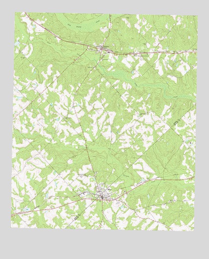
Milan, GA USGS Topographic Map
Click on map above to begin viewing in our Map Viewer.

This topographic map contains these locations and features:
Feature Name Type Latitude Longitude GNIS ID View Map
Antioch CemeteryCemeteryN32.0310°W83.0771°310553View Map
Antioch Number Two ChurchChurchN32.0310°W83.0738°354374View Map
Bell PondReservoirN32.0109°W83.1142°341216View Map
Bell Pond DamDamN32.0118°W83.1132°341215View Map
Brown PondReservoirN32.1071°W83.1231°336251View Map
Brown Pond DamDamN32.1085°W83.1215°336250View Map
Cadwell PondReservoirN32.0757°W83.1207°341212View Map
Cadwell Pond DamDamN32.0752°W83.1182°341211View Map
Cadwell Pond NorthReservoirN32.0818°W83.1182°341214View Map
Cadwell Pond North DamDamN32.0818°W83.1182°341213View Map
ChaunceyPopulated PlaceN32.1046°W83.0646°312593View Map
Chauncey Baptist ChurchChurchN32.1063°W83.0663°348108View Map
Chauncey DivisionCivilN32.1144°W83.0367°1936173View Map
Chauncey Elementary SchoolSchoolN32.1030°W83.0604°348109View Map
Chauncey Fire DepartmentBuildingN32.1034°W83.0609°2604663View Map
Chauncey Police DepartmentBuildingN32.1038°W83.0648°2733580View Map
City of ChaunceyCivilN32.1059°W83.0646°2404036View Map
City of MilanCivilN32.0195°W83.0631°2404260View Map
Cox (historical)Populated PlaceN32.1032°W83.0213°348113View Map
El Bethel ChurchChurchN32.0677°W83.0338°355652View Map
Hamilton CemeteryCemeteryN32.0991°W83.1171°315056View Map
Harpers ChapelChurchN32.1010°W83.0388°315165View Map
McCraniePopulated PlaceN32.0730°W83.0840°348133View Map
MilanPopulated PlaceN32.0174°W83.0626°318146View Map
Milan Baptist ChurchChurchN32.0235°W83.0638°348135View Map
Milan City CemeteryCemeteryN32.0107°W83.0618°356944View Map
Milan Elementary SchoolSchoolN32.0196°W83.0596°356945View Map
Milan Police DepartmentBuildingN32.0188°W83.0626°2733537View Map
Milan Volunteer Fire DepartmentBuildingN32.0187°W83.0620°2603647View Map
New Red Hill ChurchChurchN32.0171°W83.0171°319519View Map
Pilgrims Home ChurchChurchN32.1010°W83.0379°320523View Map
Popular Spring ChurchChurchN32.0991°W83.0649°321059View Map
Providence ChurchChurchN32.1046°W83.0001°321193View Map
Sand Grove ChurchChurchN32.0080°W83.1190°322413View Map
Sanders CemeteryCemeteryN32.1079°W83.0346°322439View Map
Sugar Creek ChurchChurchN32.0943°W83.0699°323720View Map
Sweet Home ChurchChurchN32.0638°W83.0893°323812View Map
Zion Hope ChurchChurchN32.1035°W83.0126°325712View Map

Note: Coordinates in the location and feature list above are referenced to NAD83 datum.


Copyright (C) 2008-2024 Ryan Niemi / Sunset Dynamics ... All Rights Reserved