TopoQuest Logo
Do you find TopoQuest useful?
Help keep TopoQuest running and adding new maps/features by donating!
Bitcoin:  19c7KJd3qBynnjoSw5npx9KScwjBe4ifkT
Litecoin:  LXs6TkuXGGXo1vDsWCkWVdjQX94eUKd6ui
Home View Maps Find Maps Find Places Resources & Links


Richey NW, Montana Topographic Map

USGS Map Title: Richey NW, MT
USGS Map MRC: 47105F2
DRG (GeoTIFF) Download: o47105f2.tif


Neighboring USGS Topographic Map Quads:


  Kraut Coulee, MT  
47105G3
 

  Lisk Creek, MT  
47105G2
 

  Duplisse Creek South, MT  
47105G1
 

  Buffalo Creek NE, MT  
47105F3
 

  Richey NW, MT  
47105F2
 

  Richey, MT  
47105F1
 

  Buffalo Creek SE, MT  
47105E3
 

  Circle Reservoir, MT  
47105E2
 

  Richey SE, MT  
47105E1


Map MRC Location:

N48°
W106°
N48°
W105°
H8 H7 H6 H5 H4 H3 H2 H1
G8 G7 G6 G5 G4 G3 G2 G1
F8 F7 F6 F5 F4 F3 F2 F1
E8 E7 E6 E5 E4 E3 E2 E1
D8 D7 D6 D5 D4 D3 D2 D1
C8 C7 C6 C5 C4 C3 C2 C1
B8 B7 B6 B5 B4 B3 B2 B1
A8 A7 A6 A5 A4 A3 A2 A1
N47°
W106°
N47°
W105°

Richey NW, MT USGS 1:24K Topographic Map Preview:
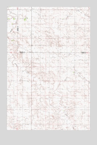
Richey NW, MT USGS Topographic Map
Click on map above to begin viewing in our Map Viewer.

This topographic map contains these locations and features:
Feature Name Type Latitude Longitude GNIS ID View Map
22N50E13BADB01 WellWellN47.6722°W105.2458°824439View Map
22N50E24BABA01 WellWellN47.6600°W105.2478°824369View Map
22N51E02CBBB01 WellWellN47.6958°W105.1475°824570View Map
22N51E02CBBC01 WellWellN47.6950°W105.1475°824564View Map
22N51E03BAAA01 WellWellN47.7031°W105.1600°824609View Map
22N51E05ADDD01 WellWellN47.6972°W105.1919°824576View Map
22N51E07CCDD01 WellWellN47.6753°W105.2291°824457View Map
22N51E10ADDA01 WellWellN47.6828°W105.1494°824498View Map
22N51E10ADDD01 WellWellN47.6828°W105.1497°824499View Map
22N51E11BCCA01 WellWellN47.6828°W105.1466°824496View Map
22N51E11BCCA02 WellWellN47.6828°W105.1466°824497View Map
22N51E19CBBB01 WellWellN47.6522°W105.2325°824323View Map
22N51E22DBAD01 WellWellN47.6514°W105.1547°824312View Map
22N51E23DDCB01 WellWellN47.6464°W105.1314°824274View Map
22N51E26ABAD01 WellWellN47.6442°W105.1333°824254View Map
22N51E27BAAB01 WellWellN47.6450°W105.1605°824261View Map
22N51E27BABD01 WellWellN47.6442°W105.1628°824255View Map
22N51E28BAAA01 WellWellN47.6450°W105.1814°824262View Map
23N50E24DDCD01 WellWellN47.7336°W105.2380°824733View Map
23N51E14CCCB01 WellWellN47.7481°W105.1478°824801View Map
23N51E14DDAD01 WellWellN47.7495°W105.1283°824810View Map
23N51E20BBBC01 WellWellN47.7458°W105.2122°824785View Map
23N51E20BBBD01 WellWellN47.7467°W105.2122°824792View Map
23N51E22CBAC01 WellWellN47.7386°W105.1666°824762View Map
23N51E22CBDB01 WellWellN47.7372°W105.1666°824749View Map
23N51E23ACAD01 WellWellN47.7422°W105.1336°824774View Map
23N51E26BDBB01 WellWellN47.7289°W105.1425°824707View Map
H S DamDamN47.7383°W105.2205°797548View Map
Johnston DamDamN47.6767°W105.1639°795464View Map
Lee Sa Number 2 DamDamN47.7450°W105.1755°796059View Map
Othar Number 1 DamDamN47.6583°W105.2189°795155View Map
Pasture CreekStreamN47.7142°W105.2500°775109View Map

Note: Coordinates in the location and feature list above are referenced to NAD83 datum.


Copyright (C) 2008-2024 Ryan Niemi / Sunset Dynamics ... All Rights Reserved