TopoQuest Logo
Do you find TopoQuest useful?
Help keep TopoQuest running and adding new maps/features by donating!
Bitcoin:  19c7KJd3qBynnjoSw5npx9KScwjBe4ifkT
Litecoin:  LXs6TkuXGGXo1vDsWCkWVdjQX94eUKd6ui
Home View Maps Find Maps Find Places Resources & Links


Buffalo Creek NE, Montana Topographic Map

USGS Map Title: Buffalo Creek NE, MT
USGS Map MRC: 47105F3
DRG (GeoTIFF) Download: o47105f3.tif


Neighboring USGS Topographic Map Quads:


  Vida, MT  
47105G4
 

  Kraut Coulee, MT  
47105G3
 

  Lisk Creek, MT  
47105G2
 

  Beery Reservoir, MT  
47105F4
 

  Buffalo Creek NE, MT  
47105F3
 

  Richey NW, MT  
47105F2
 

  Buffalo Creek, MT  
47105E4
 

  Buffalo Creek SE, MT  
47105E3
 

  Circle Reservoir, MT  
47105E2


Map MRC Location:

N48°
W106°
N48°
W105°
H8 H7 H6 H5 H4 H3 H2 H1
G8 G7 G6 G5 G4 G3 G2 G1
F8 F7 F6 F5 F4 F3 F2 F1
E8 E7 E6 E5 E4 E3 E2 E1
D8 D7 D6 D5 D4 D3 D2 D1
C8 C7 C6 C5 C4 C3 C2 C1
B8 B7 B6 B5 B4 B3 B2 B1
A8 A7 A6 A5 A4 A3 A2 A1
N47°
W106°
N47°
W105°

Buffalo Creek NE, MT USGS 1:24K Topographic Map Preview:
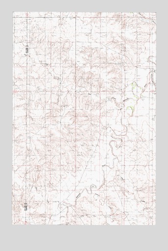
Buffalo Creek NE, MT USGS Topographic Map
Click on map above to begin viewing in our Map Viewer.

This topographic map contains these locations and features:
Feature Name Type Latitude Longitude GNIS ID View Map
22N50E06BCAC01 WellWellN47.6992°W105.3578°824587View Map
22N50E08ADBB01 WellWellN47.6856°W105.3230°824523View Map
22N50E20DADC01 WellWellN47.6506°W105.3205°824300View Map
22N50E22ACAD01 WellWellN47.6556°W105.2825°824343View Map
22N50E29CCCA01 WellWellN47.6325°W105.3383°824172View Map
22N50E29CCCB01 WellWellN47.6325°W105.3392°824173View Map
22N50E29CCCC01 WellWellN47.6322°W105.3392°824167View Map
22N50E29CCDB01 WellWellN47.6325°W105.3364°824171View Map
22N50E35AAAD01 WellWellN47.6303°W105.2558°824155View Map
2350 Redwater DamDamN47.7300°W105.2805°795002View Map
23N50E19BBB_01 WellWellN47.7464°W105.3605°824790View Map
23N50E19BDC_01 WellWellN47.7408°W105.3553°824767View Map
23N50E19DCC_01 WellWellN47.7336°W105.3500°824734View Map
23N50E22CBCD01 WellWellN47.7372°W105.2964°824750View Map
23N50E26ACAD01 WellWellN47.7278°W105.2619°824703View Map
23N50E27ADAD01 WellWellN47.7278°W105.2778°824704View Map
23N50E30BBAB01 WellWellN47.7322°W105.3578°824727View Map
23N50E34DBBC01 WellWellN47.7097°W105.2864°824645View Map
23N50E35CCAC01 WellWellN47.7061°W105.2733°824632View Map
Alkali CreekStreamN47.6645°W105.2844°799758View Map
Axtell Post Office (historical)Post OfficeN47.7078°W105.2783°1715391View Map
Axtell School (historical)SchoolN47.6903°W105.2861°1715495View Map
Berrys Land Number 2 DamDamN47.7117°W105.3722°797789View Map
Berrys Land Number 3 DamDamN47.7317°W105.3739°797790View Map
Cow CreekStreamN47.6356°W105.3330°770224View Map
Gold GulchValleyN47.7433°W105.2605°771833View Map
Hay CreekStreamN47.6939°W105.2811°772262View Map
Paxton (historical)Populated PlaceN47.6311°W105.3414°1715352View Map
Paxton Post Office (historical)Post OfficeN47.6311°W105.3414°1715353View Map
Riverside Post Office (historical)Post OfficeN47.7222°W105.2619°1715347View Map
Rose Hill School (historical)SchoolN47.7264°W105.3722°1716129View Map
Smile Number 1 DamDamN47.7350°W105.3605°797830View Map
Stark School (historical)SchoolN47.7306°W105.3444°1715574View Map
Sullivan CreekStreamN47.6420°W105.3094°777294View Map

Note: Coordinates in the location and feature list above are referenced to NAD83 datum.


Copyright (C) 2008-2025 Ryan Niemi / Sunset Dynamics ... All Rights Reserved