TopoQuest Logo
Do you find TopoQuest useful?
Help keep TopoQuest running and adding new maps/features by donating!
Bitcoin:  19c7KJd3qBynnjoSw5npx9KScwjBe4ifkT
Litecoin:  LXs6TkuXGGXo1vDsWCkWVdjQX94eUKd6ui
Home View Maps Find Maps Find Places Resources & Links


Richmond, Missouri Topographic Map

USGS Map Title: Richmond, MO
USGS Map MRC: 39093C8
DRG (GeoTIFF) Download: o39093c8.tif


Neighboring USGS Topographic Map Quads:


  Knoxville, MO  
39094D1
 

  Millville, MO  
39093D8
 

  Stet, MO  
39093D7
 

  Rayville, MO  
39094C1
 

  Richmond, MO  
39093C8
 

  Hardin, MO  
39093C7
 

  Camden, MO  
39094B1
 

  Lexington West, MO  
39093B8
 

  Lexington East, MO  
39093B7


Map MRC Location:

N40°
W94°
N40°
W93°
H8 H7 H6 H5 H4 H3 H2 H1
G8 G7 G6 G5 G4 G3 G2 G1
F8 F7 F6 F5 F4 F3 F2 F1
E8 E7 E6 E5 E4 E3 E2 E1
D8 D7 D6 D5 D4 D3 D2 D1
C8 C7 C6 C5 C4 C3 C2 C1
B8 B7 B6 B5 B4 B3 B2 B1
A8 A7 A6 A5 A4 A3 A2 A1
N39°
W94°
N39°
W93°

Richmond, MO USGS 1:24K Topographic Map Preview:
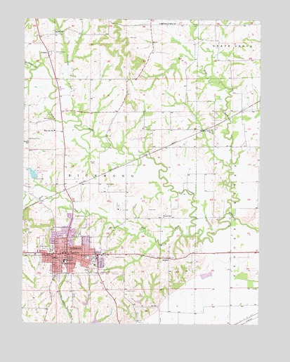
Richmond, MO USGS Topographic Map
Click on map above to begin viewing in our Map Viewer.

This topographic map contains these locations and features:
Feature Name Type Latitude Longitude GNIS ID View Map
Blue Jay SchoolSchoolN39.3292°W93.9844°714410View Map
Bryant SchoolSchoolN39.3689°W93.9808°714937View Map
City of RichmondCivilN39.2758°W93.9733°2396368View Map
Cottonwood BranchStreamN39.3328°W93.9719°716354View Map
Curtis FieldAirportN39.3285°W93.9388°758890View Map
Dale CemeteryCemeteryN39.3339°W93.9866°716641View Map
Dear Elementary SchoolSchoolN39.2777°W93.9656°729132View Map
DockeryPopulated PlaceN39.3611°W93.9886°716932View Map
East Fork Crooked RiverStreamN39.2956°W93.8922°717280View Map
Gunnell CemeteryCemeteryN39.3072°W93.9572°718936View Map
Hamilton and Hill Farm Lake DamDamN39.3083°W93.9819°762650View Map
Hickory Grove ChurchChurchN39.3297°W93.9011°719467View Map
Hill CemeteryCemeteryN39.2933°W93.9422°719598View Map
Hill SchoolSchoolN39.2770°W93.9233°719606View Map
Johnson CemeteryCemeteryN39.3158°W93.9633°720360View Map
Liberty School (historical)SchoolN39.3683°W93.8986°747108View Map
Lincoln SchoolSchoolN39.2795°W93.9747°721087View Map
McDonald BranchStreamN39.3545°W93.9938°722089View Map
McDonald CemeteryCemeteryN39.3611°W93.9844°722091View Map
Memory GardenCemeteryN39.2772°W93.9522°722226View Map
Mononame 171 ReservoirReservoirN39.2670°W93.9699°761150View Map
Mount Pleasant CemeteryCemeteryN39.3256°W93.9974°722853View Map
Nutter CemeteryCemeteryN39.2967°W93.9347°723545View Map
Nutter SchoolSchoolN39.2939°W93.9263°723546View Map
Patton SchoolSchoolN39.3247°W93.9983°724099View Map
Prairie Valley SchoolSchoolN39.3733°W93.9294°724889View Map
Ray CountyCivilN39.3524°W93.9899°758543View Map
Ray County Dam C-21DamN39.2500°W93.9619°760585View Map
Ray County Dam Number C-1DamN39.2583°W93.9652°760587View Map
Ray County LakeReservoirN39.3111°W93.9951°760350View Map
Ray County Lake DamDamN39.3100°W93.9952°760349View Map
Ray County Memorial HospitalHospitalN39.2644°W93.9574°2655023View Map
Ray County Number C-1 LakeReservoirN39.2588°W93.9660°760588View Map
Ray County Number C-21 LakeReservoirN39.2506°W93.9614°760586View Map
RichmondPopulated PlaceN39.2786°W93.9769°725280View Map
Richmond Fire DepartmentBuildingN39.2767°W93.9761°2621010View Map
Richmond High SchoolSchoolN39.2694°W93.9681°2545430View Map
Richmond Intermediate SchoolSchoolN39.2756°W93.9782°2545093View Map
Richmond Middle SchoolSchoolN39.2679°W93.9731°2545107View Map
Richmond Police DepartmentBuildingN39.2751°W93.9780°2752241View Map
Richmond Post OfficePost OfficeN39.2775°W93.9776°2783071View Map
Richmond Schools DamDamN39.2667°W93.9702°761149View Map
Roberts ParkParkN39.2772°W93.9630°725404View Map
Shirkey Recreation Park Lake DamDamN39.2717°W93.9469°762652View Map
Shotwell CemeteryCemeteryN39.2808°W93.9852°726420View Map
Sunny Slope CemeteryCemeteryN39.2803°W93.9869°727303View Map
Timber Ridge School (historical)SchoolN39.3436°W93.9455°747109View Map
Township of RichmondCivilN39.3079°W93.9956°767275View Map
Wall CemeteryCemeteryN39.3672°W93.9460°728273View Map
Watkins CemeteryCemeteryN39.2633°W93.9452°728414View Map
West Fork Crooked RiverStreamN39.2864°W93.9108°728559View Map
West Ward SchoolSchoolN39.2786°W93.9838°728640View Map
Woodland CemeteryCemeteryN39.2808°W93.9838°729100View Map

Note: Coordinates in the location and feature list above are referenced to NAD83 datum.


Copyright (C) 2008-2024 Ryan Niemi / Sunset Dynamics ... All Rights Reserved