TopoQuest Logo
Do you find TopoQuest useful?
Help keep TopoQuest running and adding new maps/features by donating!
Bitcoin:  19c7KJd3qBynnjoSw5npx9KScwjBe4ifkT
Litecoin:  LXs6TkuXGGXo1vDsWCkWVdjQX94eUKd6ui
Home View Maps Find Maps Find Places Resources & Links


Lexington West, Missouri Topographic Map

USGS Map Title: Lexington West, MO
USGS Map MRC: 39093B8
DRG (GeoTIFF) Download: o39093b8.tif


Neighboring USGS Topographic Map Quads:


  Rayville, MO  
39094C1
 

  Richmond, MO  
39093C8
 

  Hardin, MO  
39093C7
 

  Camden, MO  
39094B1
 

  Lexington West, MO  
39093B8
 

  Lexington East, MO  
39093B7
 

  Bates City, MO  
39094A1
 

  Odessa North, MO  
39093A8
 

  Mayview, MO  
39093A7


Map MRC Location:

N40°
W94°
N40°
W93°
H8 H7 H6 H5 H4 H3 H2 H1
G8 G7 G6 G5 G4 G3 G2 G1
F8 F7 F6 F5 F4 F3 F2 F1
E8 E7 E6 E5 E4 E3 E2 E1
D8 D7 D6 D5 D4 D3 D2 D1
C8 C7 C6 C5 C4 C3 C2 C1
B8 B7 B6 B5 B4 B3 B2 B1
A8 A7 A6 A5 A4 A3 A2 A1
N39°
W94°
N39°
W93°

Lexington West, MO USGS 1:24K Topographic Map Preview:
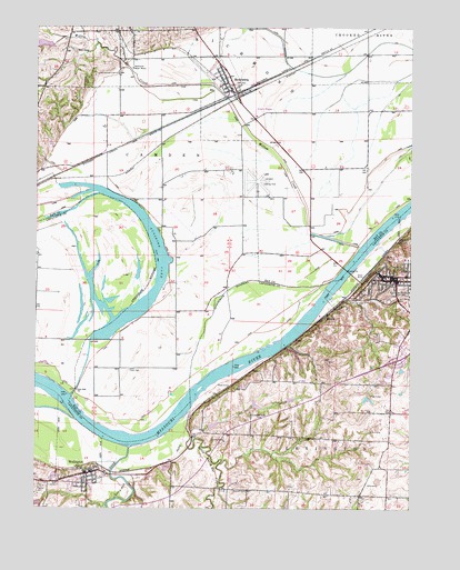
Lexington West, MO USGS Topographic Map
Click on map above to begin viewing in our Map Viewer.

This topographic map contains these locations and features:
Feature Name Type Latitude Longitude GNIS ID View Map
Bootlegger BendBendN39.1692°W93.9156°2109463View Map
City of HenriettaCivilN39.2371°W93.9386°2394353View Map
City of WellingtonCivilN39.1384°W93.9861°2397247View Map
Cravens CreekStreamN39.1542°W93.9886°716470View Map
Dam A-21 DamDamN39.1267°W93.9986°760423View Map
Foster CemeteryCemeteryN39.1614°W93.9677°718117View Map
Glenwood School (historical)SchoolN39.1439°W93.9058°747126View Map
Graddy MineMineN39.1650°W93.9088°747128View Map
HenriettaPopulated PlaceN39.2342°W93.9355°730116View Map
Henrietta Post OfficePost OfficeN39.2339°W93.9358°2783201View Map
Hollingsworth Lake DamDamN39.1483°W93.9036°762654View Map
Lafayette County Sheriff's OfficeBuildingN39.1849°W93.8825°2752453View Map
Lafayette Regional Health CenterHospitalN39.1897°W93.8771°2655072View Map
Lafayette Village Shopping CenterLocaleN39.1647°W93.8822°742513View Map
LexingtonPopulated PlaceN39.1847°W93.8799°720950View Map
Lexington Battle GroundLocaleN39.1961°W93.8766°755283View Map
Lexington Fire and Rescue DepartmentBuildingN39.1761°W93.8760°2621002View Map
Lexington Municipal AirportAirportN39.2080°W93.9261°758787View Map
Lexington Police DepartmentBuildingN39.1712°W93.8762°2752283View Map
Lexington Post OfficePost OfficeN39.1832°W93.8805°2782916View Map
Lexington School District Student Success CenterSchoolN39.1692°W93.8766°2545312View Map
Linden School (historical)SchoolN39.1494°W93.9282°721102View Map
Little Sni-A-Bar CreekStreamN39.1508°W93.9486°721321View Map
Little Sni-A-Bar Watershed Structure Number 21 DamDamN39.1533°W93.9152°762766View Map
Little Sni-A-Bar Watershed Structure Number 22 DamDamN39.1517°W93.9286°762655View Map
Little Sni-A-Bar Watershed Structure Number 23 DamDamN39.1467°W93.9419°761896View Map
Little Sni-A-Bar Watershed Structure Number 47 DamDamN39.1450°W93.9069°762653View Map
Macedonia Church (historical)ChurchN39.1700°W93.9111°1669621View Map
Macedonia School (historical)SchoolN39.1674°W93.9154°766180View Map
Marshall School (historical)SchoolN39.1573°W93.8820°747127View Map
Martin - Carr CemeteryCemeteryN39.1307°W93.9978°721926View Map
Mitchell CemeteryCemeteryN39.1294°W93.9297°722488View Map
MyrickPopulated PlaceN39.1756°W93.9030°730163View Map
Ray County Dam Number A-1DamN39.2450°W93.9936°761745View Map
Ray County Sheriff's OfficeBuildingN39.2398°W93.9408°2752577View Map
Richmond Water WorksLocaleN39.2395°W93.9686°755376View Map
Sni BendBendN39.1444°W93.9739°2109462View Map
Sni-A-Bar CreekStreamN39.1406°W93.9688°726663View Map
SunshineFlatN39.1667°W93.9583°739637View Map
Sunshine DrainCanalN39.1614°W93.9836°2109451View Map
Sunshine LakeReservoirN39.1689°W93.9791°727338View Map
Sunshine School (historical)SchoolN39.1620°W93.9730°747119View Map
WellingtonPopulated PlaceN39.1342°W93.9827°728497View Map
Wellington - Napoleon Elementary SchoolSchoolN39.1307°W93.9815°2545264View Map
Wellington - Napoleon Fire Protection DistrictBuildingN39.1349°W93.9821°2620316View Map
Wellington - Napoleon High SchoolSchoolN39.1301°W93.9812°2545095View Map
Wellington City CemeteryCemeteryN39.1330°W93.9906°2702406View Map
Wellington Police DepartmentBuildingN39.1347°W93.9830°2752277View Map
Wellington Post OfficePost OfficeN39.1339°W93.9823°2782849View Map
Wellington-Napoleon Watershed Structure B-21 DamDamN39.1350°W93.9936°762656View Map
Willow CreekStreamN39.1931°W93.8919°728942View Map

Note: Coordinates in the location and feature list above are referenced to NAD83 datum.


Copyright (C) 2008-2024 Ryan Niemi / Sunset Dynamics ... All Rights Reserved